


Digest: Latest need-to-know facts
• Escambia County emergency officials received
no other reports of fatalities from Hurricane Ivan late Thursday night,
Kelly Cooke, a communications specialist with the public information
office, said shortly after 5 a.m. Friday. The county's death toll remains
at seven, but more deaths are feared as search crews continue trying to
account for missing people. Search and rescue efforts are continuing. At
least two women in the Grande Lagoon subdivision off of Gulf Beach Highway
died when flood waters ravaged the neighborhood early Thursday. A child
was killed when a tree fell on a mobile home on Pine Forest Road near
Milton. An elderly woman suffered a heart attack and died late Wednesday
night at the Woodham High School shelter. Officials did not have details
of the other deaths on Thursday night. Others in Escambia County are
reported missing.
• Bell South reports that 156,700 people are without telephone service in Escambia, Santa Rosa, Bay, Washington, Holmes, Jackson and Okaloosa counties. Escambia emergency operations officials have not received any information from any cell phone service providers, Cooke said.
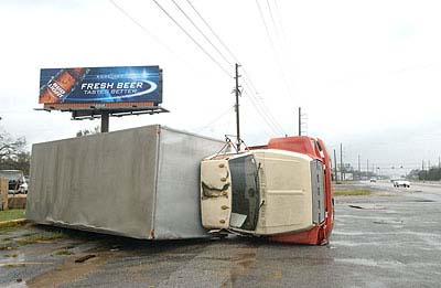
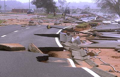
• Virtually every major bridge in Escambia and Santa Rosa counties has been closed indefinitely to all traffic, according to information from transportation, emergency and law enforcement officials. A quarter-mile section of eastbound Interstate 10 bridge over Escambia Bay connecting Santa Rosa and Escambia counties was missing; the westbound section of I-10 was damaged but still standing. A roughly 30-foot section is missing from Bob Sikes Bridge, which is the bridge from Gulf Breeze to Pensacola Beach. The Navarre Beach bridge/causeway - the other entry point to Santa Rosa Island besides Bob Sikes - suffered significant structural damage. The Navarre Beach Causeway is closed because of damage. The Garcon Point Bridge and the Pensacola Bay Bridge were closed because of structural damage. The Lillian bridge on U.S. 98 at the Florida-Alabama state line is closed because of structural damage on Alabama side and flooding on Florida side. The U.S. 90 bridge over Escambia River, between Escambia and Santa Rosa counties, is closed because of hurricane debris. The Perdido Key Bridge on State Road 292 is closed because of flooding. State transportation officials said Thursday night that bridges will remain closed until they can make inspections of the damage Friday.
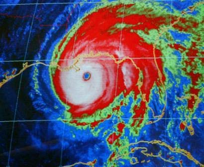
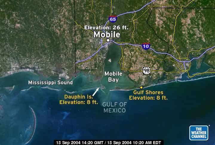
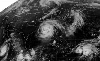
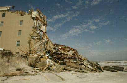
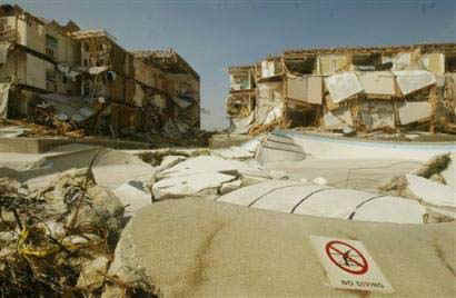
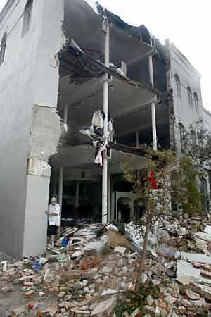
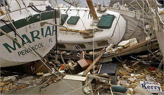
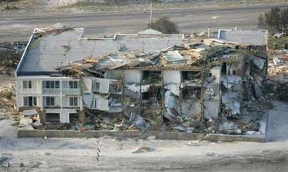
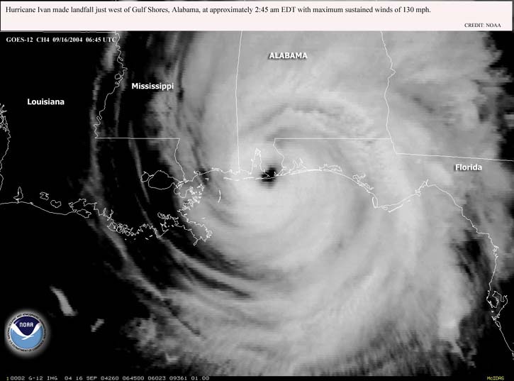
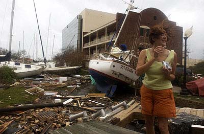
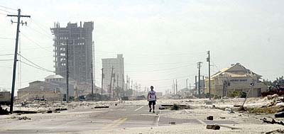
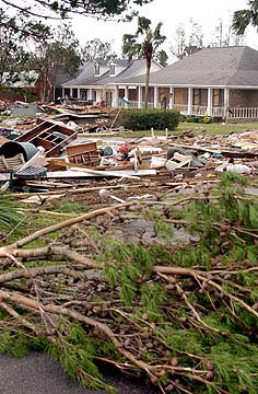
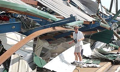
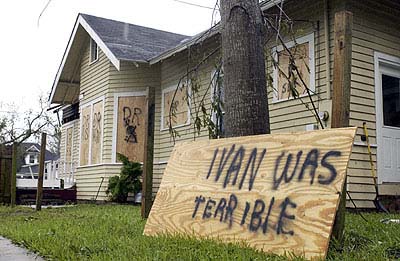
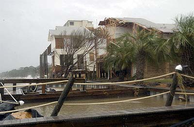
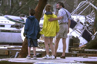
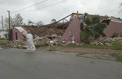
• Hundreds of homes were destroyed in both counties. Pensacola Beach homes were particularly hit hard. Officials believe that the southwest part of the county leading to Perdido Key, near where Hurricane Ivan made landfall at Gulf Shores, Ala., also received extensive damage, but no reports are available yet.
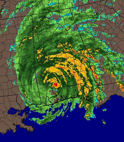
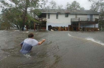
• The Pensacola Historic District is flooded as well as other parts of downtown. Other large areas across the two counties also saw flooding because of the storm surge.
• Tens of thousands of people are without running water in Escambia County. Water officials said that a worst-case scenario could leave people without it for six to eight weeks. The Escambia County Health Department has issued a boiled water advisory for all residents in Escambia County. Before drinking water residents should boil it for one minute or residents can add eight drops (1/8 teaspoon) of plain, unscented household bleach per gallon of water and let stand for 30 minutes. If water is still cloudy after 30 minutes repeat the process.
• President Bush, who visited parts of Florida affected by the previous two hurricanes, is expected to visit the Florida Panhandle on Sunday. No other details of the visit were available late Thursday, The Associated Press reported.
• The storm left Escambia County virtually without power. Gulf Power said that 364,969 of its 405,000 customers are without electricity, including 137,963 in Escambia County and just more than 60,000 in Santa Rosa County. It could take weeks for some to regain service.
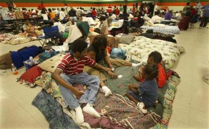
• Schools are closed until further notice in Escambia County.
• Phone service virtually is out for Escambia - cellular or land line. Many cell phone users have no way to recharge their telephones.
• Bell South reports that 156,700 people are without telephone service in Escambia, Santa Rosa, Bay, Washington, Holmes, Jackson and Okaloosa counties. Escambia emergency operations officials have not received any information from any cell phone service providers, Cooke said.
• Virtually every major bridge in Escambia and Santa Rosa counties has been closed indefinitely to all traffic, according to information from transportation, emergency and law enforcement officials. A quarter-mile section of eastbound Interstate 10 bridge over Escambia Bay connecting Santa Rosa and Escambia counties was missing; the westbound section of I-10 was damaged but still standing. A roughly 30-foot section is missing from Bob Sikes Bridge, which is the bridge from Gulf Breeze to Pensacola Beach. The Navarre Beach bridge/causeway - the other entry point to Santa Rosa Island besides Bob Sikes - suffered significant structural damage. The Navarre Beach Causeway is closed because of damage. The Garcon Point Bridge and the Pensacola Bay Bridge were closed because of structural damage. The Lillian bridge on U.S. 98 at the Florida-Alabama state line is closed because of structural damage on Alabama side and flooding on Florida side. The U.S. 90 bridge over Escambia River, between Escambia and Santa Rosa counties, is closed because of hurricane debris. The Perdido Key Bridge on State Road 292 is closed because of flooding. State transportation officials said Thursday night that bridges will remain closed until they can make inspections of the damage Friday.
• Hundreds of homes were destroyed in both counties. Pensacola Beach homes were particularly hit hard. Officials believe that the southwest part of the county leading to Perdido Key, near where Hurricane Ivan made landfall at Gulf Shores, Ala., also received extensive damage, but no reports are available yet.
• The Pensacola Historic District is flooded as well as other parts of downtown. Other large areas across the two counties also saw flooding because of the storm surge.
• Tens of thousands of people are without running water in Escambia County. Water officials said that a worst-case scenario could leave people without it for six to eight weeks. The Escambia County Health Department has issued a boiled water advisory for all residents in Escambia County. Before drinking water residents should boil it for one minute or residents can add eight drops (1/8 teaspoon) of plain, unscented household bleach per gallon of water and let stand for 30 minutes. If water is still cloudy after 30 minutes repeat the process.
• President Bush, who visited parts of Florida affected by the previous two hurricanes, is expected to visit the Florida Panhandle on Sunday. No other details of the visit were available late Thursday, The Associated Press reported.
• The storm left Escambia County virtually without power. Gulf Power said that 364,969 of its 405,000 customers are without electricity, including 137,963 in Escambia County and just more than 60,000 in Santa Rosa County. It could take weeks for some to regain service.
• Schools are closed until further notice in Escambia County.
• Phone service virtually is out for Escambia - cellular or land line. Many cell phone users have no way to recharge their telephones.