|
|
|
|
|
|
| |
NAME:
BEAU |
|
Location: Paducah, KY |
|
|
|
|
|
|
|
View my complete profile |
|
|
|
WEATHER GALLERY
|
|
|
|
Boston |
|
Ohio Valley |
|
Peoria |
|
Boulder |
|
|
|
This is my little
space, my little world, my thoughts, my dreams, my happiness, my
sorrows, my
laughter, my tears,
my life as it was yesterday, is today, and will be tomorrow |
|
|
|
 |
|
|
|
Friday
May 04, 2007 |
|
|
|
We made it home. Yeesh I never realize how big
those photos are until I get on my big computer.
They always look so small on the lap-top. Prob
take forever to download on slow connections. I
should try to remember to make them smaller :) We had
a great trip home. Seemed like it took longer to
get back than it took to get down there! Maybe it
is always that way? I don't know.
Warm and muggy here in Paducah. Scattered
storms through the weekend. Could be an isolated
severe event. I am not overly excited about any of it.
The big potential is out west in the Central Plains.
They can keep it. Just bring us the rain. We
need it.
|
|
Well I posted this before and I will post it again :)
http://www.theinterviewwithgod.com/viewmovie.html
If you watch nothing else in the next year then watch
that. :) At least once a week. :)
Can't go wrong. |
|
|
|
Daisy was THRILLED to see us! To say the least.
lol I couldn't even hold her in my arms when I got
home. She was so excited. :) She
wouldn't leave my side this morning and fell asleep in
my lap four times while trying to stay sitting up.
lol She kept falling over. It was funny.
I guess she missed me! |
|
|
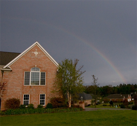
Rainbow tonight here in Ashcreek :) |
|
|
|
|
MAY 5,
2007
THE MORNING AFTER |
|
|
|
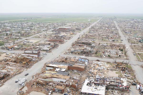
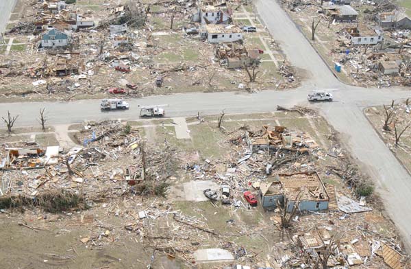
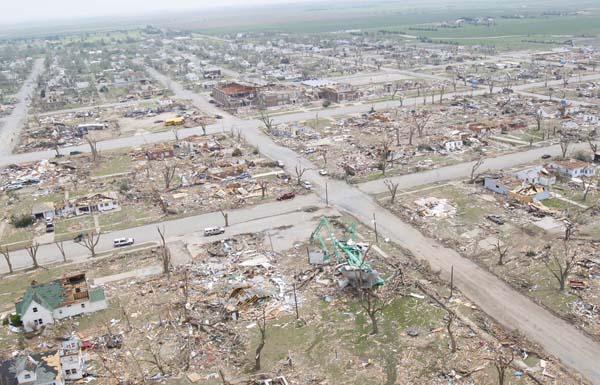
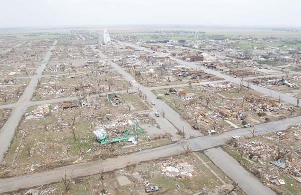
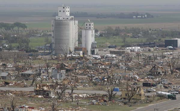
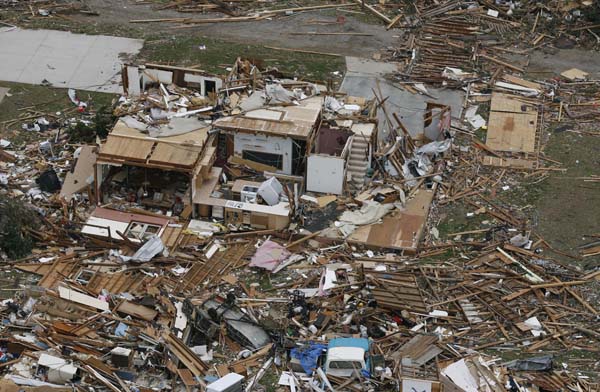
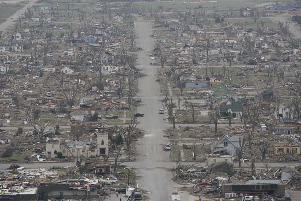
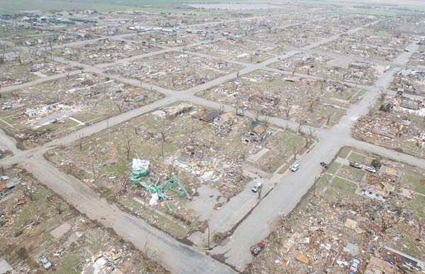
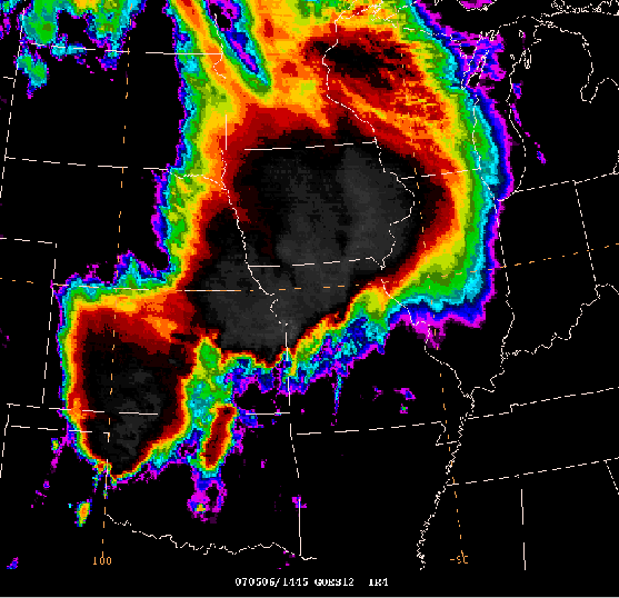
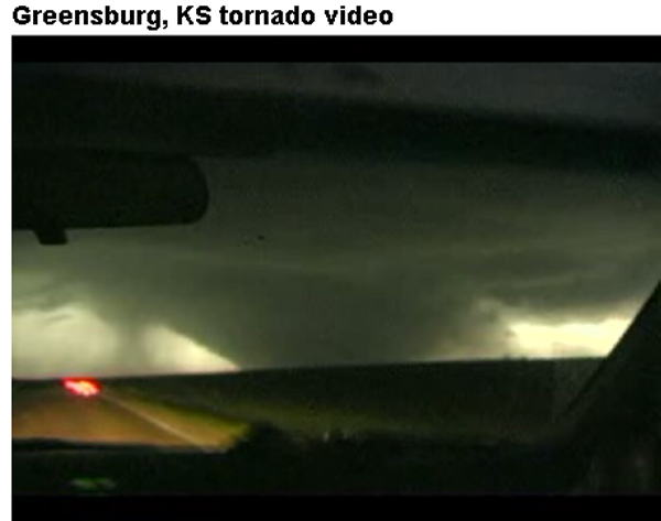
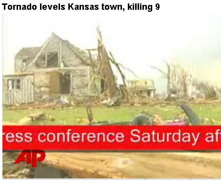
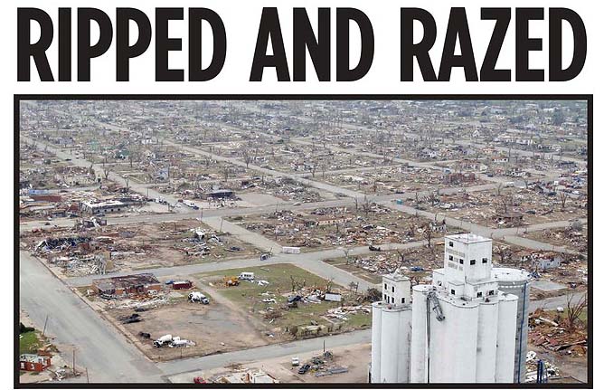
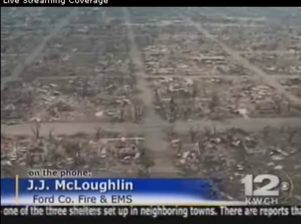
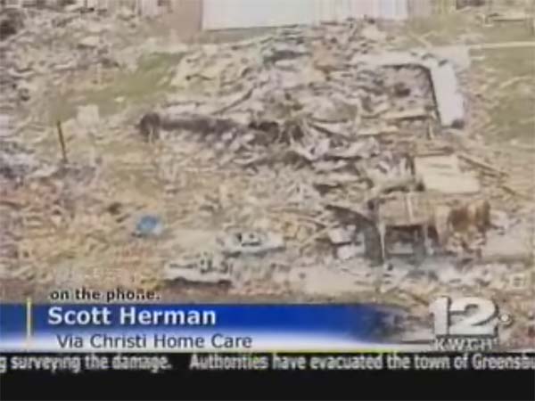
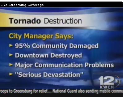
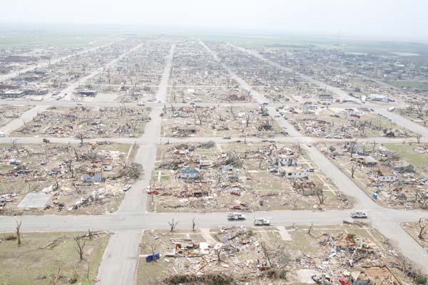
MONSTER EF5 TORNADO
HITS KANSAS OVERNIGHT AND EARLY THIS MORNING
TORNADO WAS ESTIMATED TO
BE 1 1/2 to 2 MILES WIDE.
 |
|
|
 |
|
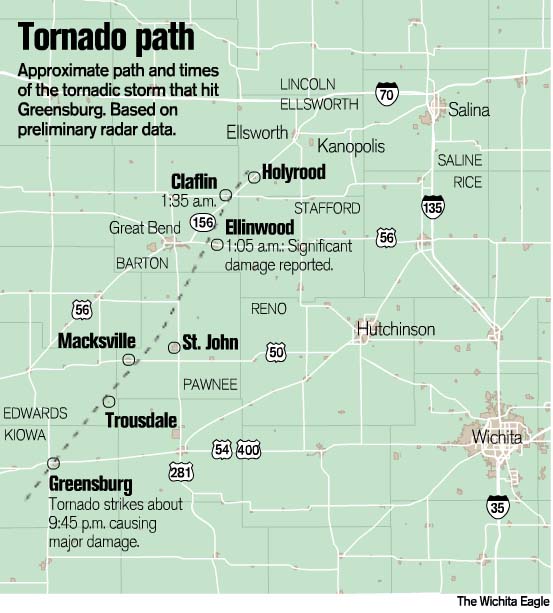
Greensburg, Kansas -
WIPED OUT |
|
|
|
|
 |
|
|
 |
|
|
 |
|
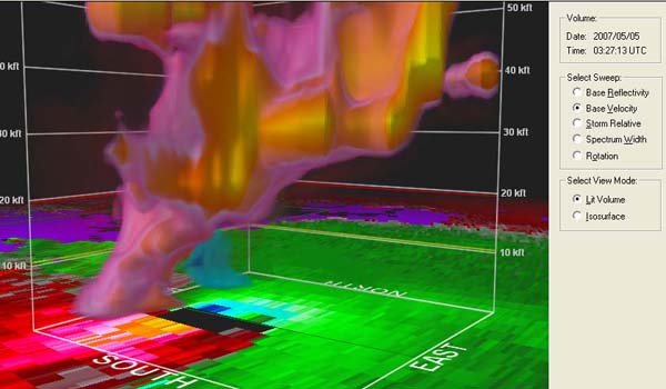
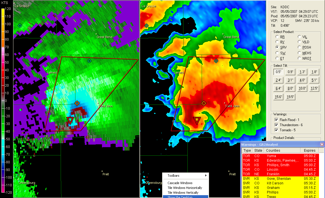
THIS IS A RADAR IMAGE
I GRABBED FROM MY RADAR SOFTWARE (GIBSON RIDGE AE) WHEN
THE TORNADO WAS HITTING THE AREA NORTHEAST OF
GREENSBURG. INCREDIBLE. |
|
|
 |
|
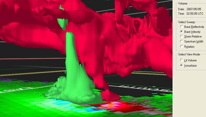
Another image from the software...incredible structure. |
|
|
 |
|
|
|
|
|
|
|
WICHITA EAGLE PHOTOS
BELOW |
|
http://www.kansas.com/ |
 |
|
|
|
|
|
|