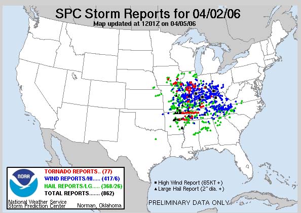
 THE OUTBREAK - Red dots are tornadoes, Blue dots are wind reports,
and green dots are hail reports.
THE OUTBREAK - Red dots are tornadoes, Blue dots are wind reports,
and green dots are hail reports.KILLER TORNADOES RIP THE QUAD-STATE REGION
27 PEOPLE KILLED
HUNDREDS INJURED
F3/F4 TORNADO TRAVELS 100+ MILES ACROSS
THE MISSOURI BOOTHEEL AND NORTHWEST TENNESSEE
VIOLENT WEATHER CONTINUES TO RIP THE AREA...
WEEK AFTER WEEK/MONTH AFTER MONTH
----------------------------------------------------------------
On April 2, 2006 one of the worst killer tornado outbreaks
in recent memory tour through the southern half of the WPSD
TV 6 Viewing Area.   More than 100 people were injured and 25+
people were killed.
Early reports are that the tornado had winds of over 200 miles
per hour and was on the ground for more than 100 miles.  This
tornado was likely an F4 and will be upgraded to such in the
coming days.
In recent years this region has been hit by at least two other F4
tornadoes.  Killer tornadoes have hit numerous counties in the
forecast area since 2003.
More severe weather is likely later this week.  Thursday and Friday
both looks ominous.  Expect more tornadoes and/or severe storms
across this region.
The following are photographs from the severe weather - including pictures
of the killer tornado.
Photographs are captured from WPSD - WSIL - KFVS - and the NWS
Although, the death toll from this outbreak was high, it could have been worse.
The Paducah and Memphis National Weather Service Offices, KFVS 12, and WPSD
TV 6 did an excellent job of alerting area residents to the tornado potential days in
advance.  Timely warnings also helped saved lives.  A big THANK YOU to all of
those agencies and stations.
PADUCAH, KENTUCKY TORNADIC SUPERCELL
Wall Cloud moves through the Lone Oak area - an F0 tornado
touched down just west of my place
The rotating cloud moves through Paducah.
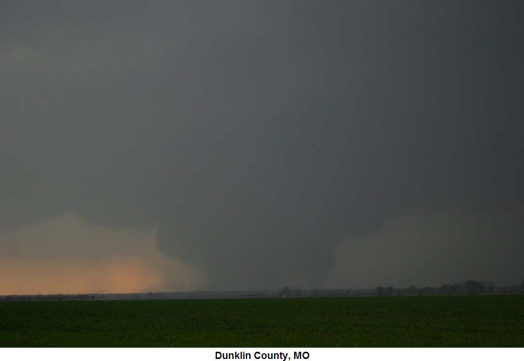
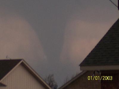
TORNADO ROARS THROUGH THE MISSOURI BOOTHEEL
Screen Radar Grab of the killer tornado as it moves towards Caruthersville, Missouri. From easternuswx.
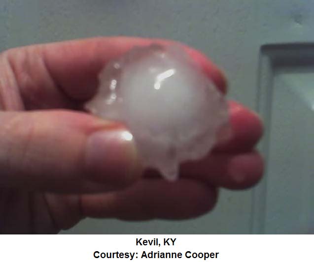
BASEBALL SIZE HAIL FALLS IN SOUTHEAST MISSOURI
TORNADO CONTINUES TO MOVE THROUGH THE BOOTHEEL OF MISSOURI.  KENNETT AREA
Tornado south of Kennett, Missouri. Photo by Bill Page.
Tornado in Kennett, Missouri. Photos by Donald Jones.
Tornado in Kennett, Missouri. Photos by Donald Jones.
Tornado in Kennett, Missouri. Photos by Donald Jones.
The Long-Tracked Tornado - Arkansas, Missouri, and Tennessee.  Three states hit by this one twister.
Tornado near Caruthersville, Missouri. Photo by Scott McCord.
Wickliff Kentucky - huge wall cloud
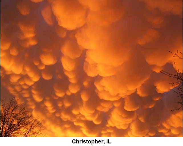
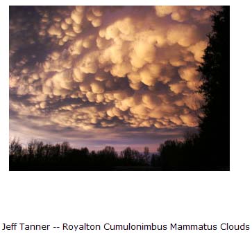
Mammatus Cloud over Western KY. Tail end of the storm to the right - wall cloud area
Missouri Bootheel HAIL
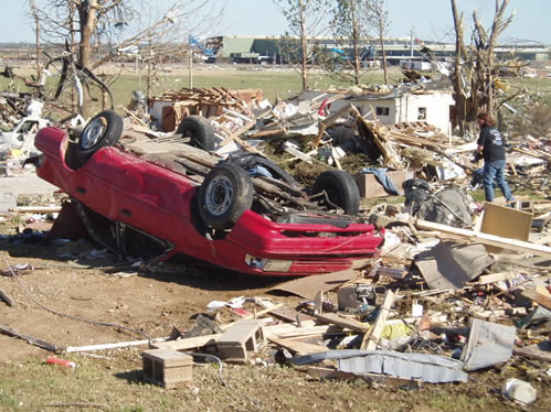
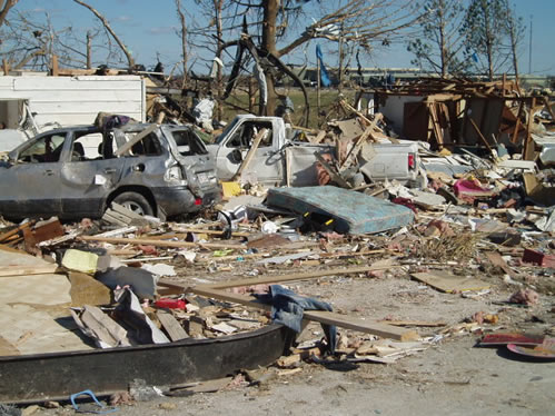
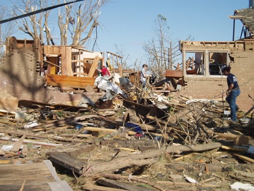
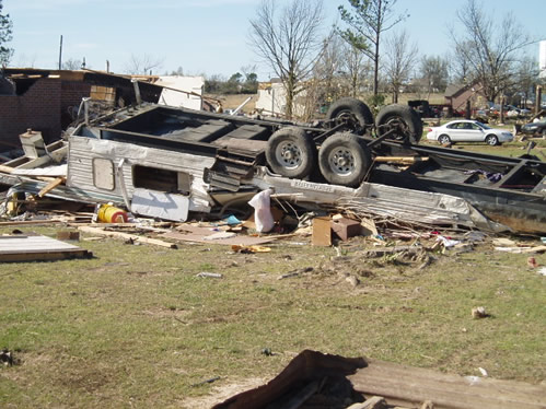
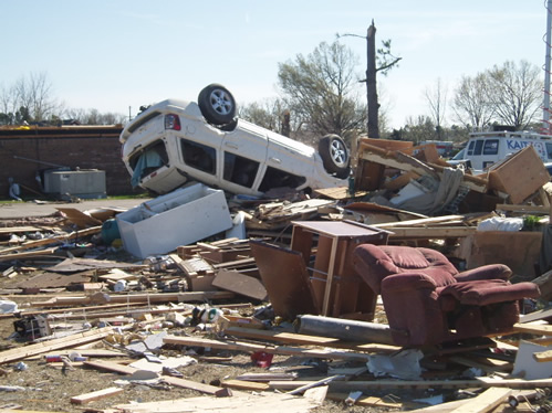
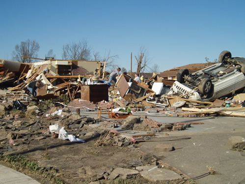
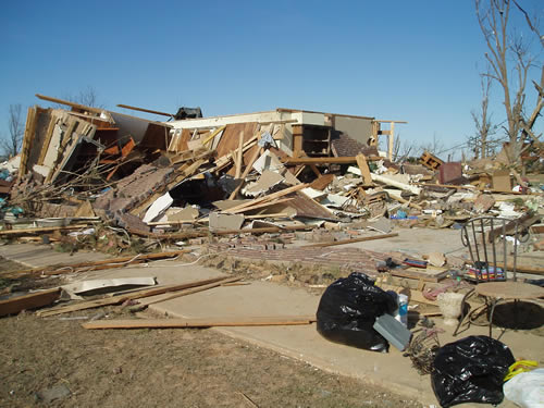
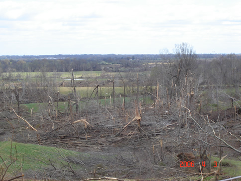
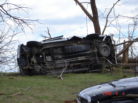
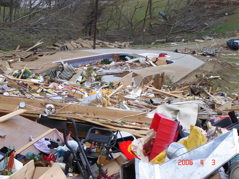
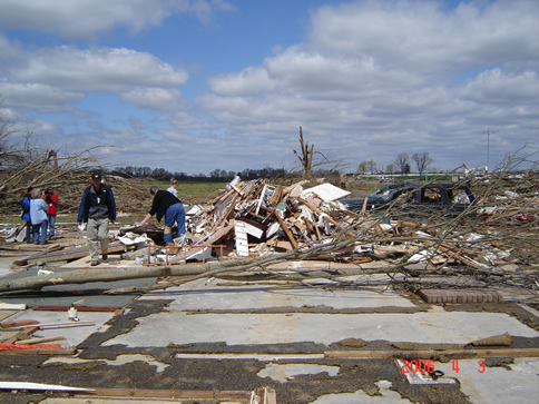
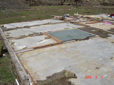
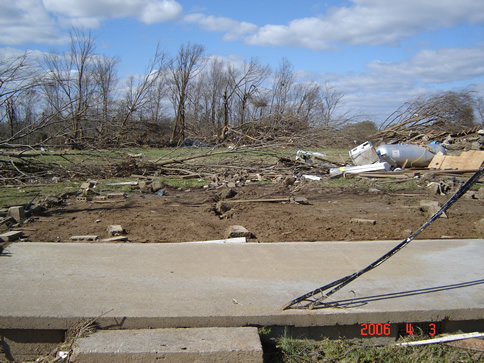
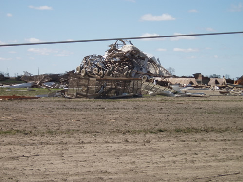
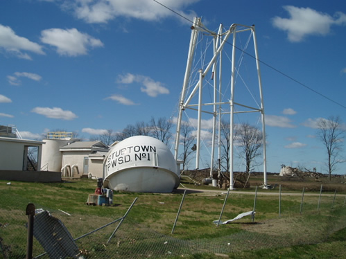
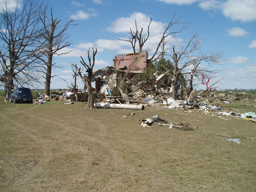
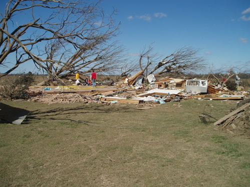
DAMAGE FROM THE MISSOURI BOOTHEEL AND NORTHWEST TENNESSEE
TURN THE PAGE CLICK HERE
HOME PAGE
------------------------------------------------------

------------------------------------------------------

LIVE: VIEW
FROM DOWNTOWN PADUCAH

...VIA WEB CAM FROM WPSD NEWS CHANNEL  6

------------------------------------------------------
------------------------------------------------------
MAILING ADDRESS
BEAU DODSON
465 Ashcreek Road
Paducah, Kentucky
42001
-
Phone Number
Home 270-554-6715
Cell 270-970-1202
Email beaudodson@hotmail.com