AUGUST - HAZY - HOT - AND HUMID!
August 20, 2005
Severe weather possible today across the
Tri-State Region. A powerful cold front will sweep through this area later
this afternoon and evening. Thunderstorms could fire along and ahead of
it. If storms do develop then we will have a chance for severe
thunderstorms. High winds will be the main threat with the squall line.
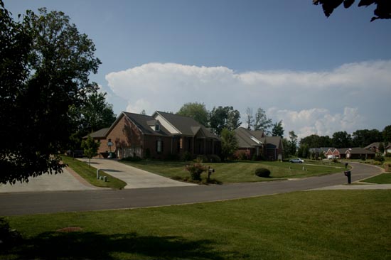
Storms approaching from the Northwest
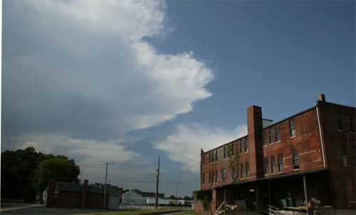
Anvil over Paducah...storm to the west
We had heavy rain and lightning. Nothing too bad today thought! Lots
of wind damage from Indiana to Pennsylvania.
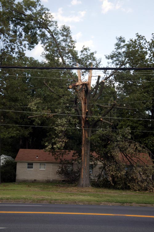
This tree EXPLODED when lightning hit it. This happened earlier in the
week. Paducah, Kentucky.
Some new Wisconsin photos...
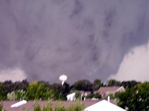
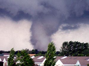
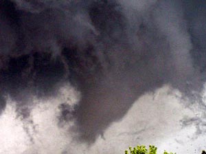
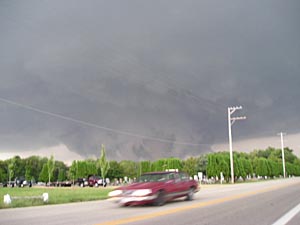
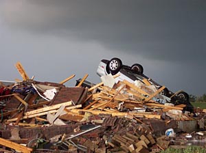
Wisconsin Gazette
http://www.gazetteextra.com/stoughtontornado/index.asp
Sunday, August 21, 2005
A bit less humid today. The nice weather
is coming tomorrow and Tuesday!!!!

Me feeding the ducks and geese heh

By contrast this is Joey feeding errr running from the ducks/geese


In search of Donald

Monday, August 22, 2005
Like a movie scene
In the sweetest dreams
I had pictured us together
Now to feel your lips
On my fingertips
I have to say is even better
Then I ever thought it could possibly be
It's perfect, it's passion, it's setting me free
From all of my sadness
The tears that I've cried
I have spent all of my life
Waiting for tonight,
When you would be here in my arms
Waiting for tonight, oh
I've dreamed of this love for so long
Waiting for tonight
Tender words you say
Take my breath away
Love me now, leave me never
Found a sacred place
Lost in your embrace
I want to stay in this forever
I think of the days when the sun used to set
On my empty heart, all alone in my bed
Tossing and turning
Emotions were strong
I knew I had to hold on
--jennifer lopez

In a world of black and white the sand
runs together through the seamless hourglass
waiting to be shattered by color

465 Ashcreek Flowers
I made this flower for a friend
"LIFE"

Even a beautiful flower is not perfect
NEW LIFE...RENEWED COLOR...AND A NEW VISION
------------------------------
Monday Evening
RED CROSS HEROES
UPDATED TOTALS

These are the
teams and the money that HAS been turned in already!
1. First Hero -
Grandma Blanche $1000.00
2. Team Justice
- $0.00
3. Team
America
- $130.00
4.
Shadow Angels -
$200.00
5. Team Canada
- $100.00
6. Team Reds
- $150.00
7. Team Birmingham - $0.00
8. Team Murray - $102.00
Tuesday Evening...
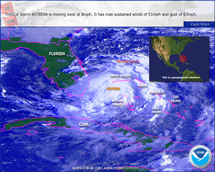
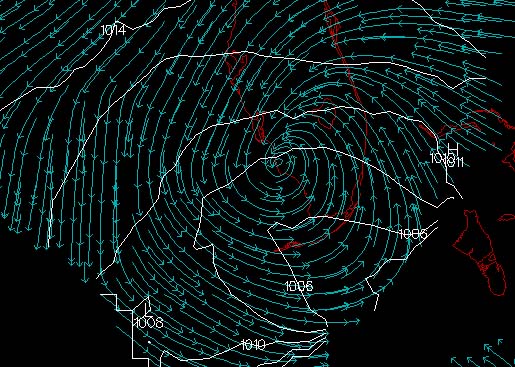
TROPICAL DEPRESSION 12 FORMS OVER THE BAHAMAS
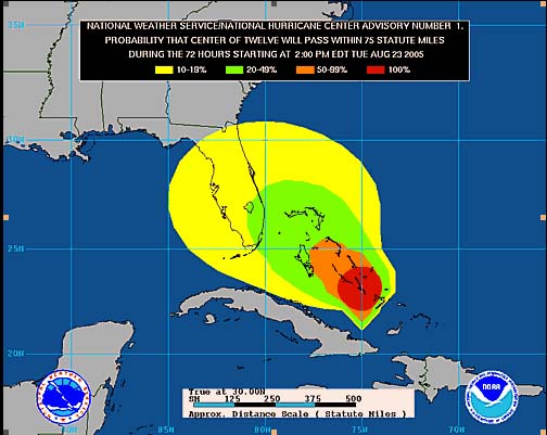
Depression 12 will likely strengthen into a tropical storm over the
next day or two and could possibly become a hurricane.
Rapid intensification is not likely.
11 p.m.
AT 11 PM EDT... 0300Z... A TROPICAL STORM WATCH HAS BEEN
ISSUED FOR
PORTIONS OF THE EAST COAST OF FLORIDA AND THE FLORIDA KEYS FROM
WEST OF THE SEVEN MILE BRIDGE NORTHWARD TO VERO BEACH. A TROPICAL
STORM WATCH MEANS THAT TROPICAL STORM CONDITIONS ARE
POSSIBLE WITHIN THE WATCH AREA...GENERALLY WITHIN 36 HOURS.
Wednesday, August 24, 2005
TROPICAL STORM KATRINA TROPICAL CYCLONE UPDATE
NWS TPC/NATIONAL HURRICANE CENTER MIAMI FL
805 AM EDT WED AUG 24 2005
...RECONNAISSANCE AIRCRAFT DATA INDICATES THAT TROPICAL DEPRESSION
TWELVE HAS STRENGTHENED INTO TROPICAL STORM KATRINA...
SHORTLY BEFORE 8 AM EDT...REPORTS FROM AN AIR FORCE RESERVE UNIT
RECONNAISSANCE AIRCRAFT INDICATE MAXIMUM SUSTAINED SURFACE WINDS IN
THE TROPICAL DEPRESSION TWELVE HAD INCREASED TO AT LEAST 40 MPH
...MAKING THE SYSTEM TROPICAL STORM KATRINA.
FORECASTER STEWART
This system could eventually move into Louisiana as a significant hurricane.
Long way off though...lots of time for things to change.
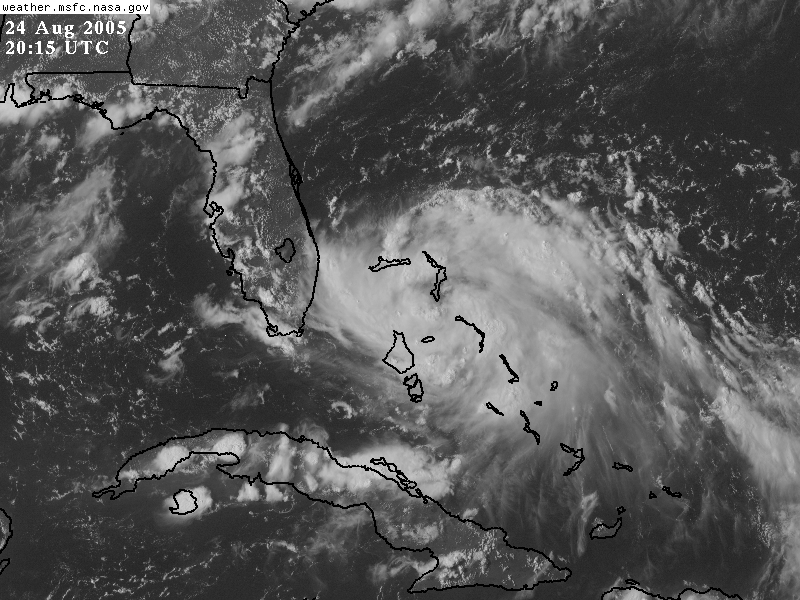
KATRINA MOVING TOWARDS FLORIDA
My first Intro to Disaster Class at the Red Cross.
The instructor was
from Nashville - Nathan. I was the co-instructor. We had about
16 people attend the class.

Intro to Disaster Class
KATRINA THIS EVENING...SPINNING OFF THE COAST OF
FLORIDA
11 p.m.
Katrina is getting an eye on radar now...Recon is also reporting a closed
eyewall.
TROPICAL STORM KATRINA ADVISORY NUMBER 6
NWS TPC/NATIONAL HURRICANE CENTER MIAMI FL
11 PM EDT WED AUG 24 2005
...KATRINA HEADING WESTWARD FOR SOUTH FLORIDA...HURRICANE WARNINGS
IN EFFECT...
AT 11 PM EDT...0300Z...A HURRICANE WARNING HAS BEEN ISSUED FOR THE
SOUTHEAST FLORIDA COAST FROM VERO BEACH SOUTHWARD TO FLORIDA
CITY...INCLUDING LAKE OKEECHOBEE. A HURRICANE WARNING MEANS THAT
HURRICANE CONDITIONS ARE EXPECTED WITHIN THE WARNING AREA WITHIN
THE NEXT 24 HOURS. PREPARATIONS TO PROTECT LIFE AND PROPERTY
SHOULD BE RUSHED TO COMPLETION.
NOON
KATRINI NEARING HURRICANE STATUS
AFTERNOON UPDATE
HURRICANE KATRINA HAS NOW FORMED
NWS TPC/NATIONAL HURRICANE CENTER MIAMI FL
335 PM EDT THU AUG 25 2005
...RECONNAISSANCE AIRCRAFT REPORTS AND DOPPLER RADAR DATA INDICATES
THAT TROPICAL STORM KATRINA HAS STRENGTHENED INTO A HURRICANE...
SHORTLY BEFORE 330 PM EDT...REPORTS FROM A NOAA RECONNAISSANCE
AIRCRAFT AND NOAA DOPPLER RADAR DATA FROM MIAMI INDICATE MAXIMUM
SUSTAINED SURFACE WINDS INCREASED TO A CATEGORY ONE HURRICANE.
DATA FROM THE STEPPED-FREQUENCY MICROWAVE RADIOMETER ONBOARD THE
NOAA AIRCRAFT MEASURED HURRICANE-FORCE SURFACE WINDS...WHICH IS
SUPPORTED BY NOAA DOPPLER RADAR VELOCITY DATA FROM WFO MIAMI.
FORECASTER STEWART
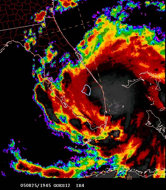
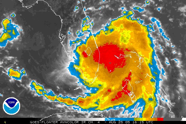
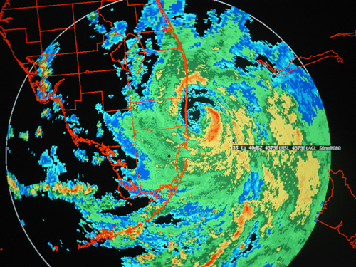
THERE SHE BLOWS - HURRICANE KATRINA NOW LOCATED
OFF THE SOUTHEASTERN FLORIDA COAST
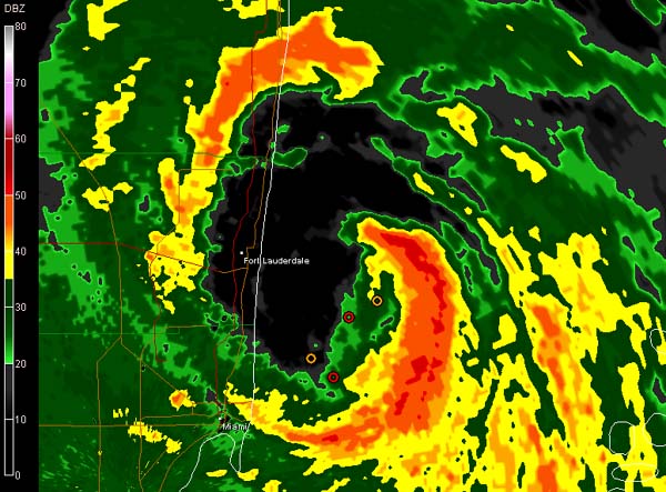
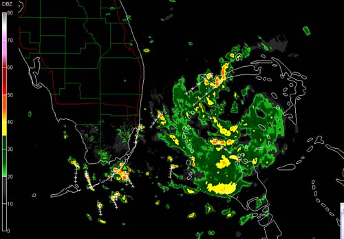
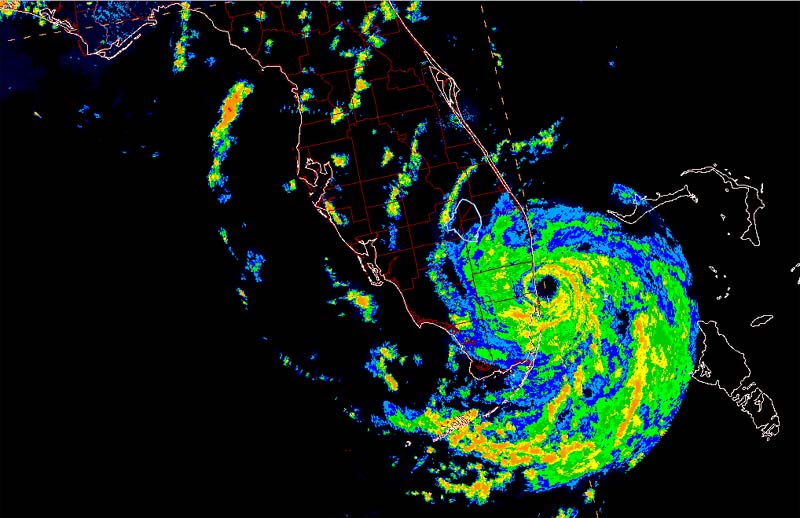
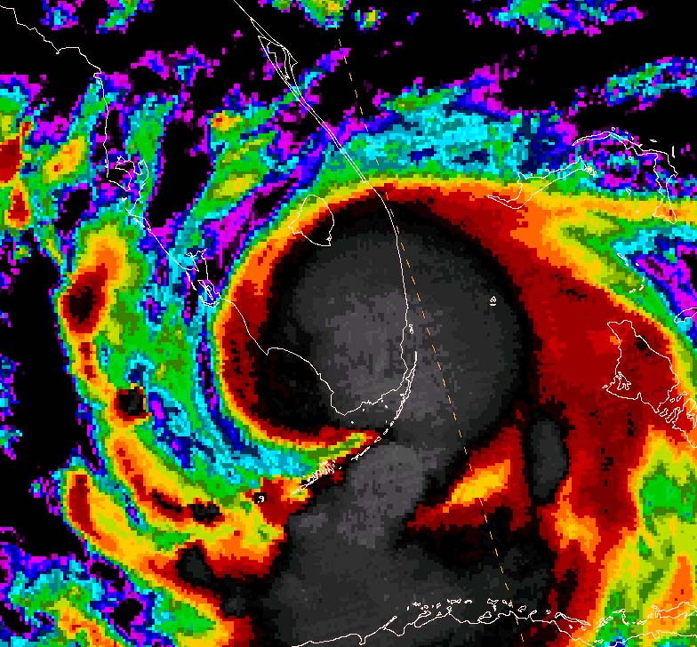
RADAR OF THE STORM MOVING INTO FORT LAUDERDALE
KATRINA AT 5 p.m. Central Time
6 p.m. Katrina
HOLLYWOOD AND MIAMI BEACH BEING HIT MY 80 MPH KATRINA
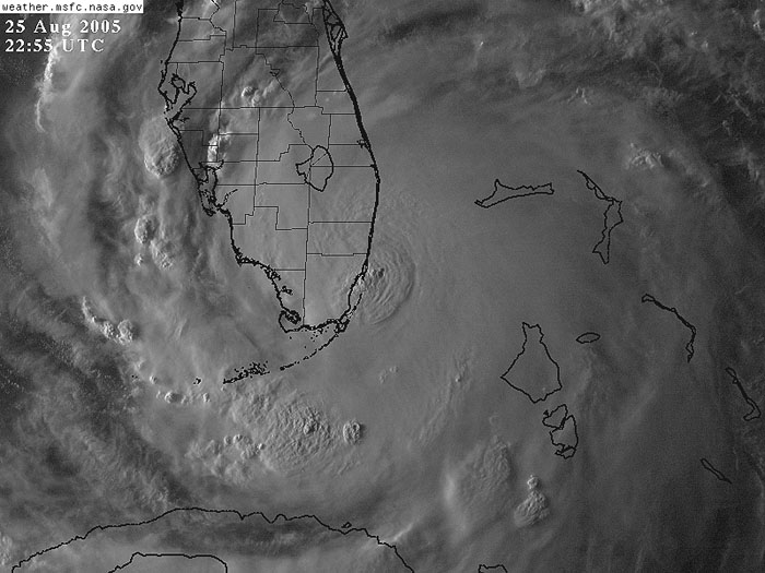
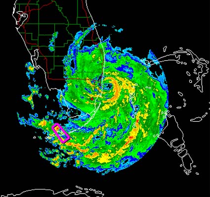
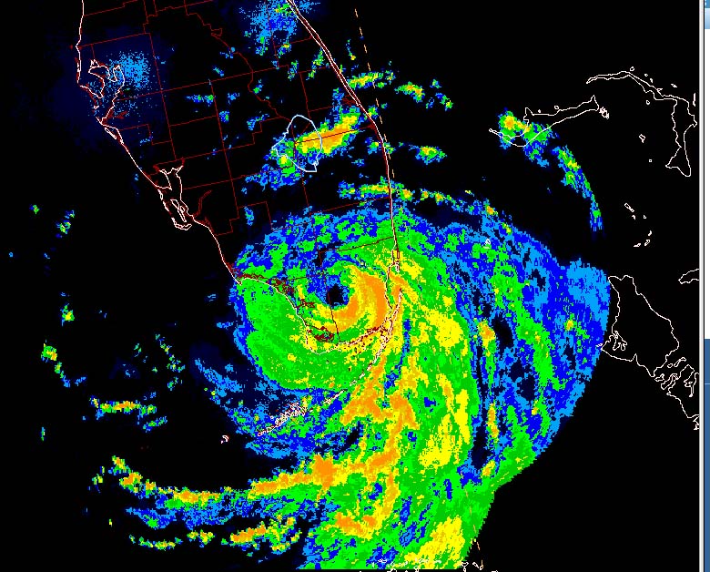
KATRINA HITTING SOUTHERN FLORIDA AS A CAT 1 HURRICANE
HURRICANE KATRINA SMACKS SOUTH FLORIDA - THURSDAY EVENING
6:30 p.m. Central Time - HURRICANE KATRINA HITTING FLORIDA
3 HOUR RAINFALL TOTALS 5 p.m. - 8 p.m. Eastern Time
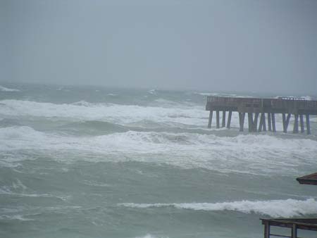
Juno Beach Pier...on-line blog photograph
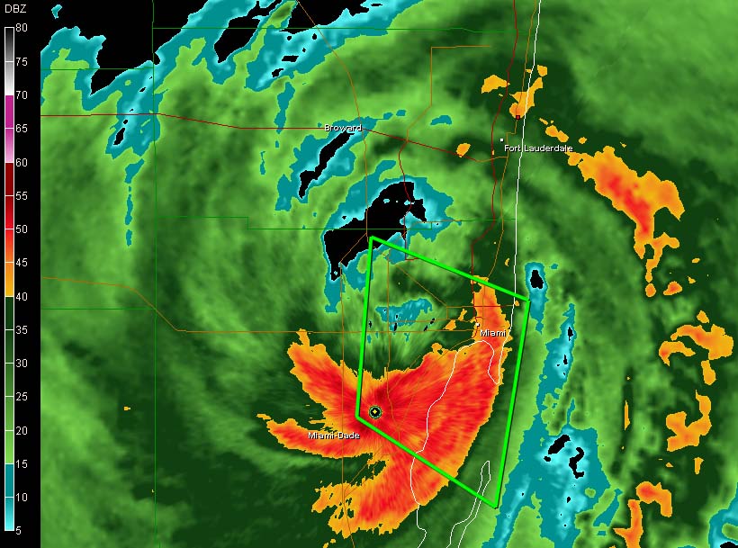
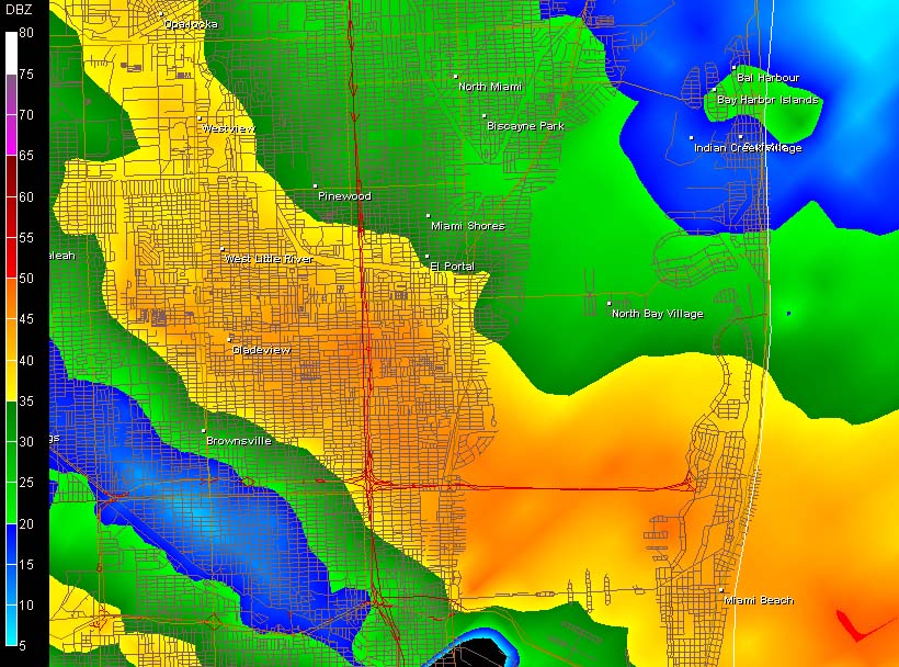
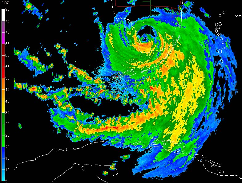
7:30 Radar zoomed in on Miami - Flash Flood Warning out,lined
in green
AP NEWS PHOTOGRAPHS
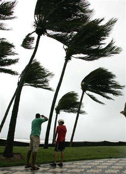
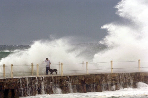
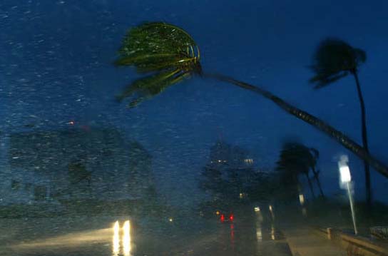
Beachgoers look at the surf from a sidewalk
as Hurricane Katrina makes landfall in
Deerfield Beach, Florida August 25, 2005.
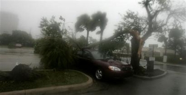
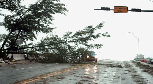
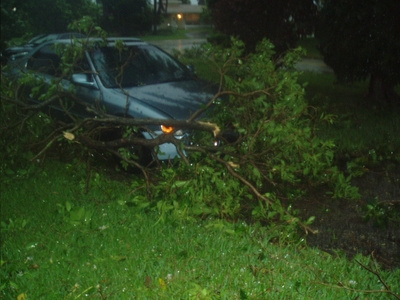
A tree was blown over on top of a car in Fort Lauderdale, Fla.
as Hurricane Katrina came ashore late Thursday, Aug. 25, 2005.
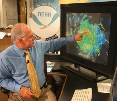
MAY MAYFIELD, NATIONAL HURRICANE CENTER

JEB BUSH DISCUSSES THE
HURRICANE
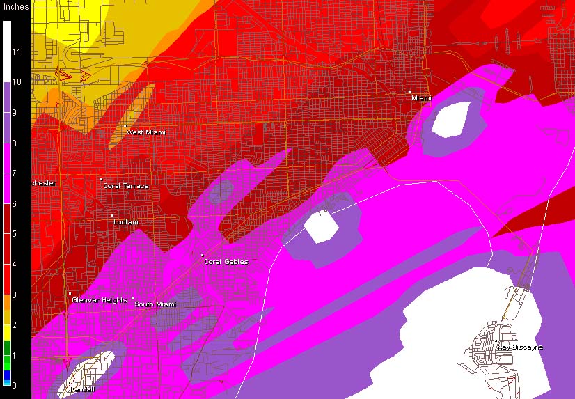
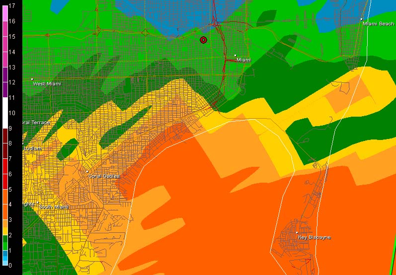
DOWNTOWN MIAMI RAINFALL - UP TO 10 INCHES OF RAIN HAS FALLEN
AP PHOTO
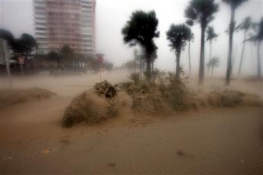
Sand is blown off the beach at Fort Lauderdale, Fla.

KATRINA POUNDING FLORIDA...POMPANO BEACH - WUNDERGROUND PHOTO
WUNDERGROUND PHOTOGRAPH - POMPANO BEACH, FLORIDA
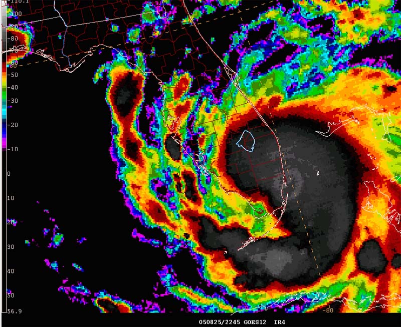
KATRINA MOVES TOWARDS FLORIDA EARLIER TODAY
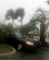
A tree was blown over on top of a
car in Fort Lauderdale, Fla. as
Hurricane Katrina came ashore late Thursday.

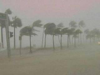
FORT LAUDEDALE, FLORIDA
HURRICANE KATRINA
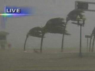
FORT LAUDEDALE, FLORIDA
HURRICANE KATRINA

FORT LAUDEDALE, FLORIDA
HURRICANE KATRINA
FORT LAUDEDALE, FLORIDA
HURRICANE KATRINA
FORT LAUDEDALE, FLORIDA
HURRICANE KATRINA
FORT LAUDEDALE, FLORIDA
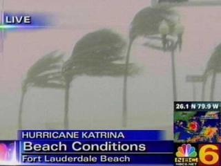
HURRICANE KATRINA - NBC 6
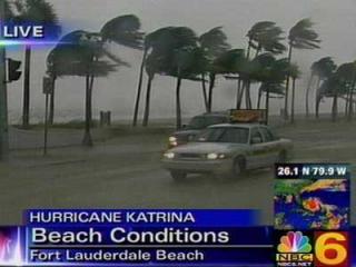
FORT LAUDEDALE, FLORIDA
HURRICANE KATRINA - NBC 6
10:45 EASTERN TIME
EXTREMELY SERIOUS FLOOD SITUATION IN MIAMI TONIGHT...UP TO 20 INCHES OF RAIN
IS POSSIBLE.
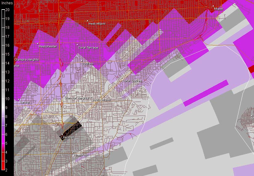
RAINFALL TOTALS OVER THE CITY OF MIAMI....BLACK IS NEARLY 19 INCHES

MIAMI FLOODING TONIGHT
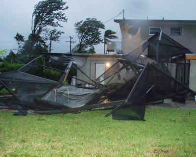
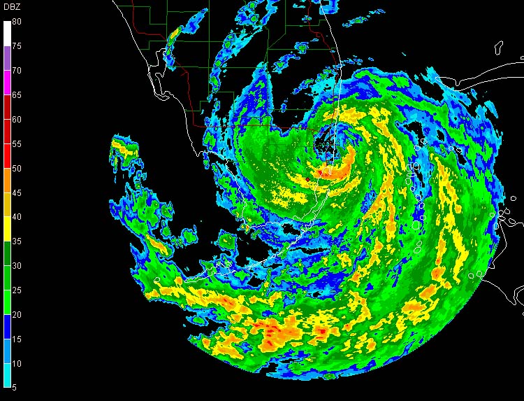
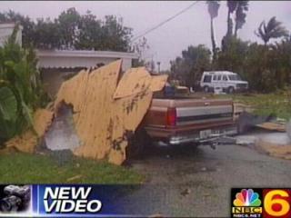
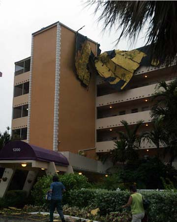
Fort Lauderdale Damage
Eleven pm Katrina...Southern Florida being pounded
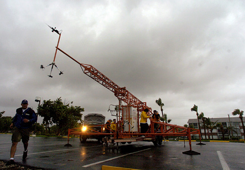
Researchers with the Hurricane Research Center Florida
Coastal Monitoring Program setting up shop
Hollywood, Florida Wind Damage
Katrina Slams Florida on Thursday Evening

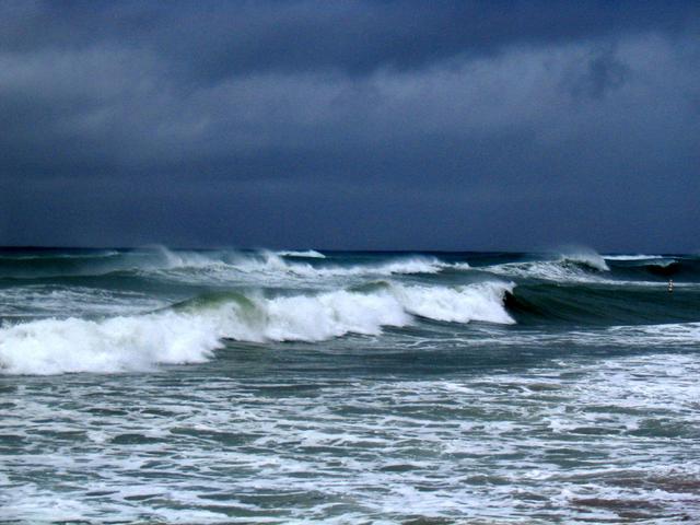
SURFS WAY UP AS KATRINA MOVES ASHORE...
WEST PALM BEACH EARLIER THIS EVENING...

BROWARD COUNTY EOC
11:15 Eastern Time
KATRINA HOLDS HER OWN!
Fort Lauderdale, Florida
FORT LAUDERDALE, FLORIDA TONIGHT
POMPANO BEACH, FLORIDA - EARLIER THIS
EVENING
KATRINA MOVING OFFSHORE - EARLIER THAN FORECAST
KATRINA MOVING OFFSHORE TONIGHT
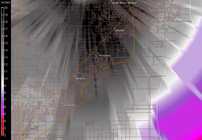
AMAZING RAINFALL TOTALS - THAT BLACK AREA IS OVER 20 INCHES OF RAIN!
Okay that is a LONG page full of
Hurricane Information sooooo
CLICK HERE TO TURN THE PAGE
RETURN TO HOME PAGE