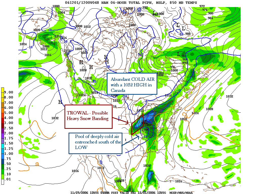
Here is the 6-hr precip forecast 48 hours out from today's 12Z ETA run. I located the TROWAL (trough of warm air aloft) between Iowa and the sfc LOW. For places where the atmosphere thicknesses support snow, there would be the potential for heavy snow banding near Chicago (more likely to the W/SW, not east).
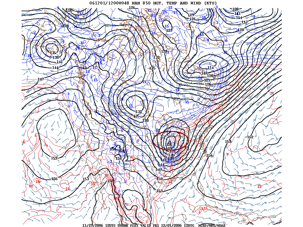
t image: A more detailed look at the TROWAL associated with 850 Temps. See the thermal "ridge" portruding to the west between Chicago and the cold pool (-12C air) associated with the 850 low? That is the TROWAL, and I circled it. Just a bit to the north/northwest of the trowal would be plenty of moisture and the potential for heavy snow. If the air is as cold as it is forecast in this run, it would be all snow.
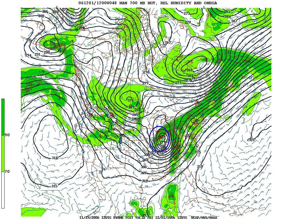
Now, this image obviously is the 700mb humidity. See the comma head of
moisture? Right over Chicago! And if this pans out, the bands would be oriented
from SW to NE across northern St Louis suburbs (but lesser snow amounts in the
city itself - they will have a higher potential of getting sleet/freezing rain),
northeast Missouri, and central Illinois, and then towards Chicago and points
west.