This is my little
space, my little world, my thoughts, my dreams, my happiness, my
sorrows, my
laughter, my tears,
my life as it was yesterday, is today, and will be tomorrow
Had a SUPER time with Kristy down in Florida. She
will not be home until this weekend. I will have
to play catch up with her later. I miss her
already! Hopefully we will get to see each other
again in December or January.
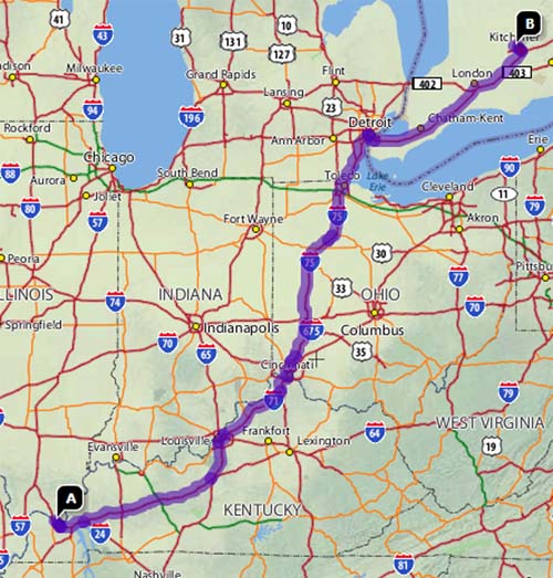
LONG drive today. Left the house
at 6 a.m. and arrived in Detroit around 2 p.m. -
now that is making some good time! Stopped once to
fill up. Made it to Canada on less than two tanks
of gas! Pretty good for the SUV...I would imagine
a lot of cars wouldn't even do that. 740 miles of
driving.
This is what that looks like on a map :)
Took awhile to get to Waterloo though...lost an hour
because of time change and there were several wrecks
along the way. Feels good to be here though!!!!
7-7-07
Hey it's a lucky day I guess!
Going to see Oceans 13 tonight - would seeing Ocean's 13
on 7-7-07 be unlucky???
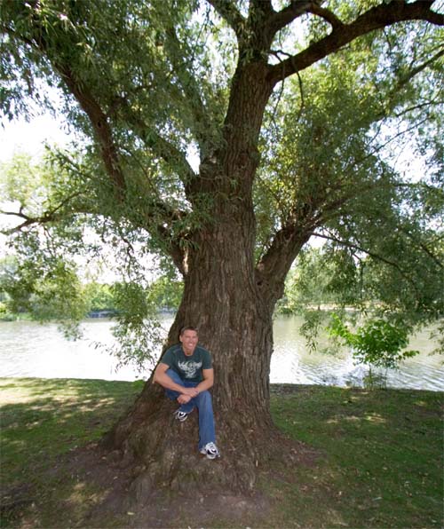
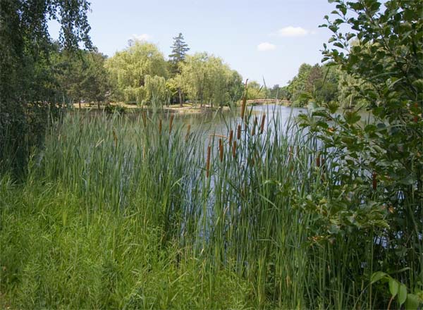
David and I went to one of the parks (Victoria Park)
here in Waterloo...nice park. There were TON of
weeping willow trees. This one was a BIG one!
Check out the size of the trunk. BIG. This
is probably one of the larger weeping willow trees that
I can remember seeing.
Victoria Park
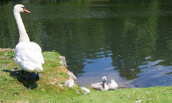
This mother goose was keeping a close eye on her babies.
So a GREAT day in Waterloo. The movie was
awesome. I enjoyed the first two movies, of that
series, so this one was not a disappointment either!
Well worth seeing on the big screen.
We are going to a coin show on Thursday or Friday...I
am looking forward to that. Then there is some
uncertainty beyond as to what we are doing beyond this
Friday. Perhaps Romania or perhaps Croatia.
Time will tell.
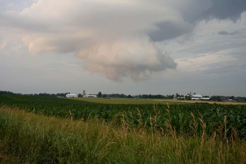
July, 8 2007
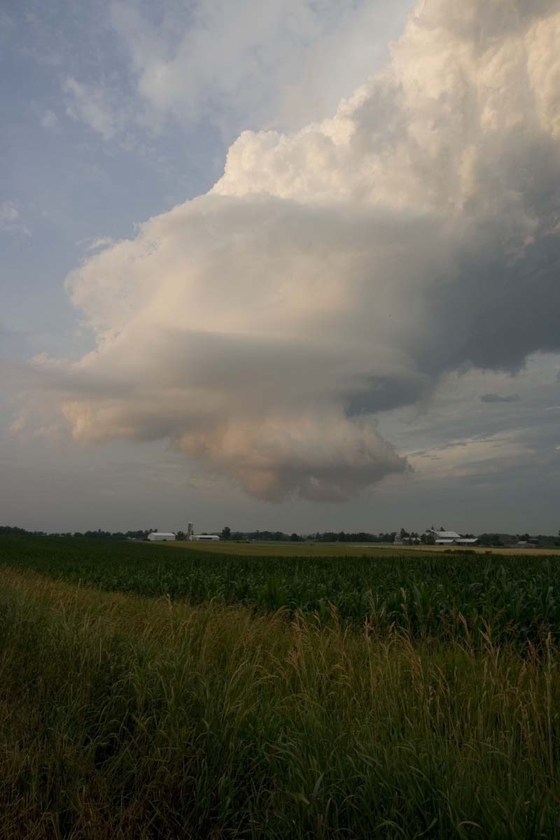
Storms moving into Waterloo this morning...
Kitchener - Cambridge - Region of Waterloo
8:58 AM EDT Sunday 8 July 2007 Severe thunderstorm warning for
Kitchener - Cambridge - Region of Waterloo issued
At 8:55 AM weather radar indicates a line of strong to
severe thunderstorms extending from Arthur to near
lucknow with motion southeastwards at around 40 km/h.
The main threats from these storms is large
hail..Torrential rain and intense frequent lightning.
There is also a slight risk of brief damaging wind
gusts.
CCN10 CWTO 082124
CONVECTIVE WEATHER FORECAST FOR THE PROVINCE OF ONTARIO
ISSUED BY ENVIRONMENT CANADA AT 5:24 PM EDT SUNDAY 8 JULY 2007
THIS FORECAST IS ISSUED AT 4 AM AND 4.30 PM DAILY BETWEEN MAY 1
AND SEPTEMBER 30.

NOTE:  THIS IS NOT A SEVERE WEATHER WATCH WARNING OR SPECIAL WEATHER
       STATEMENT.

DISCUSSION OF THUNDERSTORM POTENTIAL.

TONIGHT..SCATTERED THUNDERSTORMS WITH A MODERATE RISK OF A FEW
ORGANIZED SEVERE THUNDERSTORMS STRETCHING FROM LAKE HURON AND THE
BRUCE PENINSULA SOUTHEASTWARDS TO THE GOLDEN HORSESHOE. THIS IS
ASSOCIATED WITH A LOW MOVING ACROSS THE CENTRAL GREAT LAKES AND
ITS ATTENDANT WAVE CREST AND WARM AND COLD FRONTS. SOME OF THESE
STORMS MAY REACH AS FAR EAST AS GEORGIAN BAY AND EASTERN LAKE
ONTARIO OVERNIGHT. TORRENTIAL RAINFALL..LARGE HAIL..FREQUENT
DANGEROUS LIGHTNING AND DAMAGING WIND GUSTS ARE ALL CONCERNS WITH
THESE STORMS. THERE IS ALSO THE RISK OF AN ISOLATED TORNADO MAINLY
THIS EVENING.

MONDAY..SCATTERED THUNDERSTORMS WITH A SLIGHT RISK OF SEVERE OVER
SOUTHERN ONTARIO NEAR THE LOWER GREAT LAKES. DAMAGING WINDS AND LARGE
HAIL WOULD BE THE MAIN THREATS WITH THESE STORMS AS THE COLD FRONT
PASSES THROUGH. THEY WILL ALSO BE ACCOMPANIED BY TORRENTIAL
DOWNPOURS AND INTENSE FREQUENT LIGHTNING. ADDITIONALLY ISOLATED
NON-SEVERE THUNDERSTORMS OVER FAR NORTHERN ONTARIO.

TUESDAY..THERE IS A SLIGHT RISK OF SEVERE THUNDERSTORMS OVER
NORTHWESTERN ONTARIO AS A SIGNIFICANT DYNAMIC DISTURBANCE ARRIVES
FROM SOUTHERN MANITOBA. THE MAIN THREAT WOULD BE CLOSE TO THE
INTERNATIONAL BORDER WITH LARGE HAIL AND DAMAGING WINDS. ISOLATED
NON-SEVERE THUNDERSTORMS ARE POSSIBLE IN SOUTHWESTERN ONTARIO LATE
IN THE DAY OR EVENING.

A SEVERE THUNDERSTORM IS DEFINED AS HAVING ONE OR MORE OF THE
FOLLOWING

 - WIND GUSTS OF 90 KM/H OR GREATER.
 - HAIL OF 2 CENTIMETRES DIAMETER OR GREATER.
 - RAINFALL RATE GREATER THAN 50 MILLIMETRES IN 1 HOUR OR
   LESS OR 75 MILLIMETRES IN 3 HOURS OR LESS.
 - TORNADOES

END/ASHTON
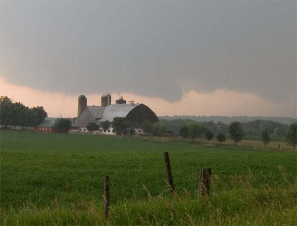
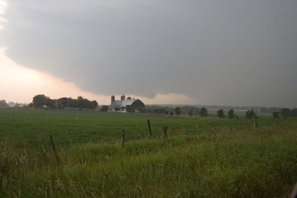
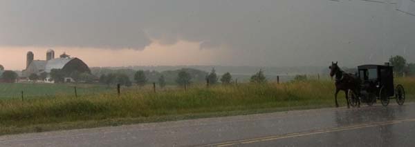
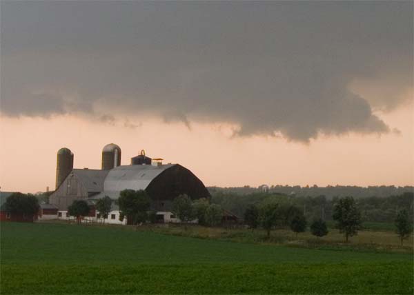
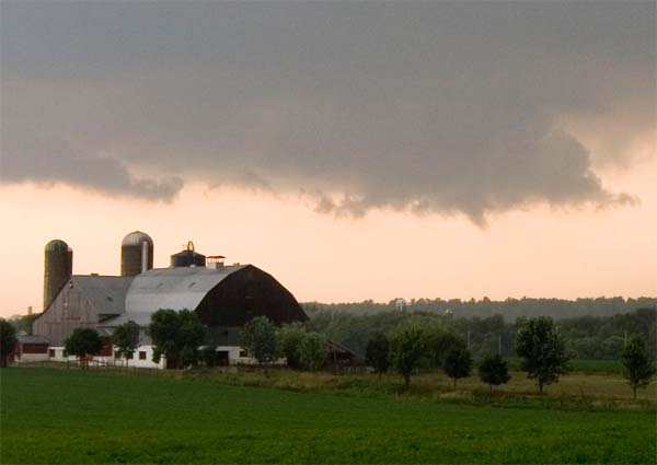
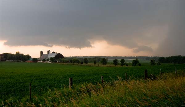
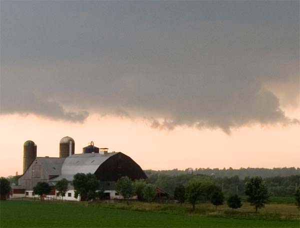
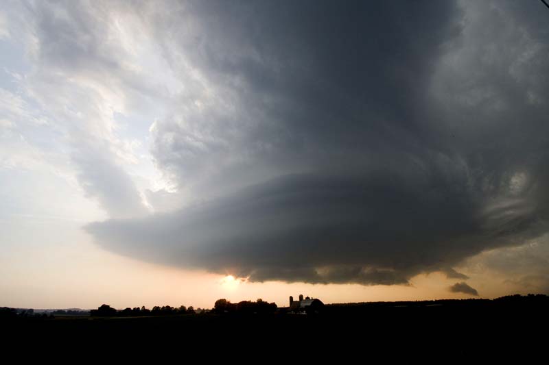
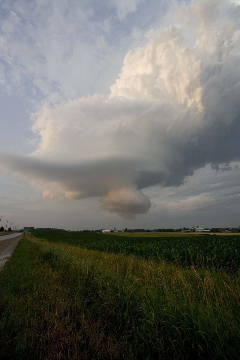
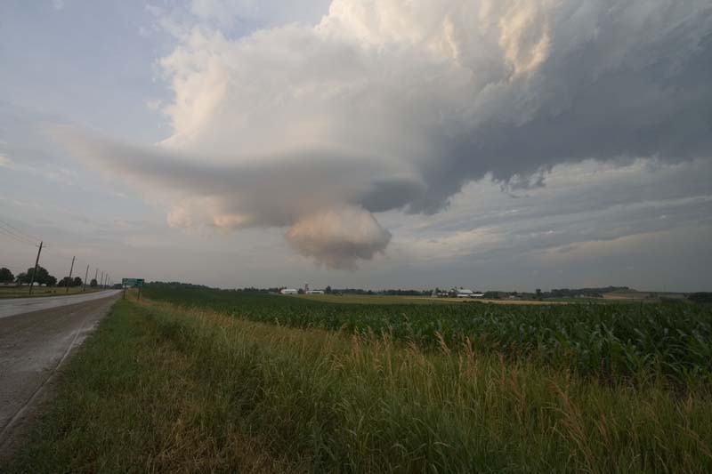
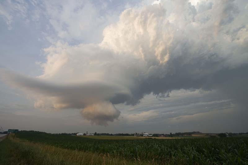
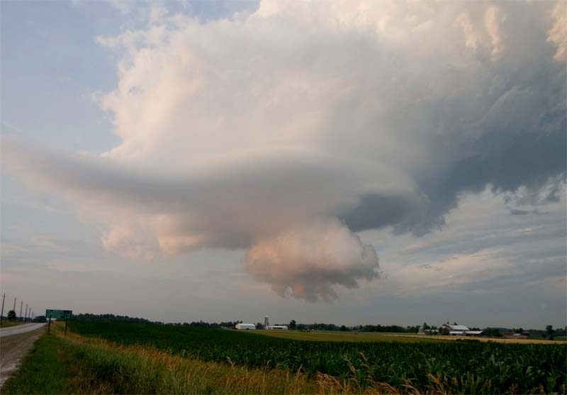
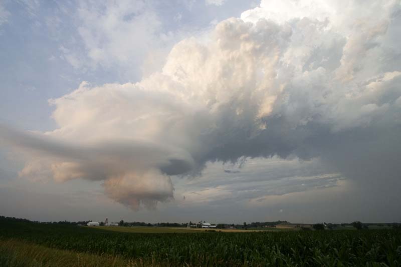
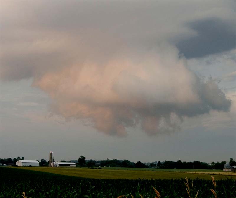
SUNDAY EVENING TORNADO CHASE!
SOUTHERN ONTARIO
There were several tornadoes near my location this
evening. Most of the photos below were taken a few
miles to the north of Waterloo, Ontario. David and
I went storm chasing and managed to catch the storm -
hail and wall clouds. It had IMPRESSIVE storm
structure. This storm reminded me of something you
would see in Oklahoma or Kansas...not Ontario. We
had hail up to the size of quarters. There were
reports of tennis ball size hail to our north and west
by just a few miles...same storm. Two tornadoes
were reported. We were able to see an impressive
series of wall clouds and a few small funnels!
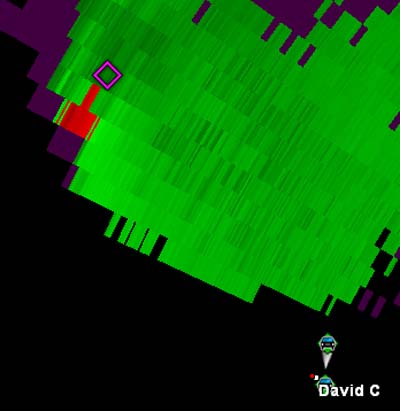
Gibson Ridge Radar showed a number of chasers near
the supercell. Unsure as to whether anyone got
photographs of the two tornadoes that touched down.
I took the photos below.
Mount Forest - Arthur - Northern Wellington County
7:46 PM EDT Sunday 8 July 2007
Tornado warning for
Mount Forest - Arthur - Northern Wellington County
continued
At 7:30 PM Doppler weather radar and spotter reports
continue to indicate strong rotation associated with a
tornado producing storm east of Wallace near Listowel.
This is a long-tracked rotating storm which has produced
tornadoes for close to an hour and a half. Torrential
rain and large hail is also occurring. There have been
reports of hail larger than tennis ball sized. There
have been reports of hail damage and some trees down
along the storm swath. The tornado is tracking
southeastward and will likely be in the conestoga lake
area towards 8:30 PM.
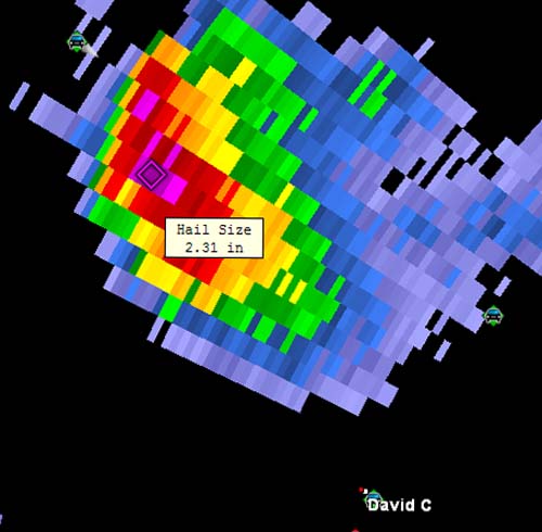
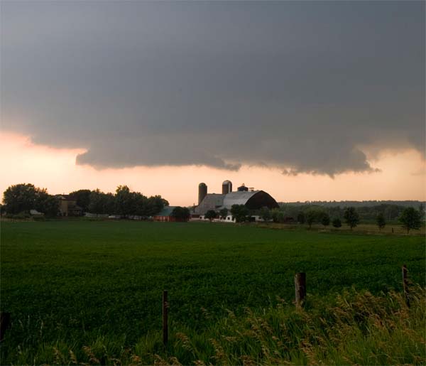
Meso on radar - tornado warnings issued. Red on
Green
is the area of rotation.
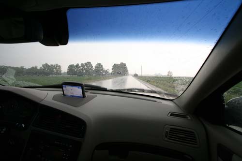
David drove while I took pics...we ran into the rain and
eventually hail.
It hailed for awhile. Started out as pea size and
got larger as time
passed.
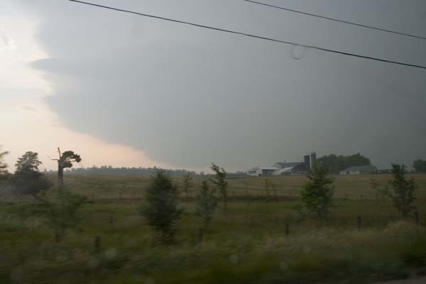
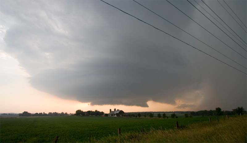
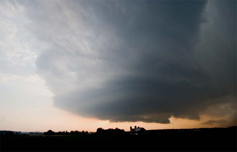
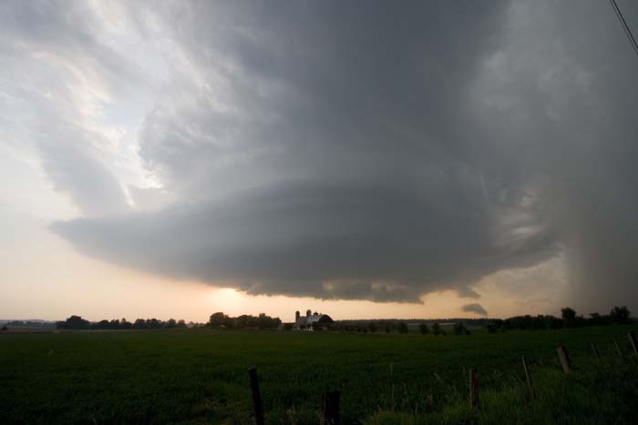
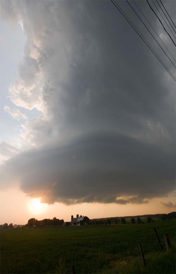
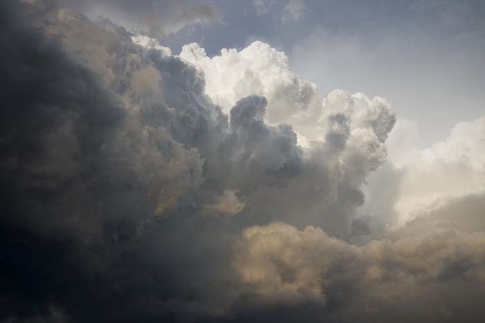
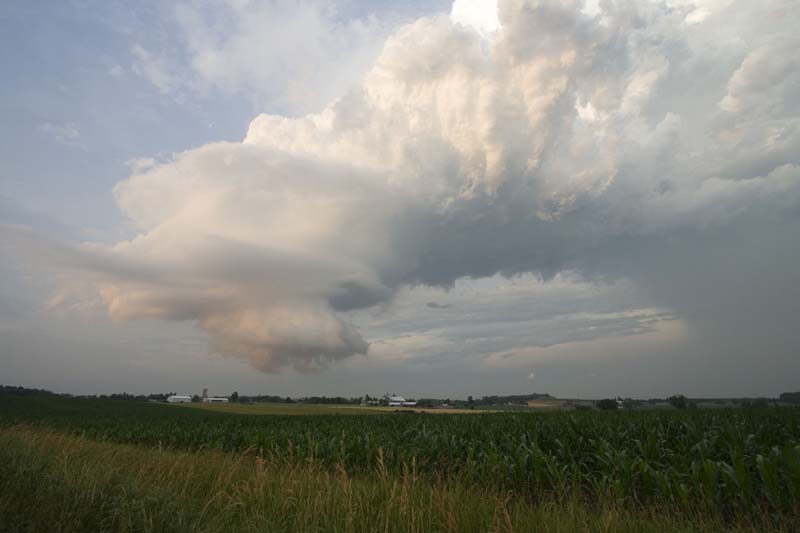
Storm to the southwest...with a wall cloud. You
can see the striations to the left above the wall cloud
- nice storm structure.
Wall Cloud to the west/northwest
You can see the rain and hail to the east of the wall
cloud - we were experiencing hail up to the size of
quarters.
Hail fell on us for about 15 minutes...
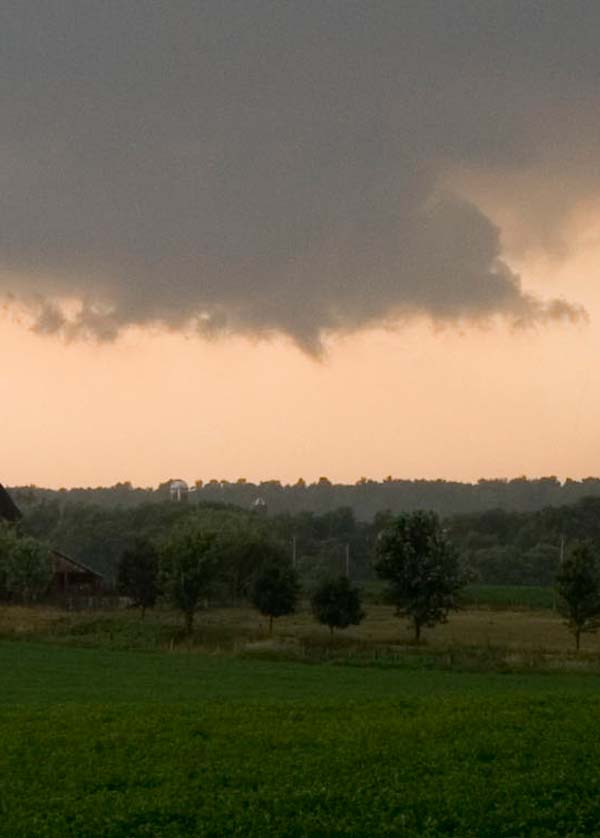
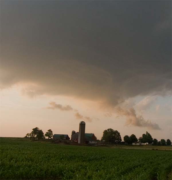
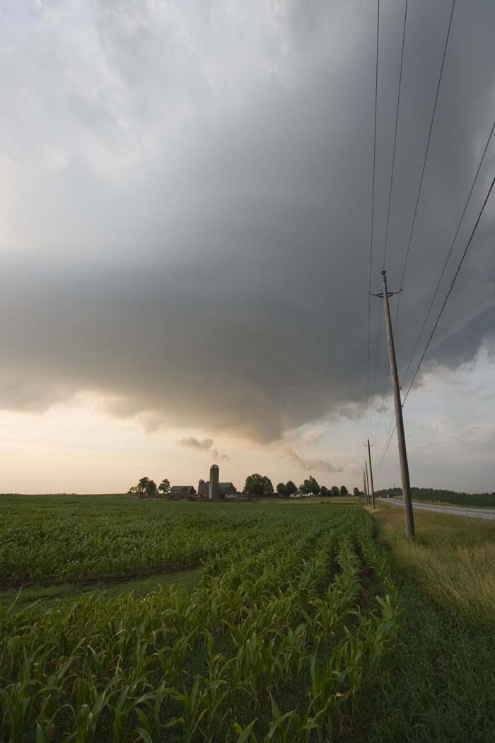
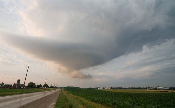
Funnel Cloud and Wall Cloud north of Waterloo, Ontario
Large wall cloud on the southwest side of the severe
thunderstorm. Large hail was falling to the north
of this wall cloud...we were experiencing hail up to the
size of quarters.
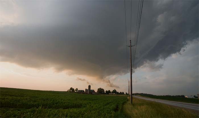
You can see the striations in the clouds and it spins...
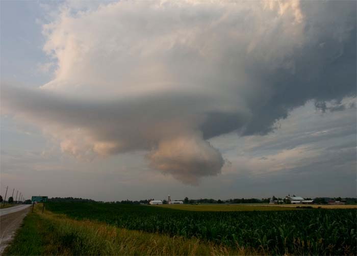
Nice bowl shape to the meso
Just to the east of the meso...mean looking clouds - the
sky was pretty amazing
A new meso rapidly formed after the first one dissipated
Coolness factor of 10 :)
One of the best storm structures I believe I have ever
seen! TO TOTALLY amazing for Ontario. Still
waiting to watch the news to see what kind of damage was
reported. We know that two tornadoes touched down
- according to spotters. Hail damage was reported
with the storm - the tennis ball size hail most likely
broke some cars windshields. Will post more later.
There were a number of chasers on the storm - I am
sure someone photographed the tornadoes.
MEGA thank you to Jason Darnall for helping cover
radar and get us into the right spot!!!!!