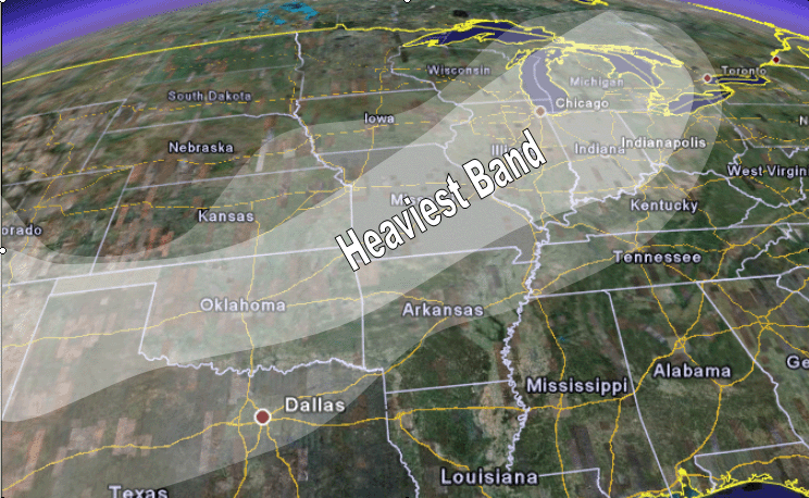
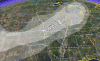
 Updated Severe Weather Threat Map
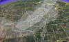
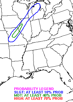
 Thursday/Friday Strong/Severe Weather Potential
November 2006
November 26, 2006
Potential winter storm later this week. Stay tuned :)
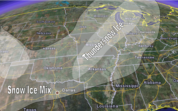
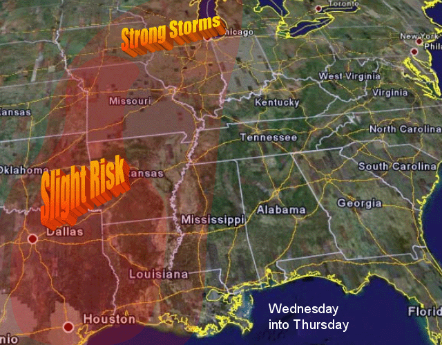
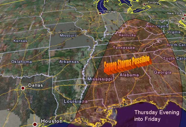
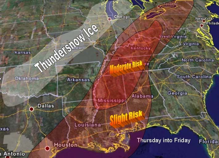
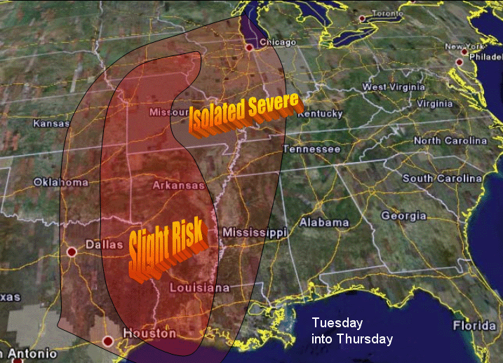
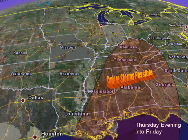
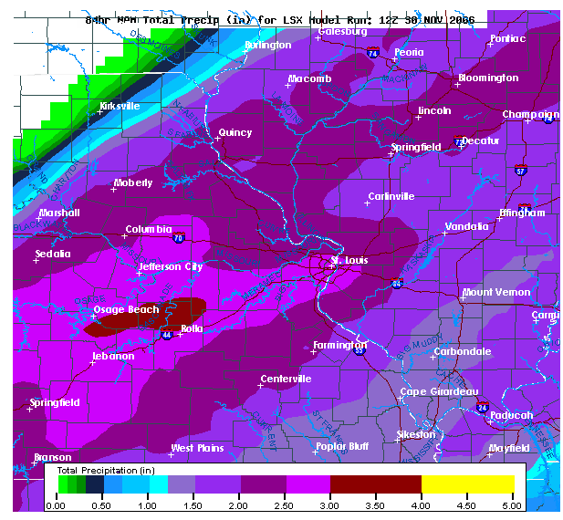
Monday - Third Call - Friday 1st Call Sunday 2nd Call -------- What a complicated system. Not much change in my thoughts on the snow. Same area as before. Looking for confident in keeping areas to the south and east out of the main threat. Obviously everything is going to hang on the infamous track of the low. Models are all over the place on strength and track. Several things that I was concerned about on Friday and Sunday. 1. I believed that each model run would show a stronger low. They have. 2. I was concerned about a secondary threat developing for severe weather if we did indeed end up with that low. We have. SPC has now painted a larger area to go along with that. 3. Heaviest snow threat appeared to be from MO, IL, WI, and IN. That still appears to be the case. 4. Continue with the same thoughts on the 30-40 degree temperature drop. Winds of 30-40 mph with the front across many areas. Wind chills into the single digits and teens across a large area. A nasty "welcome to December" is in store for many people. Thoughts and changes 5. Shifted the frozen chances a bit southward into Louisiana and a bit more into Mississippi - behind the front there should be enough moisture left for some frozen precip to fall. 6. The "real" push of cold air will not begin until Tuesday Afternoon from the Dakotas into Nebraska and by Wednesday Afternoon this cold air will have advanced into Missouri/Kansas/Iowa/Illinois/Oklahoma. It will be knocking on the door of Arkansas. 7. Believe portions of the Missouri Valley into Illinois/Indiana could see temperatures in the single digits before all is said and done. 8. Will up the timing on some of the strong storms to include tomorrow. 9. Will shift the strong/severe area of greatest potential more towards the NW to coincide with better instability. Relative speaking. ----- No real change in the heavy rain threat although models look wetter than they did over the last few days. NCEP believes some areas in Missouri and Illinois will see FOUR inches of precip. I am not sure if that will happen but obviously some substantial precip is going to be in order. Widespread 1-3 inches of precip across a large portion of the ARKLATEX, MISSOURI VALLEY, and up into ILLINOIS and WISCONSIN/INDIANA. One of the heavier precip makers in recent weeks (months?). This makes one of many systems over the past six months that will end up being a prolific precip maker. El Nino? I don't know but we have certainly had our share of heavy precip makers this year. CAPE values continue to increase on the models. By Wednesday Afternoon temperatures will likely be near 70 degrees across Western MO and near freezing in Northwest Kansas. A drop of nearly 40 degrees! A strip of CAPE Values of 200-1500 should line up along the cold front from Wisconsin and Illinois down to Oklahoma and Texas. I still believe this area has the potential for isolated severe thunderstorms. I would question the higher CAPE values if we end up having more widespread precip and cloud cover on Wednesday. Either way both Tuesday and Wednesday could both produce convection along the frontal system - with some of that being severe/strong. Wednesday Afternoon into Wednesday Night will likely bring the best opportunity (still marginal) for severe/strong thunderstorms across areas from Oklahoma up into Missouri. The strongest forcing appears to center around that time frame as the front attempts to push eastward. High winds and marginal hail appear most likely. Negative for severe 1. Instability/lapse rates not impressive 2. Arctic front - shallow cold air. Not like a spring cold front or summer. 3. Bottom line is that this first time frame is not looking like a huge event. The big story is the arctic cold front advancing eastward/southeastward. ---------So a few changes on the severe map - pushed things a bit further NW to include the highest CAPE areas and forcing. Second/Third storm system on Thursday/Friday. As mentioned earlier it now appears more and more likely that a significant winter storm will indeed be on the map by later this week. Not only will this system produce frozen precipitation but it will also bring the threat for additional severe weather to portions of the southlands and Tennessee Valley. One saving factor might be the fact that the storm doesn't "crank" up until it is well into KY/IN/OH. Added a second map to indicate what I believe will be a second enhanced area for severe. Still looks marginal for severe. Looks like thundersnow/ice will be likely across portions of Missouri and especially Illinois and Northwest Indiana on Thursday Night/Friday. Heaviest snow/ice totals will likely run from Central Missouri to Northwest Indiana. Exact track of the low is still in question. The 12z GFS takes the low into Western KY. This is further west than earlier runs. Something to consider.Updated Severe Weather Threat Map
Thursday/Friday Strong/Severe Weather Potential
 Updated Snowfall Potential - Dark White is heavier precip and the lighter white area is anything
from flurries to light frozen precip.
Something of interest - showing how the models are not in agreement
EAST...
THE MEDIUM RANGE FCST OVER THE ERN HALF OF THE COUNTRY REMAINS
CHALLENGING DURING DAYS 3-5/THU-SAT. AS LUCK WOULD HAVE IT...THIS
SYSTEM POSES A SIGNIFICANT THREAT OF BOTH LIQUID AND WINTRY
PRECIPITATION BEFORE IT MOVES OUT INTO ATLANTIC CANADA AND THE
WESTERN ATLANTIC. THE NCEP ENSMEMBERS SUPPORT THE 00Z GFS SOLUTION
WHILE THE 26/12Z ECMWF ENSMEMBERS SUPPORT THE 00Z ECMWF...WHICH
LOWERS CONFIDENCE IN ANY PARTICULAR FORECAST SOLUTION. THERE IS A
DECENT CONSENSUS UPON DEVELOPMENT OF A SIGNIFICANT WAVE IN ASSOC
WITH MID LVL TROF EJECTING FROM THE SW CONUS/PLAINS... BUT NO
AGREEMENT UPON TRACK/STRENGTH/TIMING. AN INTERMEDIATE SOLN
SIMILAR TO THE 06Z GFS APPEARS BEST AT THIS TIME. EARLIER THIS
MORNING...NO INDIVIDUAL MODEL OR ENSEMBLE MEAN PROVIDED AN
ACCEPTABLE STARTING POINT... WHICH REQUIRED SIGNIFICANT MANUAL
ADJUSTMENT FROM INITIAL BASE MAPS. A SOLUTION TOWARDS THE 06Z GFS
REQUIRED LITTLE ADDITIONAL MODIFICATION.
ROTH/RAUSCH
Updated Snowfall Potential - Dark White is heavier precip and the lighter white area is anything
from flurries to light frozen precip.


Something of interest - showing how the models are not in agreement

EAST...
THE MEDIUM RANGE FCST OVER THE ERN HALF OF THE COUNTRY REMAINS
CHALLENGING DURING DAYS 3-5/THU-SAT. AS LUCK WOULD HAVE IT...THIS
SYSTEM POSES A SIGNIFICANT THREAT OF BOTH LIQUID AND WINTRY
PRECIPITATION BEFORE IT MOVES OUT INTO ATLANTIC CANADA AND THE
WESTERN ATLANTIC. THE NCEP ENSMEMBERS SUPPORT THE 00Z GFS SOLUTION
WHILE THE 26/12Z ECMWF ENSMEMBERS SUPPORT THE 00Z ECMWF...WHICH
LOWERS CONFIDENCE IN ANY PARTICULAR FORECAST SOLUTION. THERE IS A
DECENT CONSENSUS UPON DEVELOPMENT OF A SIGNIFICANT WAVE IN ASSOC
WITH MID LVL TROF EJECTING FROM THE SW CONUS/PLAINS... BUT NO
AGREEMENT UPON TRACK/STRENGTH/TIMING. AN INTERMEDIATE SOLN
SIMILAR TO THE 06Z GFS APPEARS BEST AT THIS TIME. EARLIER THIS
MORNING...NO INDIVIDUAL MODEL OR ENSEMBLE MEAN PROVIDED AN
ACCEPTABLE STARTING POINT... WHICH REQUIRED SIGNIFICANT MANUAL
ADJUSTMENT FROM INITIAL BASE MAPS. A SOLUTION TOWARDS THE 06Z GFS
REQUIRED LITTLE ADDITIONAL MODIFICATION.

ROTH/RAUSCH
Tuesday Weather Update
Outlook for Wednesday into Thursday - Severe Weather Outlook


Thursday into Friday Outlook
Models are trending towards a more easterly storm system.  This would give us a great chance for
snow and ice.  It is still too early to determine how much frozen precip is going to fall across the
region.  Winter storm watches and/or advisories may be needed by Thursday and Friday.
Stay tuned!
 FINAL SNOW FORECAST MAP FOR THIS STORM
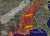 Severe Weather Outlook
Wednesday Night
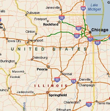
Have decided to go on a snow chase :)  Going to Central Illinois to try to get in on the big winter
event.  Hopefully they will get a lot of snow.
Sunday, December 3, 2006
We made it back from Peoria!  WHAT A TRIP!  We saw a ton of snow and took a lot of photos.  I will post
the photos.  If anyone wants to read the play by play then they can visit this site :)
http://www.easternuswx.com/bb/index.php?showtopic=115062
Here are some photos...all of these are from Peoria except the ice.  The ice storm photos are from Central
Illinois.  No snow here in Paducah.
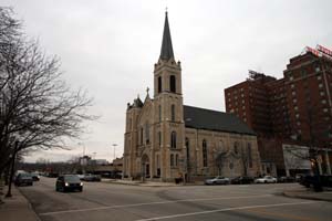
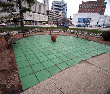
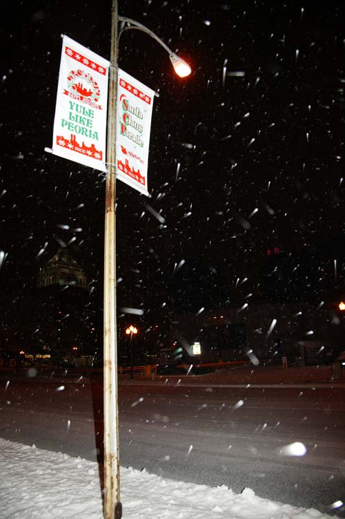
ALL PHOTOS FROM PEORIA ILLINOIS
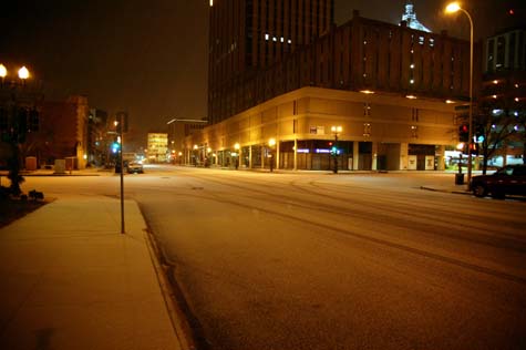
Downtown
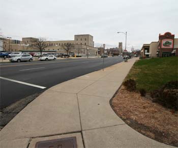
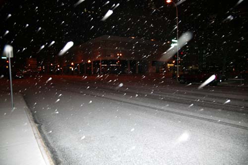
Peoria before the storm

Beau waiting on the snowstorm :)
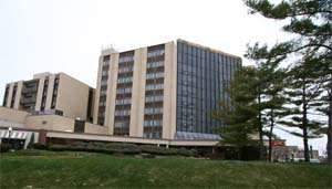
In front of the hotel
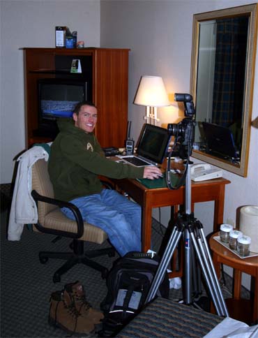
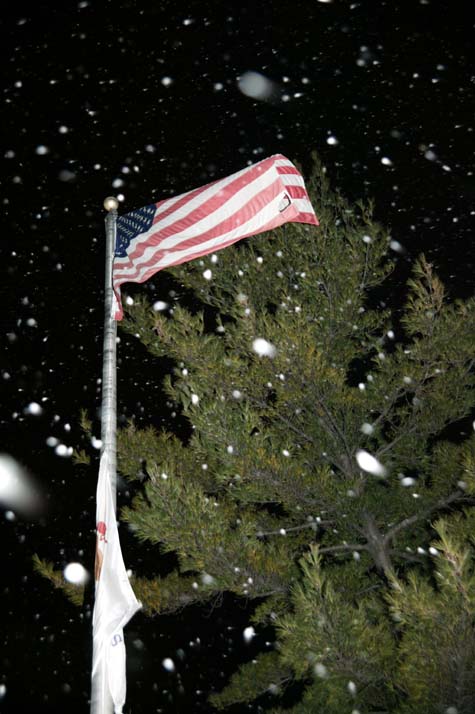
All set up for the big snow
Snowstorm 2006 - 6:00 p.m. November 30th 2006
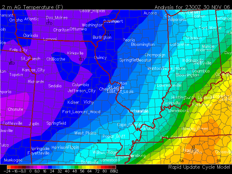
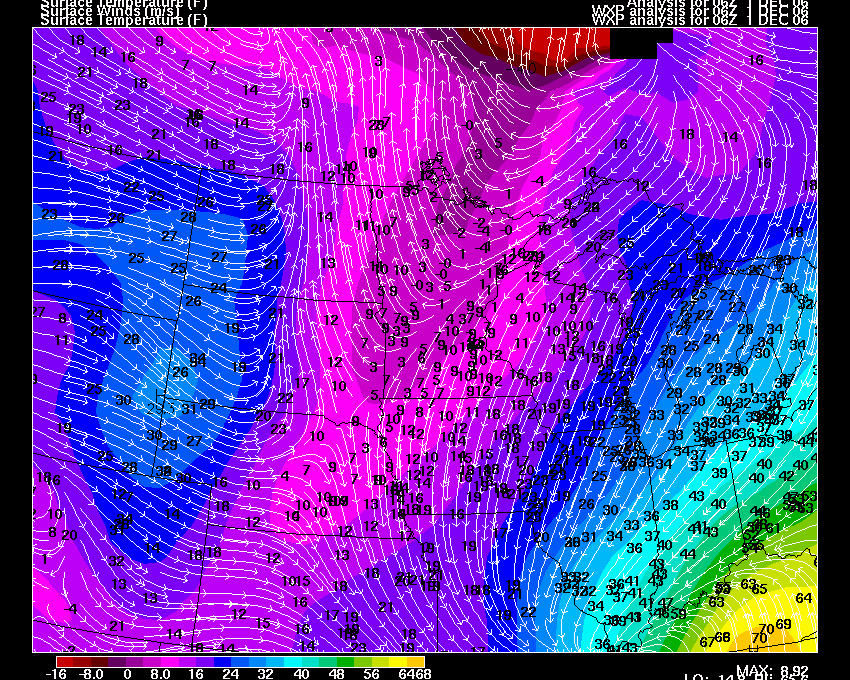
6 P.M. Surface Temps - Thursday Evening
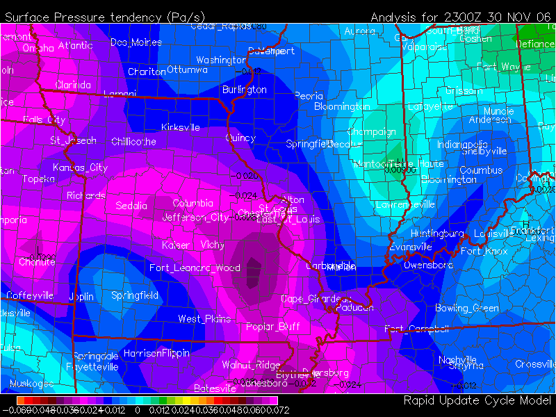
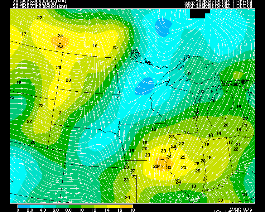
6 P.M Surface Pressure Falls - Thursday Evening
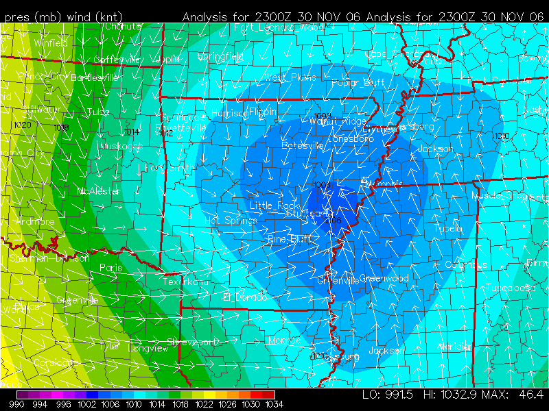
Thursday Evening Pressure Readings
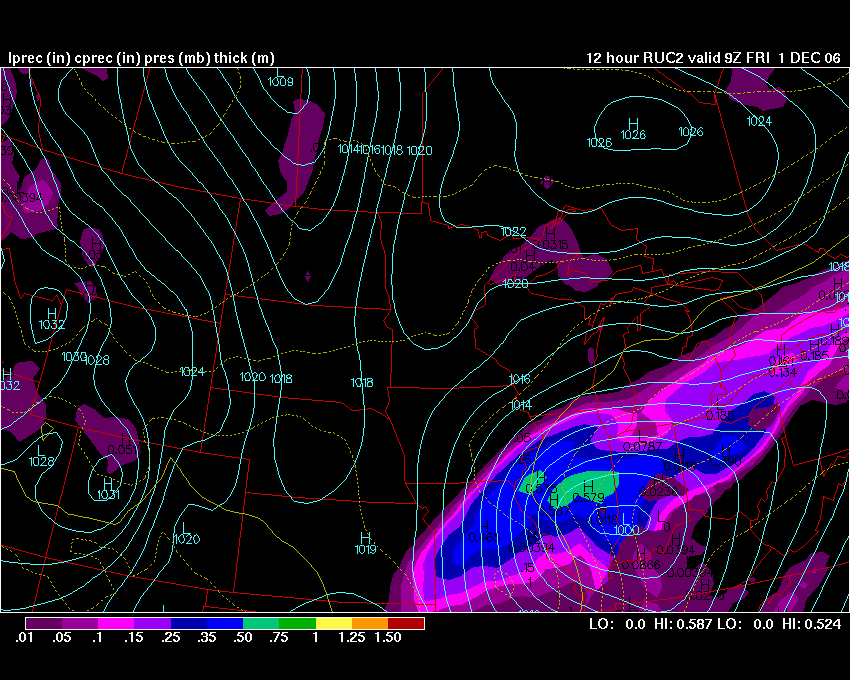
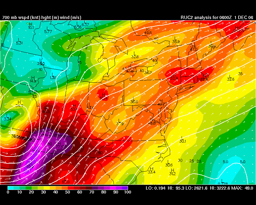
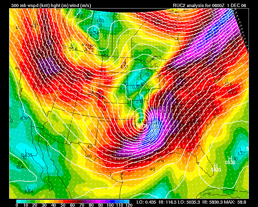
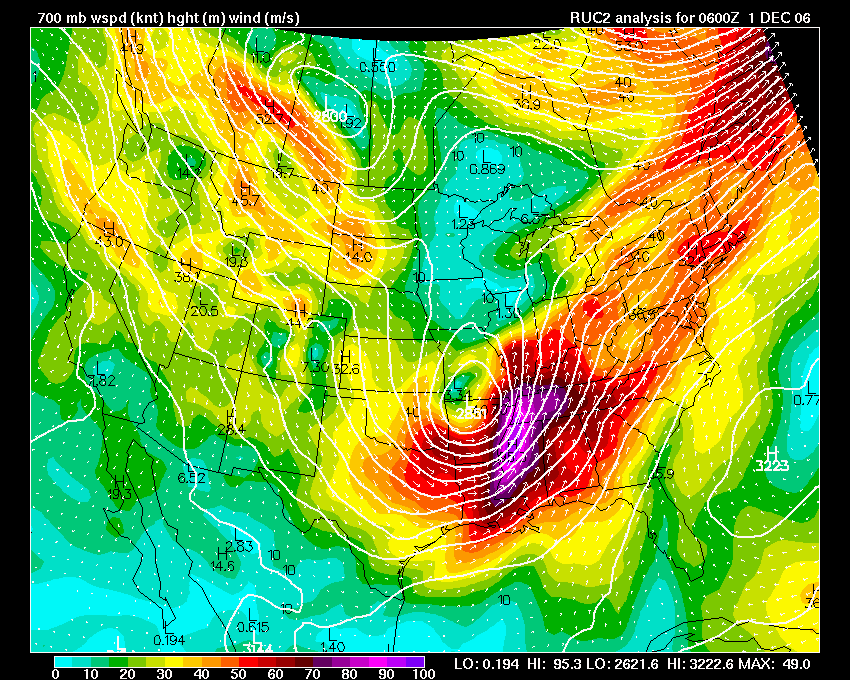
RUC FORECAST
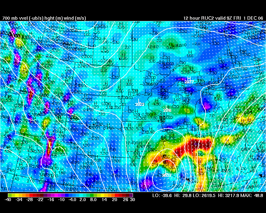
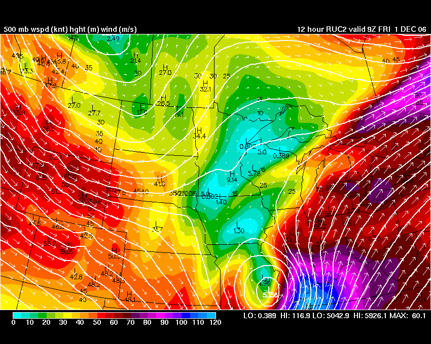
RUC 500mb and 700mb
MAPS FROM RUC -21z RUN
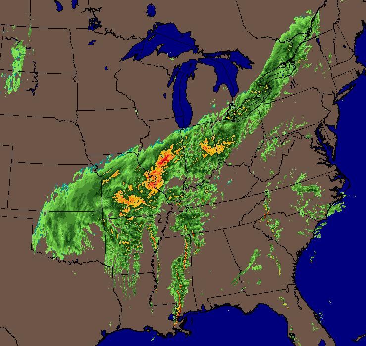
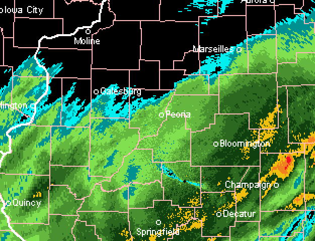
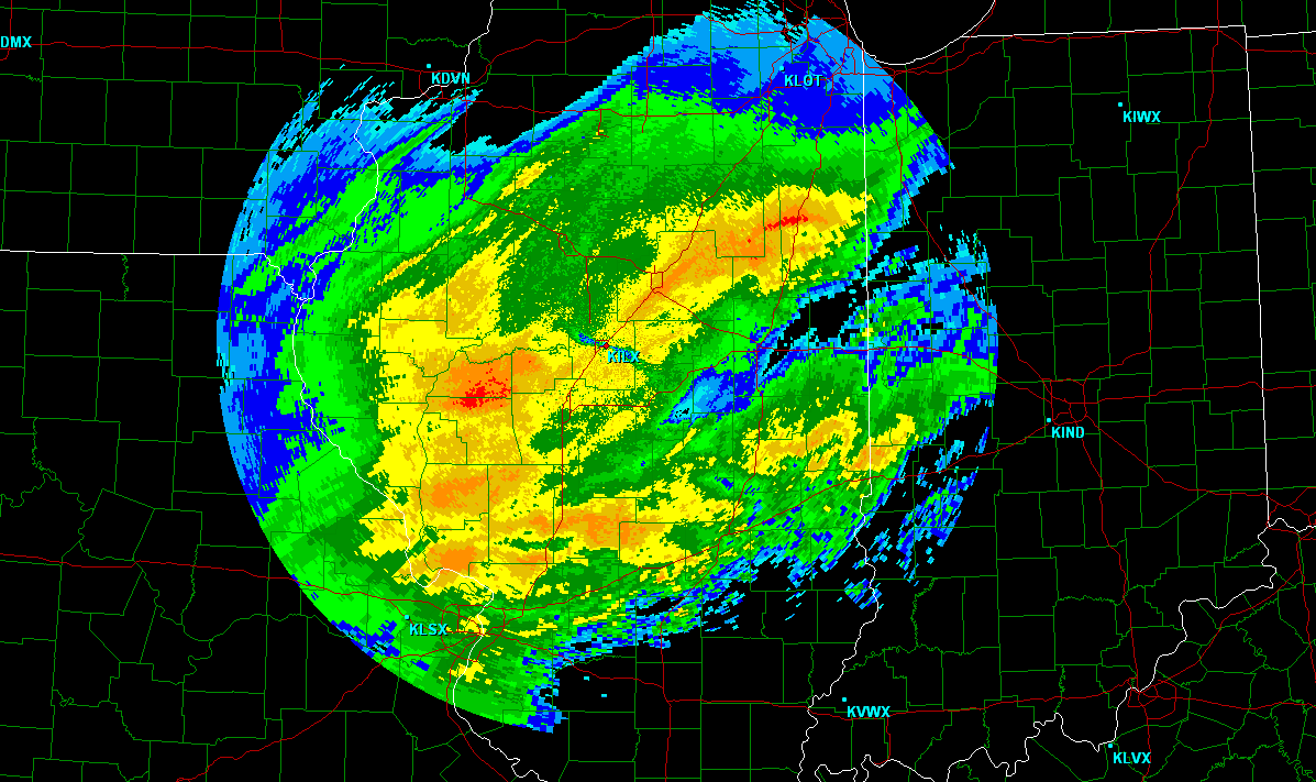
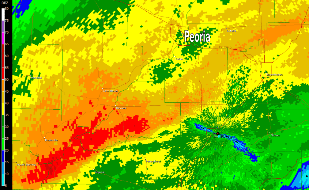
Radar
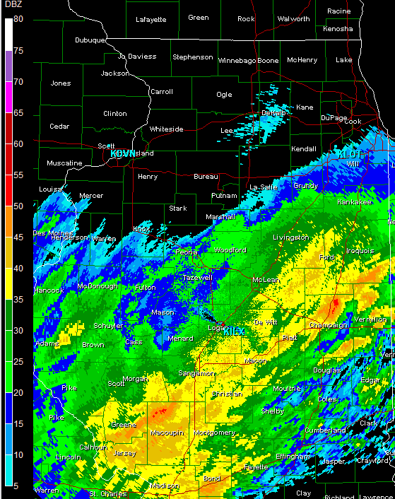
6:15 p.m. Radar - Peoria entering precip
Latest HPC Forecast for Snowfall Greater than 12 inches
24 Hour Precip Forecast Overlayed on St Louis Radar
FIRST SNOWFLAKES IN PEORIA
845 p.m.
8:21 p.m. Radar
8:52 p.m. Radar
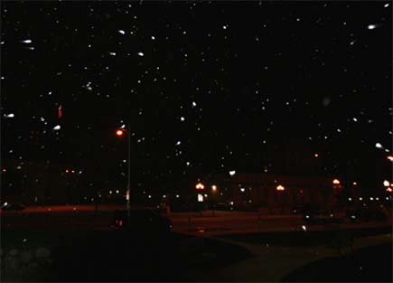
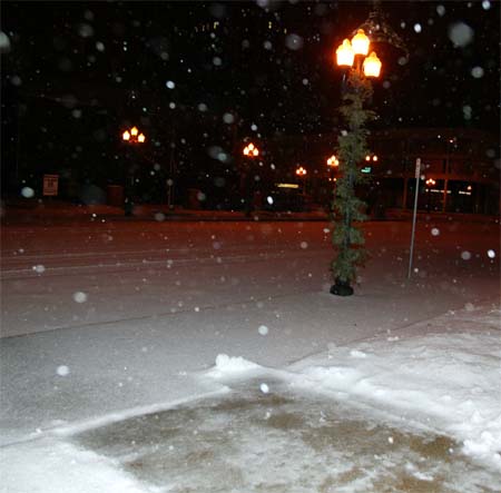
9:15 pm SNOW IN PEORIA
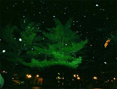
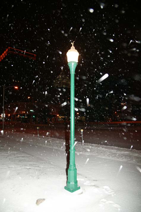
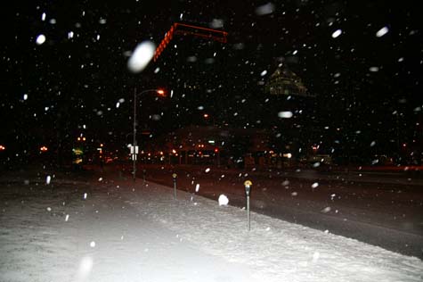
Snow falling over Peoria
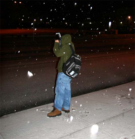
Taking pics in the snow :)
Snow and sleet in downtown Peoria
Streets are covered in ice.
Snow and large sleet pellets.
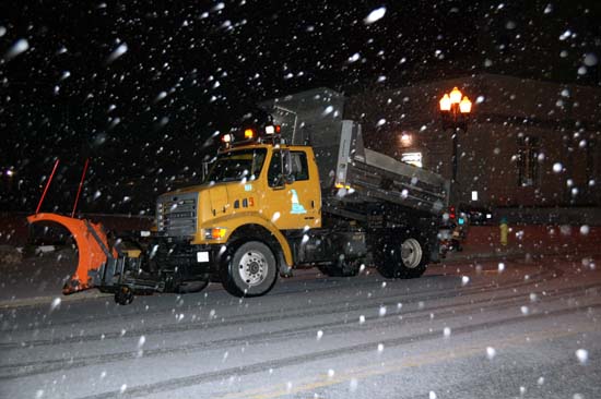
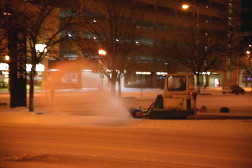
Salt Truck in Peoria clearing the streets
Not too deep YET!
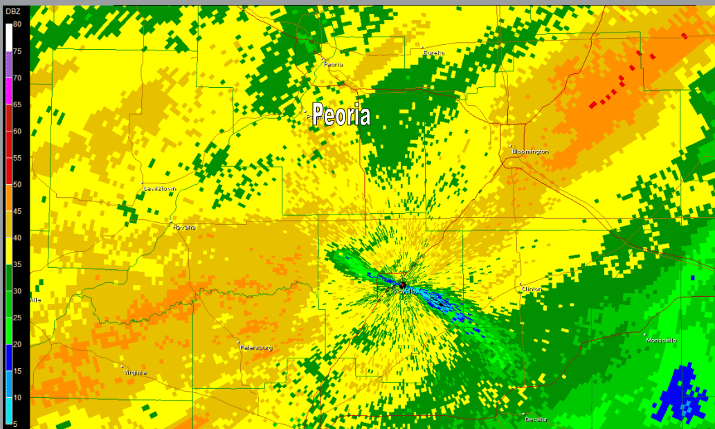
9:50 p.m. RADAR PEORIA
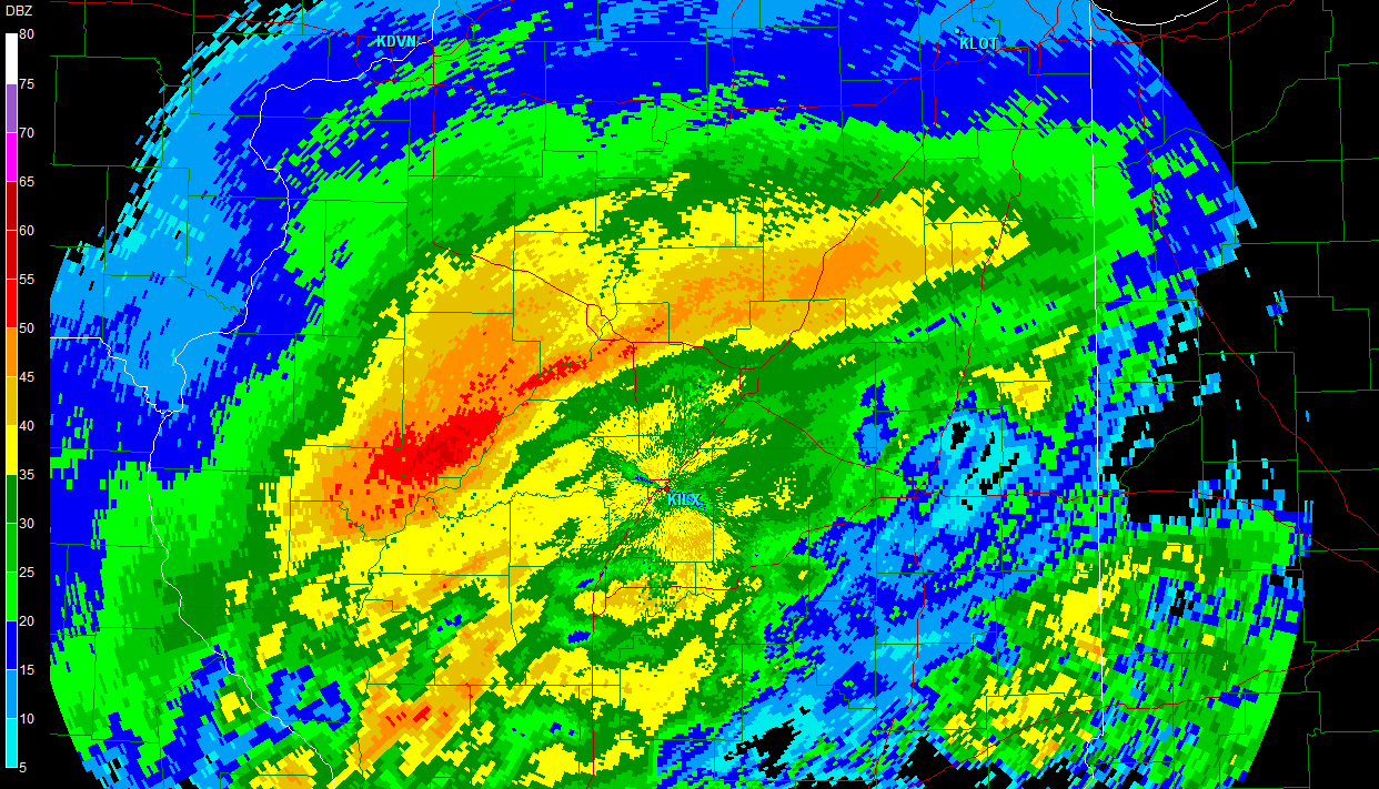
10:15 p.m. Radar Peoria - Central Illinois
AREA FORECAST DISCUSSION
NATIONAL WEATHER SERVICE LINCOLN IL
906 PM CST THU NOV 30 2006

.DISCUSSION...
LOTS OF MODERATE TO HEAVY SLEET OCCURRING ACRS THE CENTRAL PART OF
THE CWA WITH FREEZING RAIN IN THE DEC TO CMI AREAS AND A LITTLE
SOUTH. SOME...NOT MUCH...WARM AIR HAS ADVECTED BACK INTO EASTERN
PARTS OF THE CWA...BUT SO FAR NOT FAR ENOUGH TO CHANGE ANY PCPN BACK
TO ALL RAIN. LARGE AREA OF PCPN HAS OVERSPREAD THE AREA...MAINLY
NORTH OF I-70...WITH MOST IN THE FORM OF SLEET AND FREEZING RAIN.
AREAS IN THE EXTREME NORTHWEST HAVE BEEN SEEING SNOW AND BELIEVE THE
SLEET HAS BEEN LARGE ENOUGH...2 TENTHS OF A DIAMETER AT ILX...THAT
ASOS/AWOS IS REPORTING IT AS SNOW AND NOT SLEET.

QUICK LOOK AT THE MODELS INDICATES THAT THE CURRENT FCST IS ON TRACK
WITH ICE PCPN CONTINUING TONIGHT AND THEN CHANGING TO ALL SNOW
AROUND TO AFTER MIDNIGHT.

THEREFORE CURRENT FCST APPEARS TO BE ON TRACK AND WILL NOT BE
UPDATING.

&&
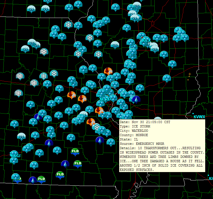
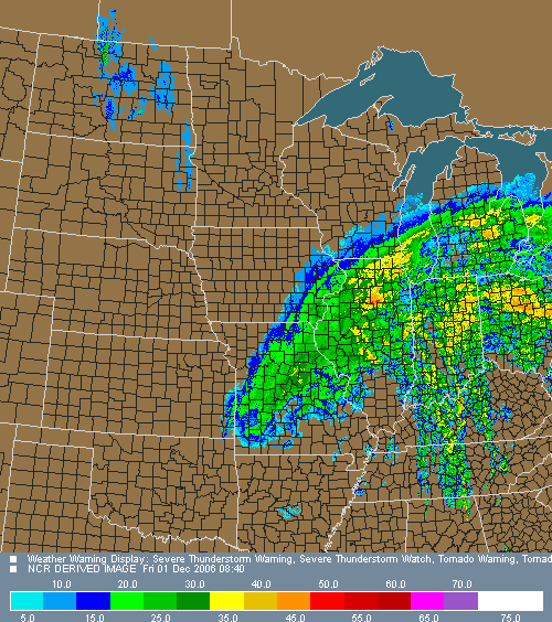
STORM REPORTS ARE POURING IN FROM MO AND IL. LOT OF ICE AND SNOW.
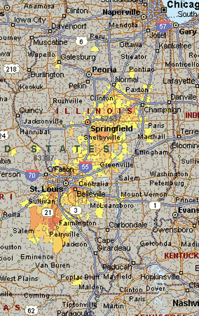
Power Outage Area - 125000 without
power at 11:30 p.m.
12 a.m. Peoria - Freezing rain at this time.
Scraping the parking lot - 1" of sleet on the ground
Sleet and freezing rain falling at midnight.
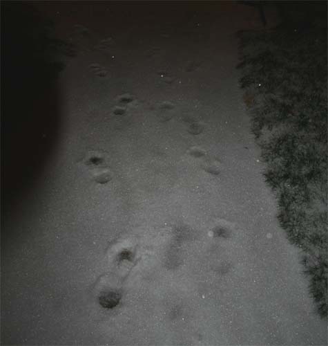
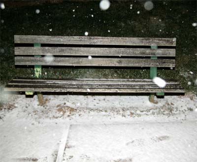
Footprints in the sleet - Midnight in Peoria
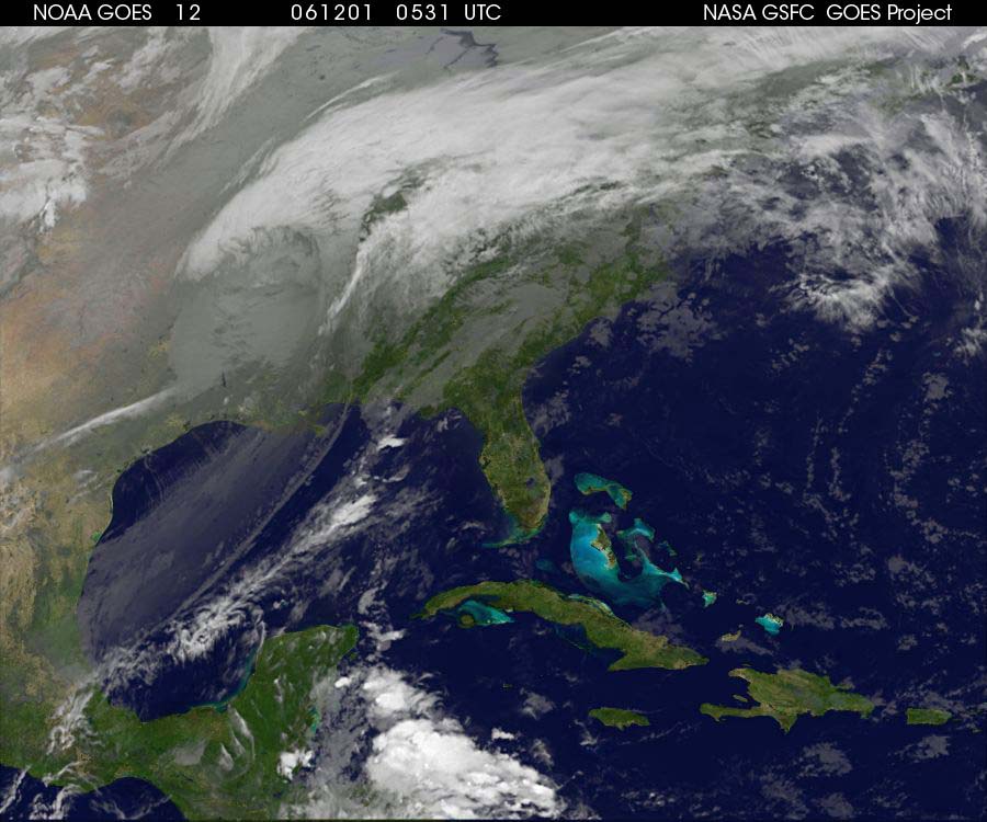
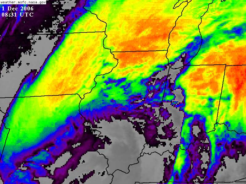
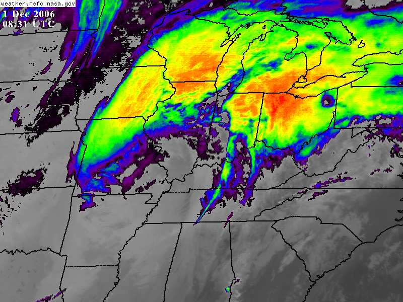
Midnight Satellite View
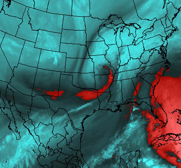
1 a.m. Lightning Data -
Strikes in the cold air - Missouri and Illinois
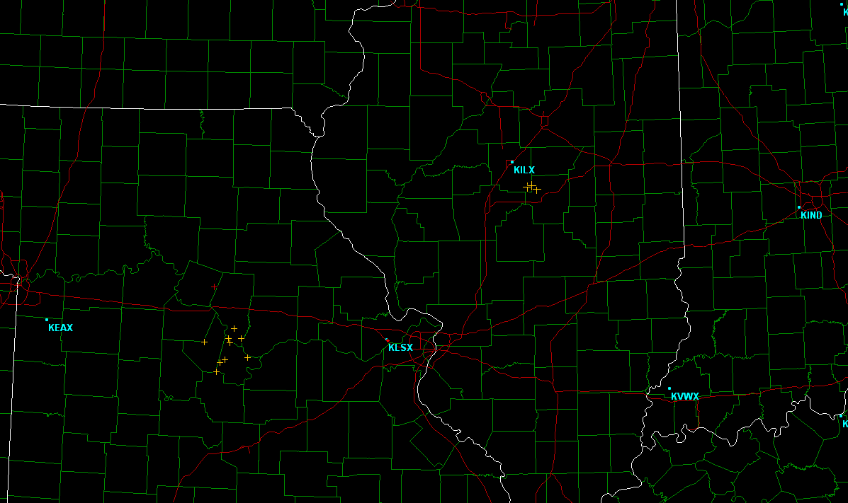
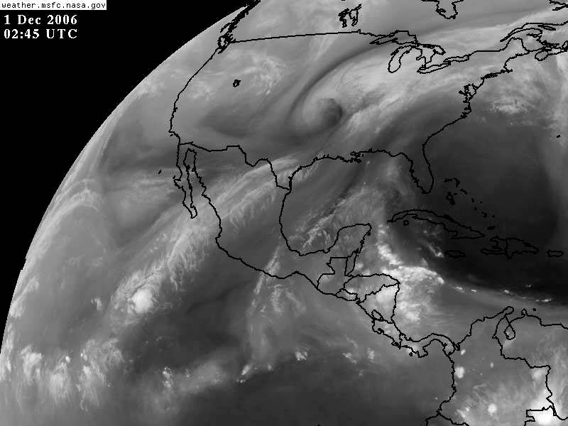
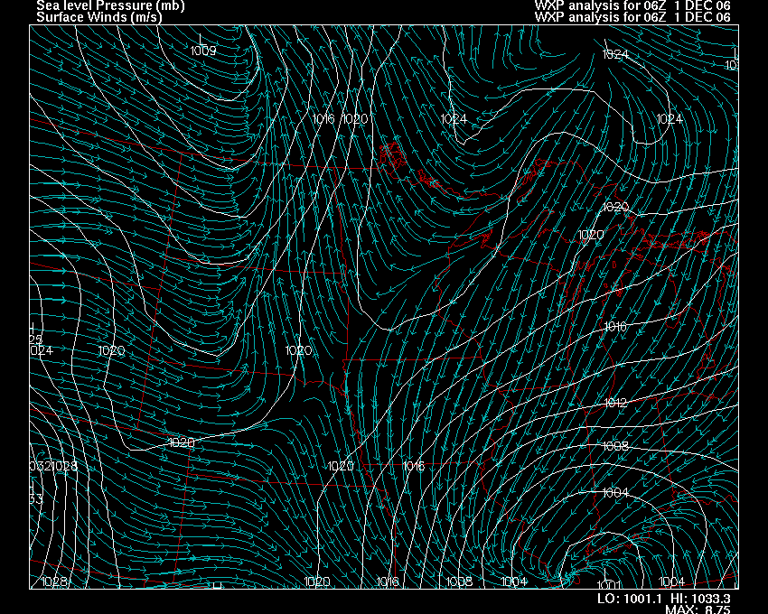
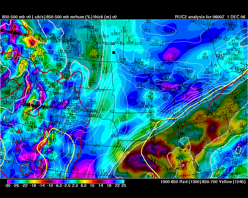
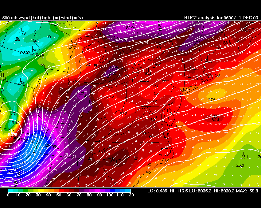
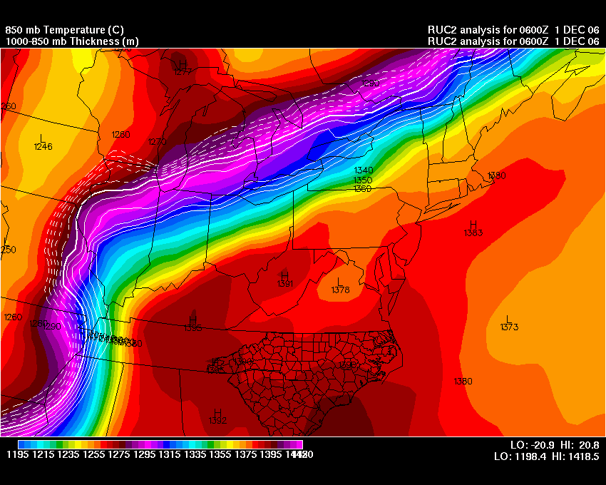
06z IMAGES FROM WRIGHT WEATHER
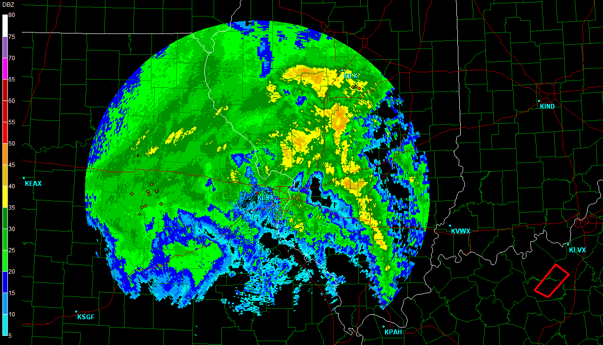
1:15 Radar HEAVY ICING
HERE IN PEORIA AT THIS TIME
2 a.m. Snow mixing in with ice
2 a.m. Snow mixing in with ice
Snow and Ice 2 a.m. - Snow and sleet coming down pretty
hard now in the downtown area of Peoria. Right on
the river.
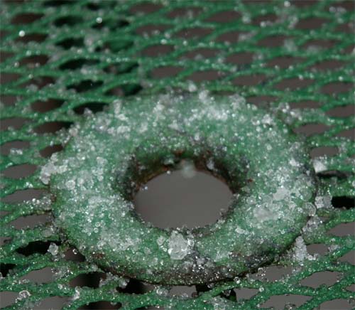
Chunks of ice falling in Peoria :) This was not sleet. I believe
it was hail during the peak of the convective part of the storm.
Some of the stranger weather I have experience.
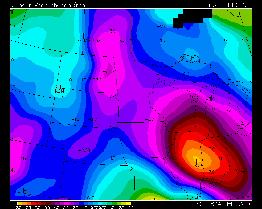
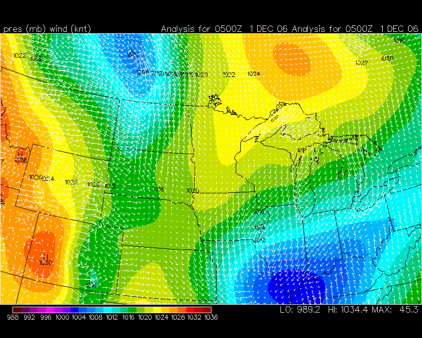
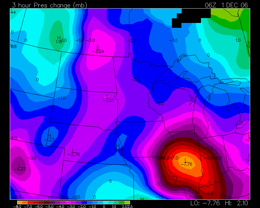
2 a.m. Pressure Falls
Wright Weather Image
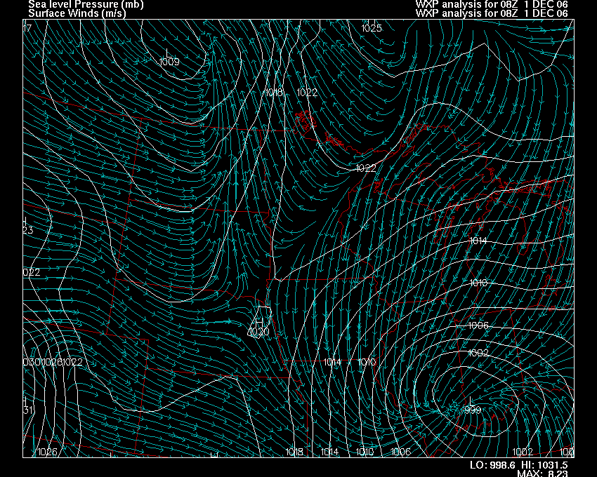
2 a.m. Pressure
- low is in Indiana
06z RUC IMAGES Wright Weather
Satellite Images Below
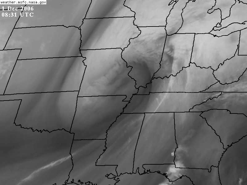
3 a.m. Radar
![]()
TURN THE PAGE FOR MORE SNOWSTORM PHOTOS CLICK HERE
------------------------------------------------------
------------------------------------------------------
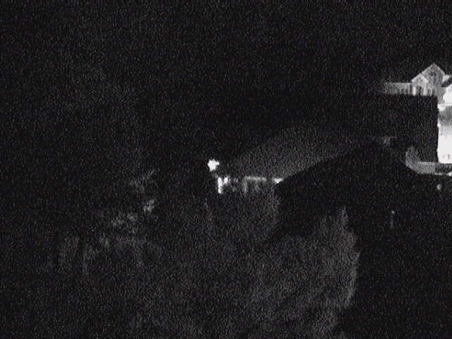
LIVE: VIEW FROM ATOP BEAU'S HOUSE
------------------------------------------------------
------------------------------------------------------
MAILING ADDRESS
BEAU DODSON
465 Ashcreek Road
Paducah, Kentucky
42001
-
Phone Number
Home 270-554-6715
Cell 270-970-1202
Email beaudodson@hotmail.com