 NWS PHOTOGRAPH
Additional Kansas Tornadoes
See link below for Andy Fischer Photographs of the tornado outbreak.
http://www.tornadohead.com/092106chase.htm
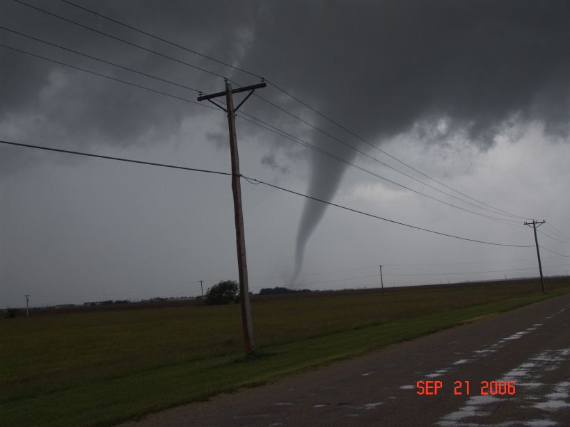
September 21 2006 northcentral KS tornadic mini-supercell chase
RUSSELL, KANSAS TORNADO
NWS PHOTOGRAPH


RUSSELL, KANSAS TWISTER

MORE ON RUSSELL, KANSAS FROM THE NATIONAL WEATHER SERVICE
http://www.crh.noaa.gov/ict/scripts/viewstory.php?STORY_NUMBER=2006092200
RUSSELL, KANSASRADAR FROM THAT TORNADO
DAMAGE FROM THE TWISTER


---------------------------------------------------------------------------------
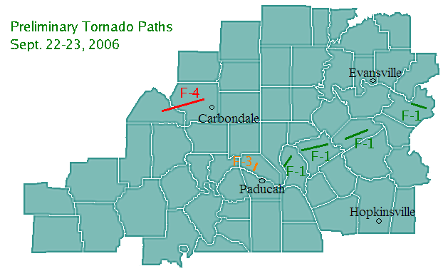
PRELIMINARY MAP FOR THIS AREA - MORE TORNADOES TO BE ADDED
NOAA STATEMENT...
One of the worst tornado outbreaks of 2006 hammered portions of Missouri, Illinois and Kentucky Friday night and Saturday and then record rains brought intense flash flooding that claimed six lives in Kentucky on Saturday.
NOAA’s Storm Prediction Center received 37 tornado reports from Sept. 22. Twelve reports came from Missouri, ten from Illinois and two from Kentucky. Tornadoes were also reported in Alabama, Arkansas and Tennessee.
In Missouri, tornadoes occurred in Phelps, Crawford, Reynolds, Washington, Iron, Madison and Dunklin counties. Illinois counties hit by tornadoes included Massac, Pope, Jackson, Washington and Pike. Tornadoes were also reported in Livingston and Daviess counties in Kentucky. Preliminary information from emergency management indicated several injuries from the twisters, but no fatalities.
The Storm Prediction Center also recorded 67 reports of high winds and 107 reports of large hail, including a report of softball-size hail north of Ava in Douglas County, Missouri. (See Storm Prediction Center report and map at http://www.spc.noaa.gov/climo/reports/060922_rpts.html).
Local storm reports and additional information on the tornadoes may be found on NOAA’s St. Louis forecast office web site at http://www.crh.noaa.gov/lsx/?n=09_22_06.
Damage covered by the Springfield, Mo., forecast office is available on the web at http://www.crh.noaa.gov/sgf/?n=20060922_event.
Storm information from the Paducah forecast office is available at http://www.crh.noaa.gov/pah by selecting the icons for Preliminary assessments for the storms Friday and Saturday and the Widespread heavy rain event.
On the heels of Friday’s severe weather, record rainfall occurred in Kentucky and Missouri Friday night and Saturday Sept.22-23. Up to 14 inches of rain was reported in some locations. (See report on the rains and rainfall maps by NOAA’s Louisville forecast office at . Select from the top three banners under News of the Day.)
Thirteen weather forecast offices issued 223 Flash Flood Warnings covering portions of eight states, along with 401 Severe Thunderstorm Warnings issued by 26 forecast offices in 13 states.
Six fatalities occurred in Kentucky Friday night or early Saturday morning due to the flooding, according to reports provided to the Louisville office.
One fatality occurred in Jessamine County, Ky., at about 12:30 a.m. Saturday when an individual tried to drive across a flooded road and was swept away. Two fatalities occurred in Fayette County, Ky., when two 25-year-old females were swept away when they tried to walk across a flooded road. A truck slid off Interstate 65 into flood waters near Elizabethtown in Hardin County, Ky., late Friday resulting in two fatalities. A Franklin County woman was killed about 6 a.m. Saturday when her car was swept away after she drove into high water.
--------------------------
NOAA PROCLAIMS THIS AN HISTORIC OUTBREAK....
NUMEROUS SIGNIFICANT TORNADOES HIT THE MISSOURI AND OHIO VALLEY
NATIONAL WEATHER SERVICE OFFICES ARE STILL DOING STORM SURVEYS.
AT LEAST 8 F2+ TORNADOES HAVE NOW BEEN RECORDED
--------------------------
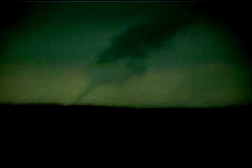
Storm Chaser Joel Wright caught this tornado in Delavan Illinois
--------------------------
Storm Chaser Andrew Pritchard caught this rapidly rotating wall cloud near Springfield, Illinois
Springfield, Illinois Wall Cloud - Tornado Warning had been issued for
this storm.  September 22, 2006.
Tornado warned cell with the wall cloud near Springfield, Illinois
ADDITIONAL WEATHER MAPS FROM THAT DAY
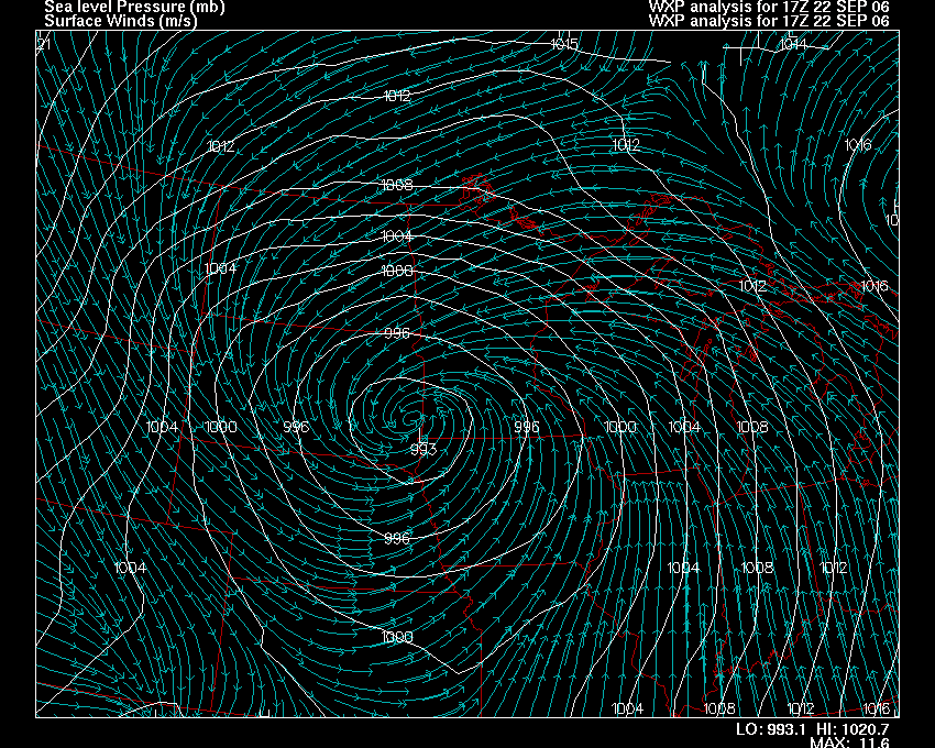
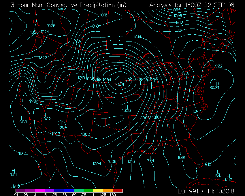
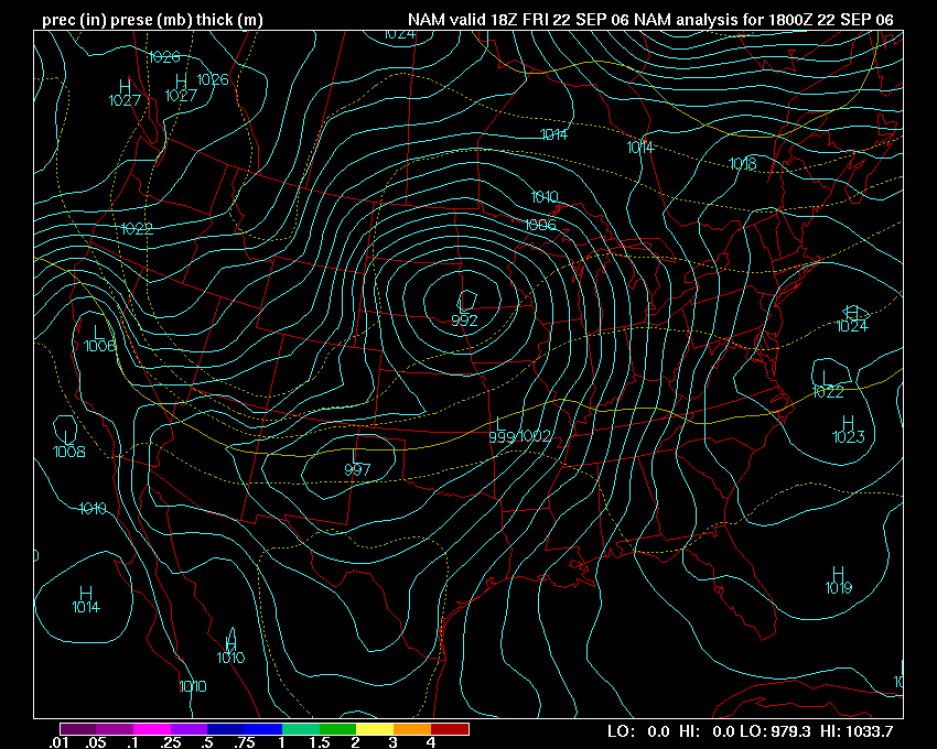
FRIDAY AFTERNOON WEATHER
MAP SHOWED A STRONG LOW PRESSURE
AREA OVER IOWA...MOVING INTO MINNESOTA


UNITED STATES WEATHER MAP
FRIDAY AFTERNOON.
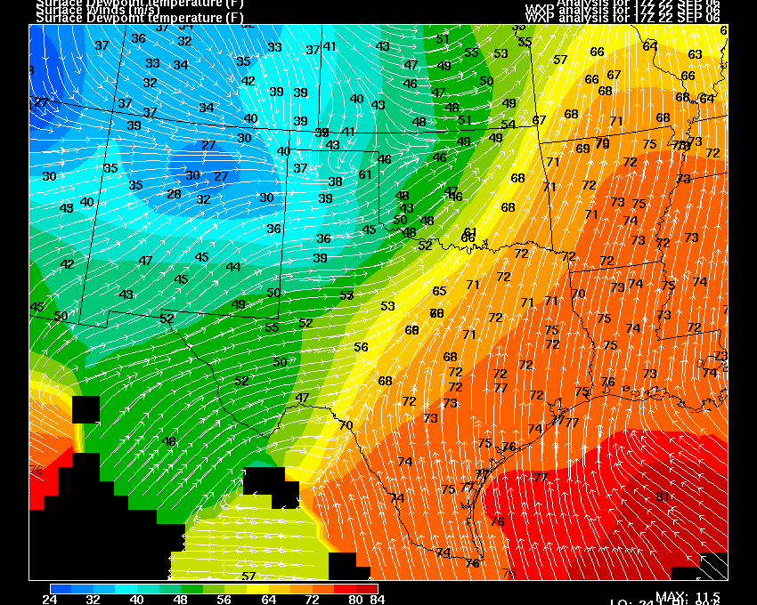
FRIDAY AFTERNOON DEW POINTS
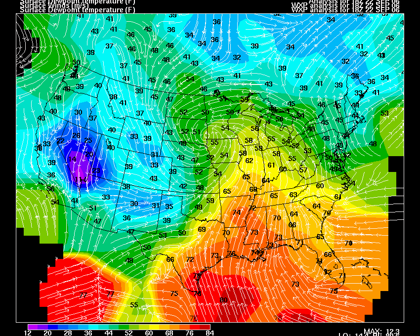
FRIDAY AFTERNOON NATIONAL MAP - DEW POINTS.
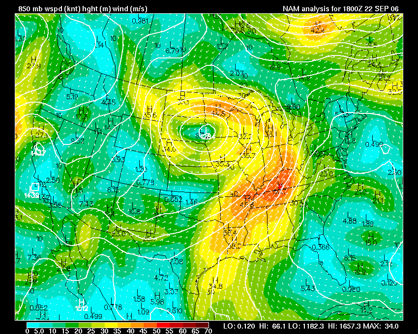
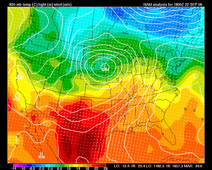
FRIDAY AFTERNOON 850 MB WIND FIELDS
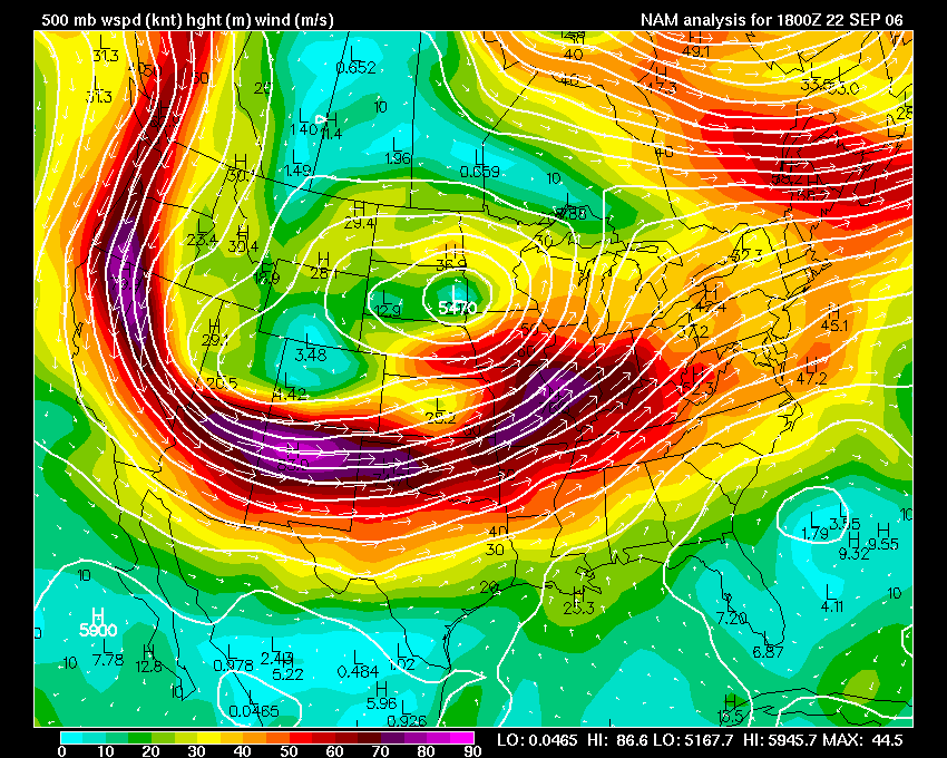
FRIDAY AFTERNOON 500 MB WIND FIELDS
FRIDAY 18z WEATHER MAP
FRIDAY AFTERNOON 850 MB WIND AND TEMP MAP
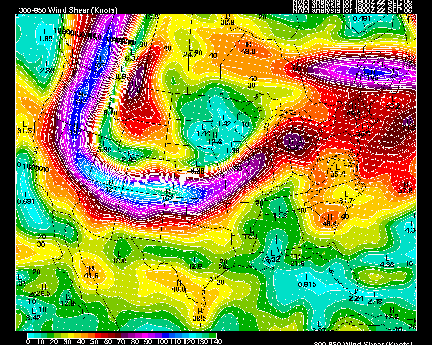
Upper Air Map - Wind Shear
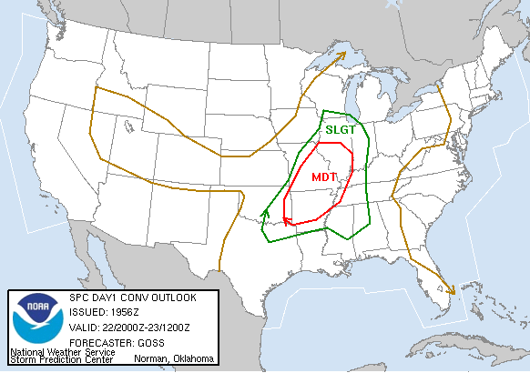
SEVERE WEATHER OUTLOOKS FROM SEPTEMBER 21 - 22
THURSDAY NIGHT TORNADOES WERE ALREADY BEING REPORTING IN OKLAHOMA AND INTO
ARKANSAS.  THIS WOULD SPREAD NORTHEASTWARD THROUGH THE OVERNIGHT HOURS.


THE NEXT DAY THE MODERATE RISK WOULD COVER MY ENTIRE AREA.
THE RISK FOR TORNADOES WAS VERY HIGH


WIND DAMAGE PROBABILITY OUTLOOK
HAIL RISK WAS NOT AS HIGH...STILL SIGNIFICANT THOUGH.  FOUR INCH HAIL WAS REPORTED
IN MISSOURI FROM THE SEVERE THUNDERSTORMS ON FRIDAY AFTERNOON.
LATER IN THE DAY MORE OF OUR AREA WOULD BE PLACED IN A MODERATE RISK
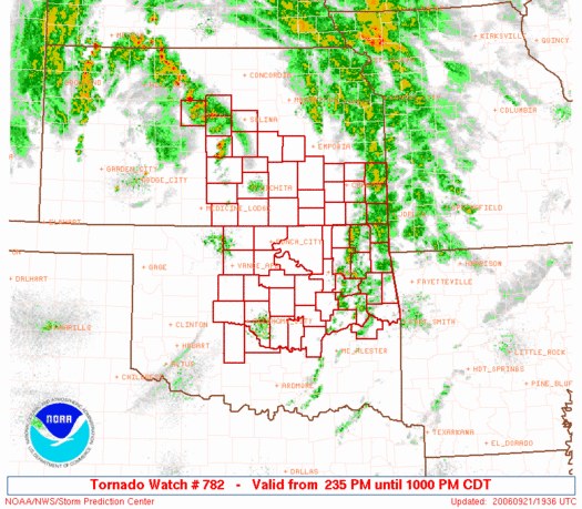
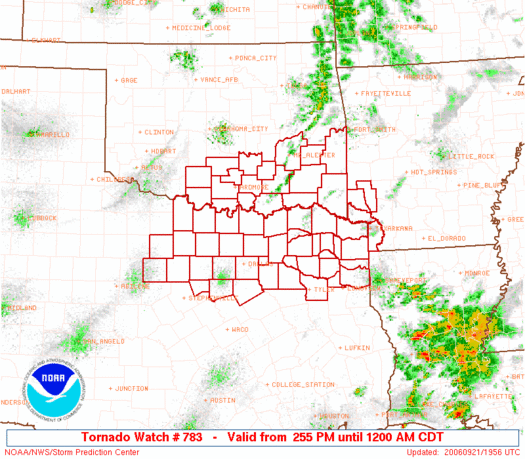
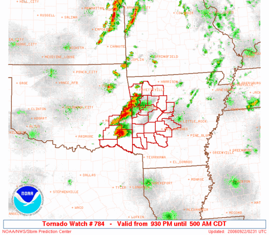
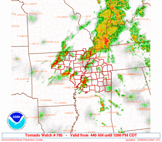
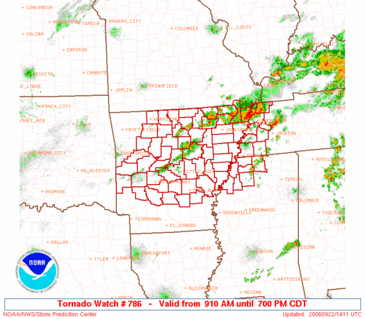
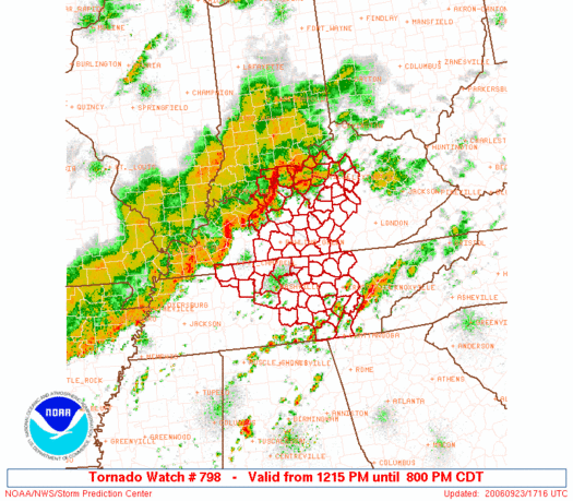
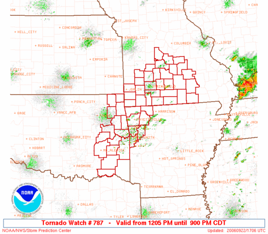
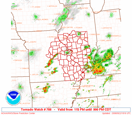
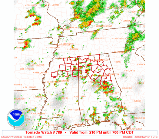
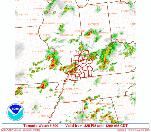
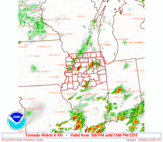
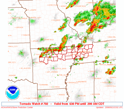
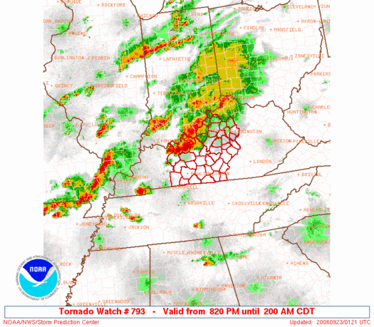
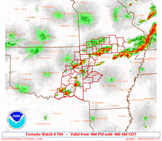
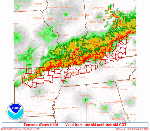
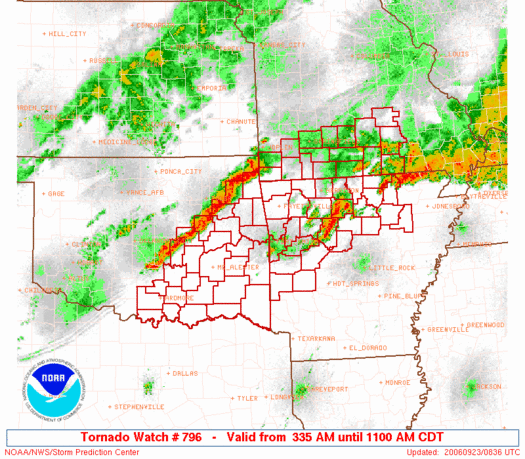
TORNADO WATCHES ISSUES FROM SEPT 21st through the 23rd
URGENT - IMMEDIATE BROADCAST REQUESTED
   TORNADO WATCH NUMBER 797
   NWS STORM PREDICTION CENTER NORMAN OK
   845 AM CDT SAT SEP 23 2006

   THE NWS STORM PREDICTION CENTER HAS ISSUED A
   TORNADO WATCH FOR PORTIONS OF

          CENTRAL AND EASTERN ARKANSAS
          SOUTHERN ILLINOIS
          FAR SOUTHWEST INDIANA
          WESTERN KENTUCKY
          SOUTHEAST MISSOURI INCLUDING THE BOOTHEEL
          FAR NORTHWEST TENNESSEE

   EFFECTIVE THIS SATURDAY MORNING AND AFTERNOON FROM 845 AM UNTIL
   400 PM CDT.
MORE ON THE TORNADO OUTBREAK CLICK HERE
HOME PAGE
------------------------------------------------------

------------------------------------------------------

LIVE: VIEW
FROM DOWNTOWN PADUCAH

...VIA WEB CAM FROM WPSD NEWS CHANNEL  6

------------------------------------------------------
------------------------------------------------------
MAILING ADDRESS
BEAU DODSON
465 Ashcreek Road
Paducah, Kentucky
42001
-
Phone Number
Home 270-554-6715
Cell 270-970-1202
Email beaudodson@hotmail.com