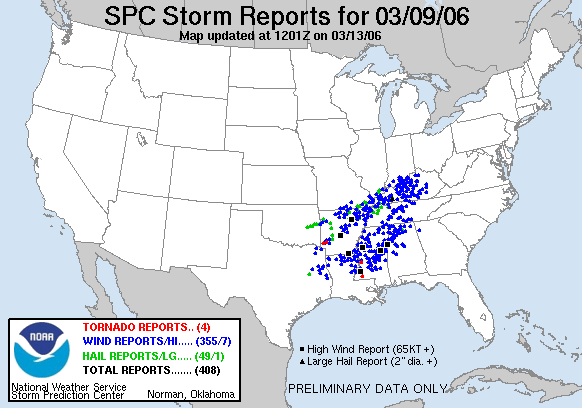
STORM PREDICTION CENTER SEVERE WEATHER PROBABILITIES.
March Continues...
March 11, 2006
Major severe weather outbreaks are forecast for Tonight and on Sunday Afternoon and Evening. I expect significant severe weather across the Missouri Valley, Lower Ohio Valley, and back into Texas. Tornadoes are likely on Sunday. There could be a significant outbreak. Everyone should stay tuned to their NOAA Weather Radios and local media for updated forecast and possible watches and warnings.
Flooding is also going to be a concern across the entire region. Rivers and streams are already having problems from the recent heavy rainfall.
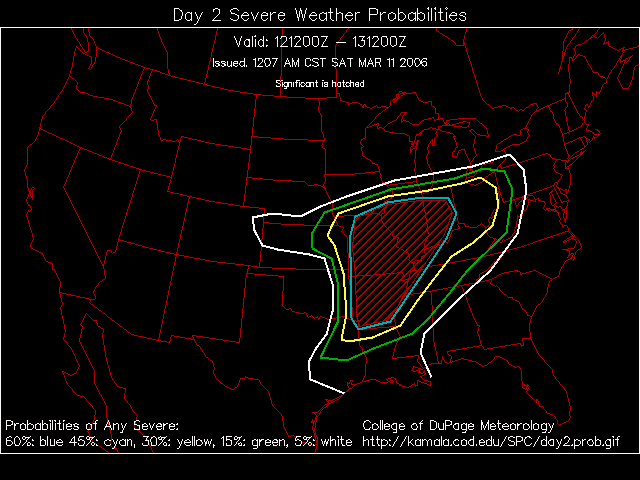
The storm prediction center has our region in a moderate risk for severe storms on Sunday (and today as well)
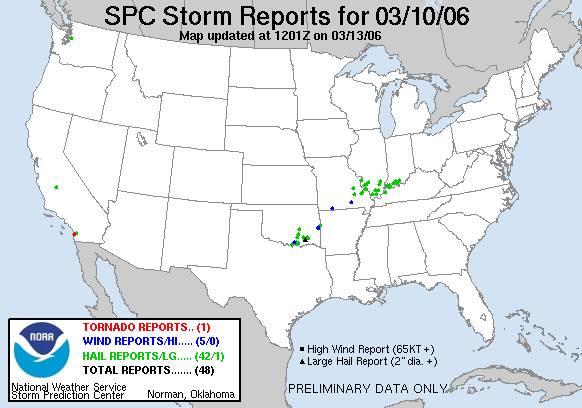
Here is the map for tomorrow
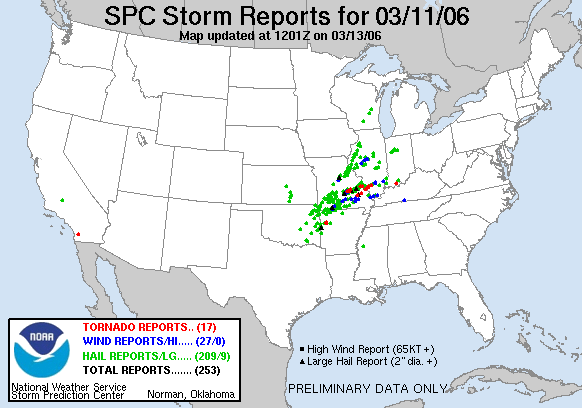
STORM PREDICTION CENTER SEVERE WEATHER PROBABILITIES.
SUNDAY, March 12, 2006
SIGNIFICANT TORNADO OUTBREAK HAS HIT OUR AREA
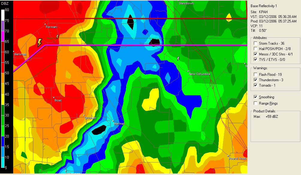
NUMEROUS TORNADOES STRUCK SOUTHEAST MISSOURI AND SOUTHERN ILLINOIS OVERNIGHT.
Straight line winds hit Pulaski and Massac Counties at 5:30 a.m. this morning. There was a strong hook echo as it moved through the counties. The NWS issued tornado warnings as it moved through.
SPC HAS THIS AREA IN A MODERATE AND HIGH RISK FOR SEVERE THUNDERSTORMS AND TORNADOES
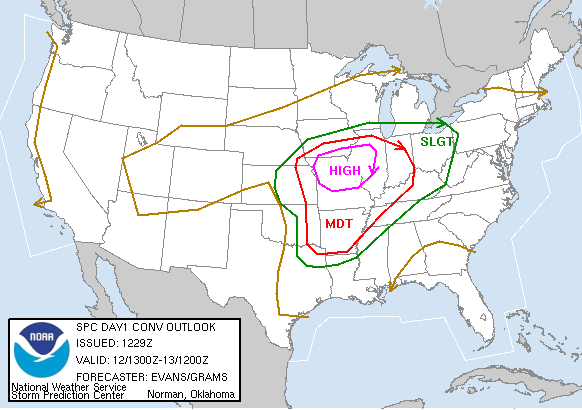
MORE SEVERE WEATHER LIKELY LATER THIS AFTERNOON AND TONIGHT
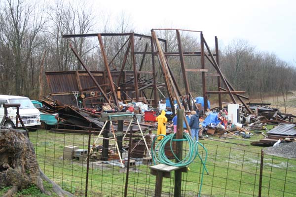
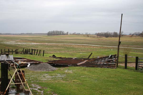
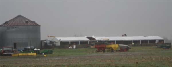
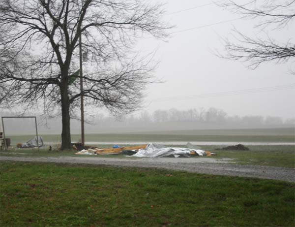
Morning photos from Massac County near Boaz and Old Board Road...barn destroyed...and other damage.
The bulletin...
BULLETIN - EAS
ACTIVATION REQUESTED
TORNADO WARNING
NATIONAL WEATHER SERVICE PADUCAH KY
527 AM CST SUN MAR 12 2006
THE NATIONAL WEATHER SERVICE IN PADUCAH KENTUCKY HAS ISSUED A
* TORNADO WARNING FOR...
MASSAC COUNTY IN SOUTHERN ILLINOIS.
EASTERN PULASKI COUNTY IN SOUTHERN ILLINOIS.
* UNTIL 600 AM CST.
* AT 521 AM CST...NATIONAL WEATHER SERVICE DOPPLER RADAR INDICATED A
SEVERE THUNDERSTORM CAPABLE OF PRODUCING A TORNADO 6 MILES
NORTHWEST OF NEW GRAND CHAIN...OR ABOUT 13 MILES SOUTHEAST OF
ANNA...MOVING EAST AT 40 MPH.
* LOCATIONS IN THE WARNING INCLUDE BUT ARE NOT LIMITED TO KARNAK
IN ADDITION TO THE TORNADO...THIS STORM PRODUCED DAMAGING WINDS IN
ULLIN IN PULASKI COUNTY.
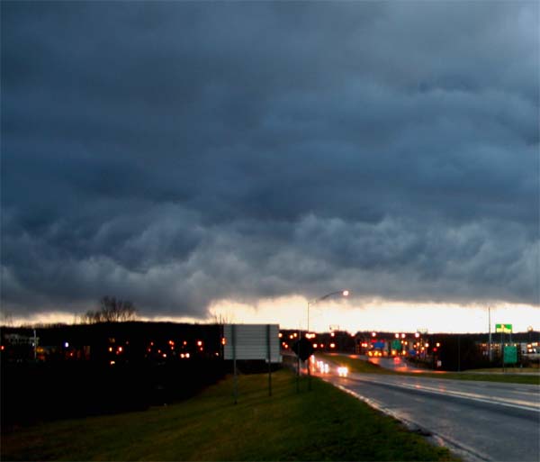
Possible Wall Cloud south of Paducah earlier in the morning.
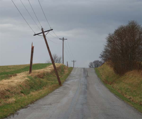
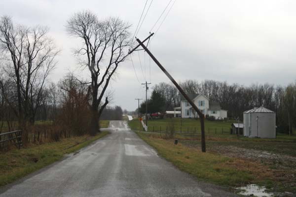
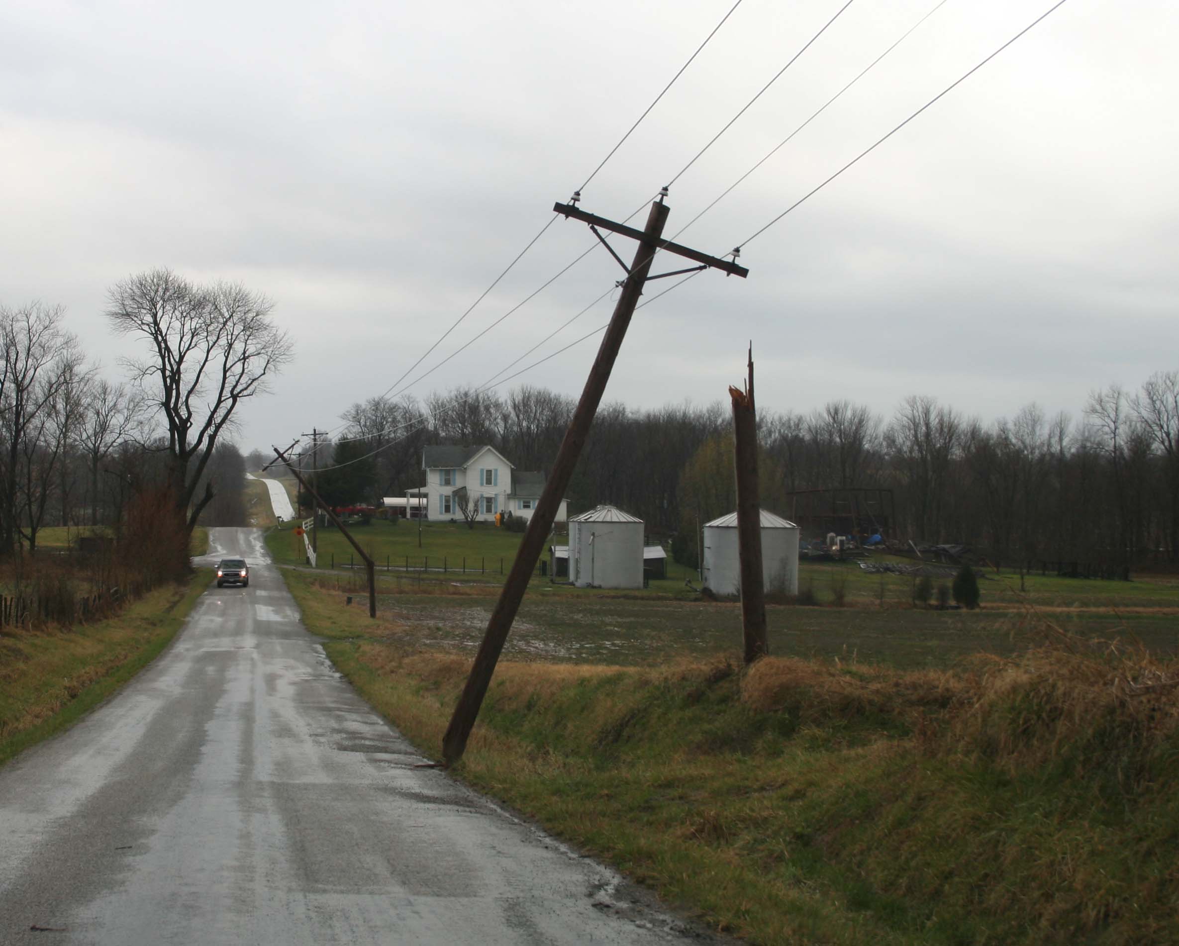
Power poles snapped along Boaz Road in Massac County

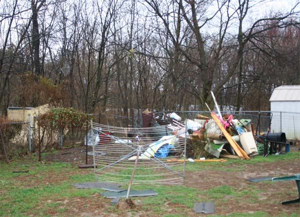
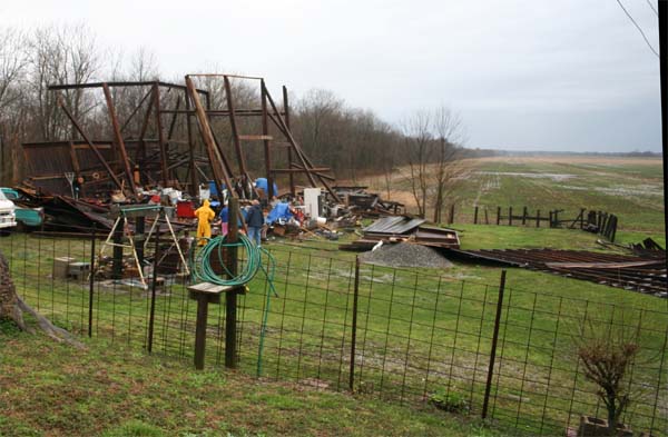
Barn Destroyed - Boaz Road - Massac County
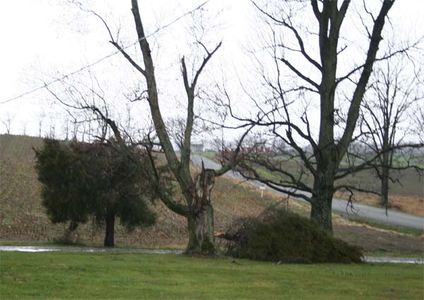
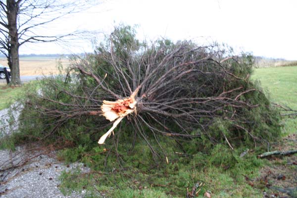
Anderson Church on Boaz Road tree damage
SUNDAY
TORNADO OUTBREAK HAS HIT MISSOURI AND ILLINOIS. A LARGE TORNADO HAS MOVED THROUGH CENTRAL MISSOURI ALL THE WAY THROUGH ILLINOIS. SPRINGFIELD,. ILLINOIS HAS BEEN HIT BY A WEDGE TORNADO.
113 TORNADOES HIT MISSOURI AND ILLINOIS LAST NIGHT
INCREDIBLE OUTBREAK....
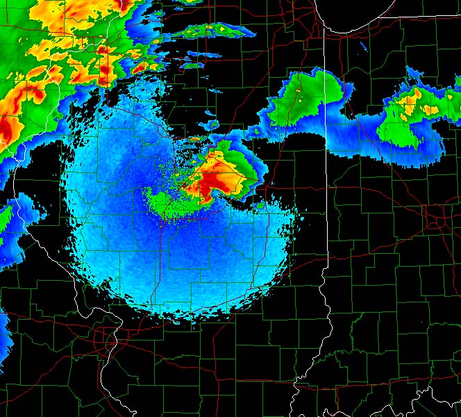
Here are some maps from this outbreak
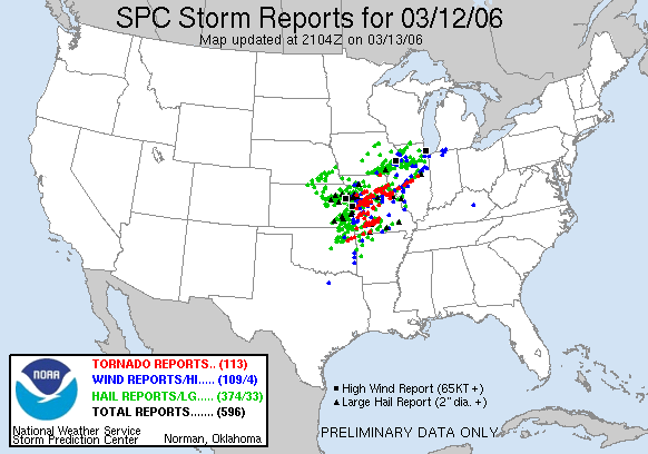
TORNADO OUTBREAK ON SUNDAY
The storm that moved through Central Illinois
SPRINGFIELD ILLINOIS TORNADO
SPRINGFIELD ILLINOIS UPDATE
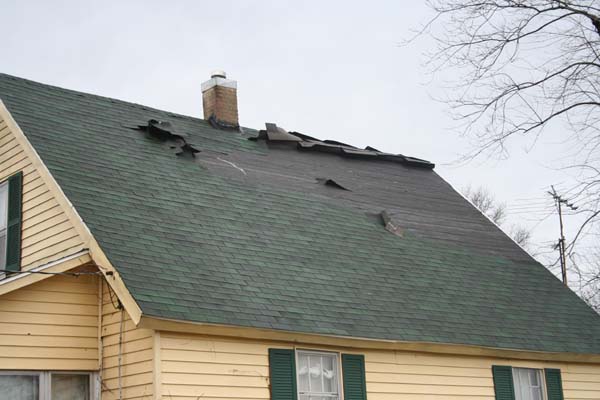
1.700 BUILDINGS DAMAGED - 1000+ DESTROYED
Survey finds 1,548 homes damaged
Mayor estimates 1,000 of those uninhabitable
By BERNARD SCHOENBURG
STAFF WRITER
Published Wednesday, March 15, 2006
More than 1,700 buildings in the city of Springfield were damaged by Sunday’s
storm, most of them people’s homes, city officials said.
City spokesman Ernie Slottag said Tuesday afternoon that a review by inspectors
found that 1,741 buildings have been “damaged in some way,” 1,548 of them
residential. The rest are commercial.
Of those totals, 255 residential buildings had major damage or were destroyed.
About 55 of the commercial buildings had major damage or were destroyed,
according to the city’s count.
The residential numbers count the buildings themselves. Since some of those are
apartment buildings, each containing more than one housing unit, the number of
affected households is clearly larger, Slottag said.
Wednesday, March 15
BEAUTIFUL WEATHER SWEEPING ACROSS THE AREA :) I love it! It feels like SPRING outside. The flowers are all starting to bloom. The trees are budding out :) Lots of energy. Temperatures are great. No complaints on the weather this week!
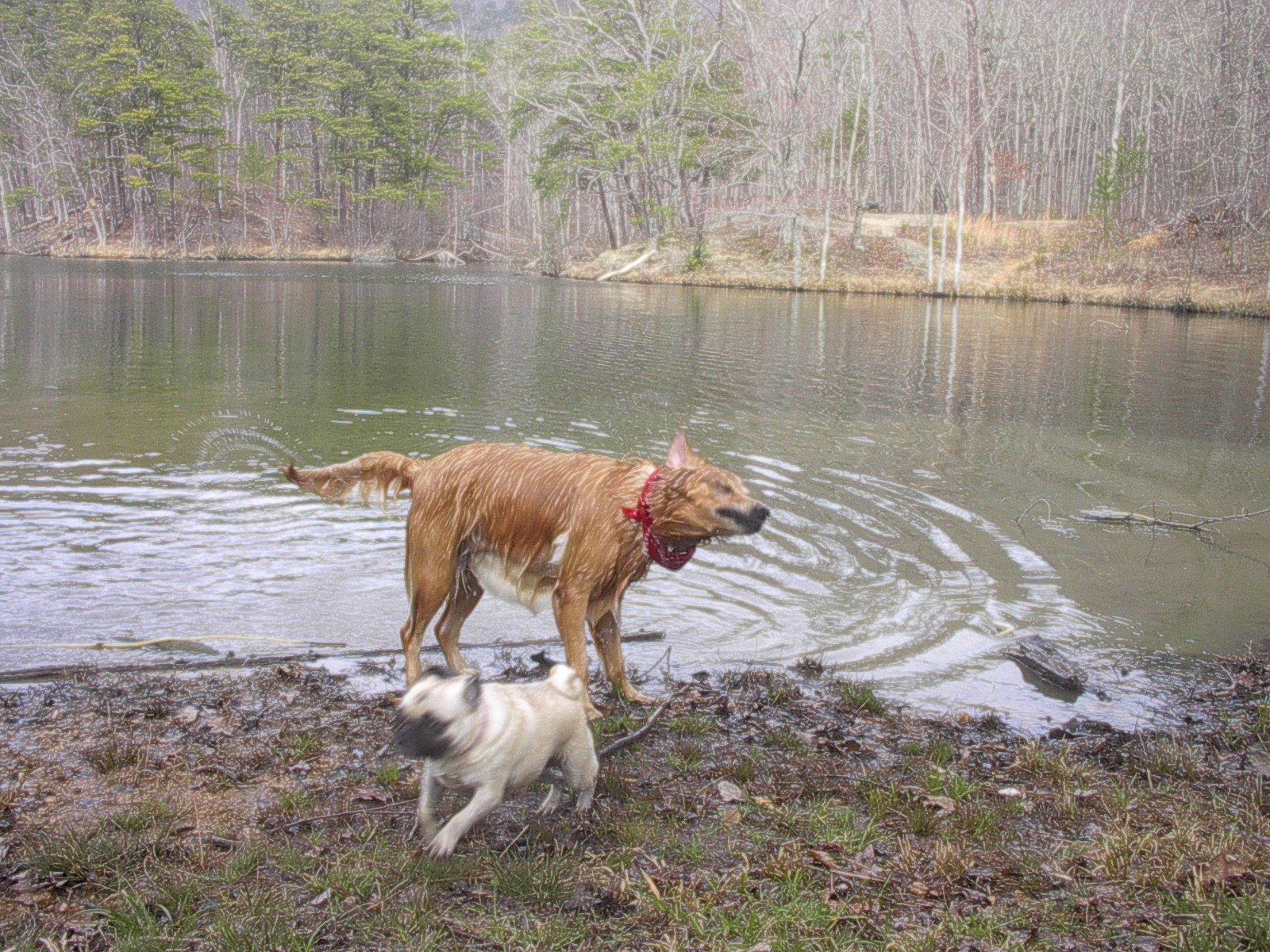
Lucy went camping last week...SUPPOSEDLY (although we do have our doubts, however, she did get her feet muddy below...soooooooooo I guess it is POSSIBLE).
Everything else is going great down here. Staying busy with working on the house and outside the house. Definitely enjoying the nice weather. It is nice not having to worry about tornadoes for a few days.
David is up north and reports LOTS of snow. Hmmmm some people have all the luck!!!!! I guess we are finished with snow down this way. Will have to wait till next winter.
Mother is going great and so is everyone else in the family.
:)
All is well!
WEATHER RADIOS FOR SALE
I have REECOM NOAA Weather Radios For Sale - They are half
price and are selling for $35.00. These are high quality alert weather
radios. I use them here at the house.

TRACK OF THE SUPERCELL ON SUNDAY! AN INCREDIBLE STORM.
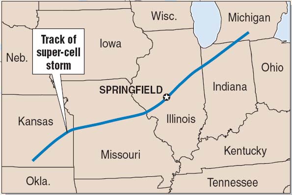
THIS STORM TRACKED THROUGH FIVE STATES
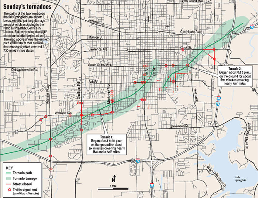
TRACK OF THE F3 TORNADO THROUGH SPRINGFIELD, ILLINOIS
Friday, March 17, 2006
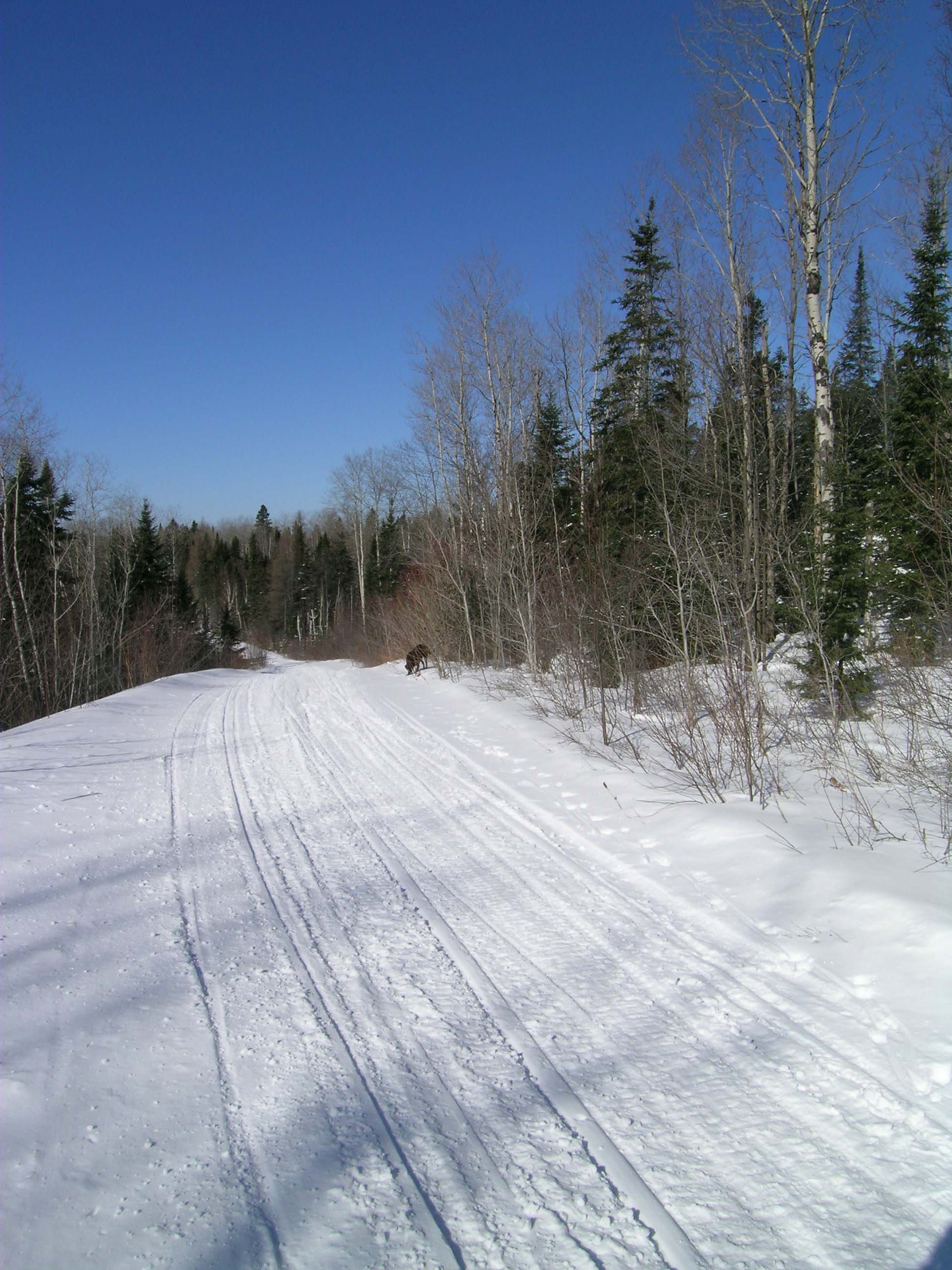
Snow in Canada :) David sent this photo...looks nice!
Big snowstorm forecast for Missouri and Illinois on Monday. Looks like
COLD rain here ;)
March 20, 2006
WELLLL Everything is fine down here. Been extremely busy. I am leaving for Switzerland, Japan, and China on Friday! I will be in Toronto for one day or so. Mother and Joey will be house sitting.
Should be a fun trip. I will try to post pics if I have time.
March 21, 2006
It snowed today...light flurries. What more can I say. Getting ready for my trip. I still have a few weather radios...for those who need one :)
Want to see some REAL SNOW :)
OMG!!!!!!!!
Yellowstone National Park :)
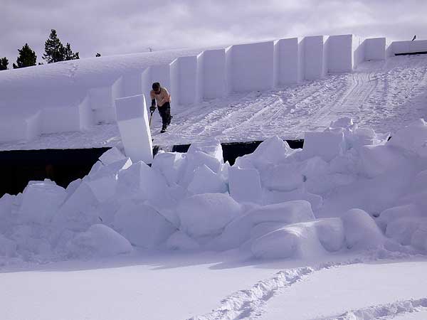
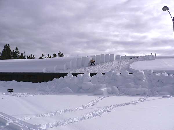

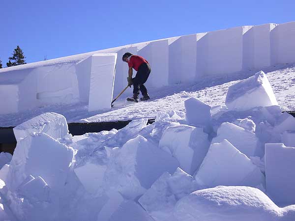
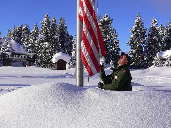
Just dang!
Heroes Update
01. First Hero -
Grandma Blanche $1000.00
02.
Team Justice - $0.00
03. Team
America
- $230.00
04. Shadow Angels - $1000.00
05. Team Ca
TURN THE PAGE CLICK HERE
HOME PAGE
------------------------------------------------------

------------------------------------------------------

LIVE: VIEW
FROM DOWNTOWN PADUCAH

...VIA WEB CAM FROM WPSD NEWS CHANNEL  6

------------------------------------------------------
------------------------------------------------------
MAILING ADDRESS
BEAU DODSON
465 Ashcreek Road
Paducah, Kentucky
42001
-
Phone Number
Home 270-554-6715
Cell 270-970-1202
Email beaudodson@hotmail.com