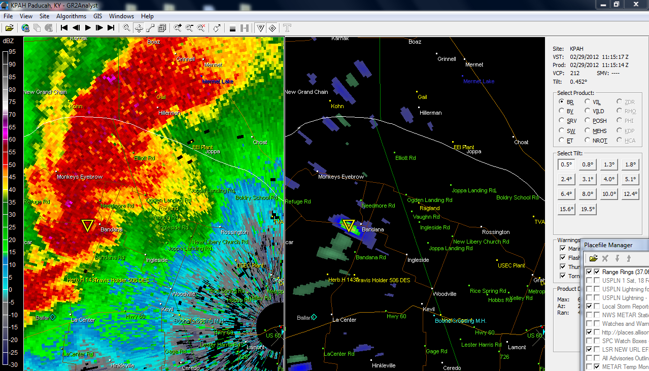
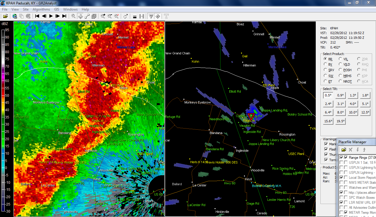
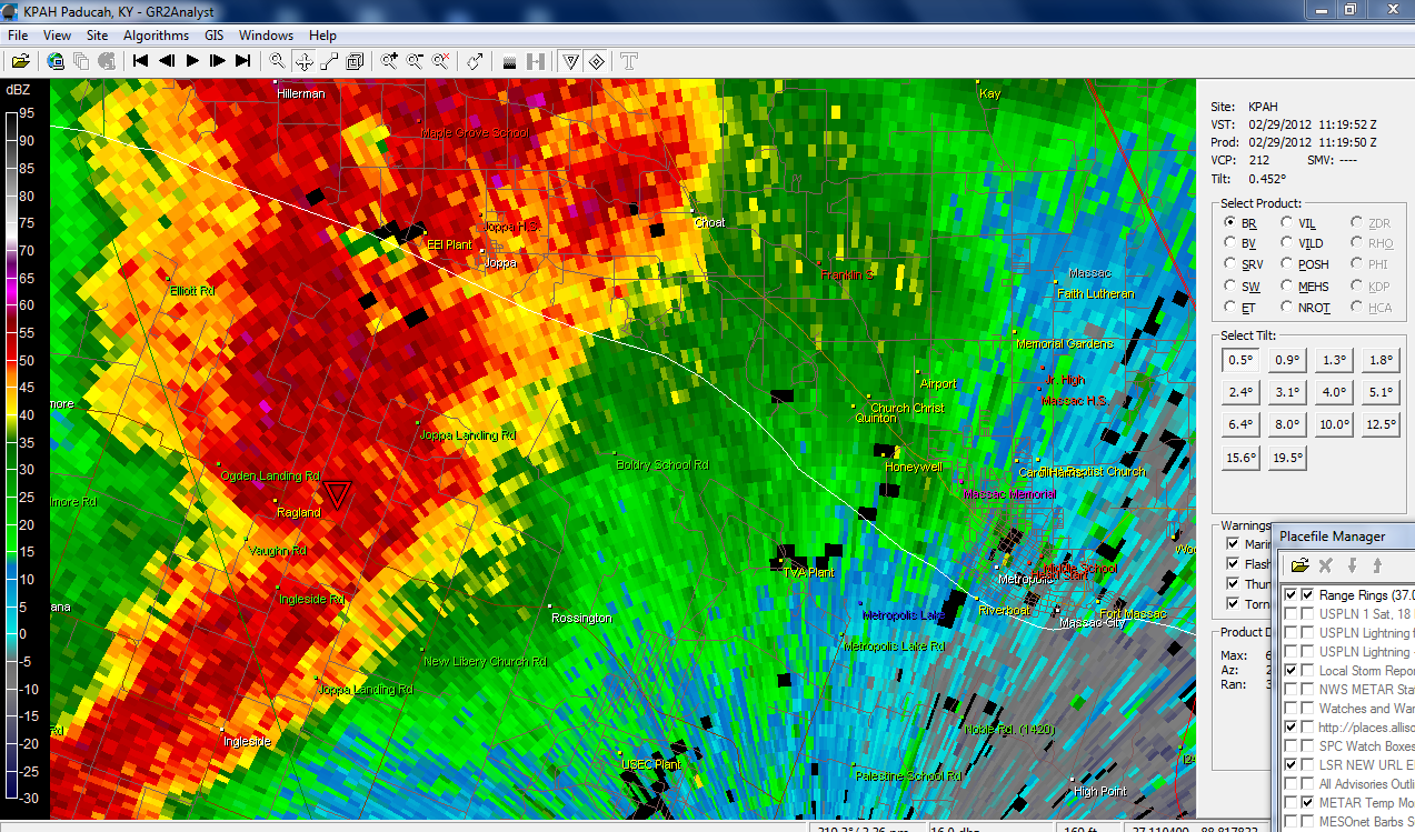
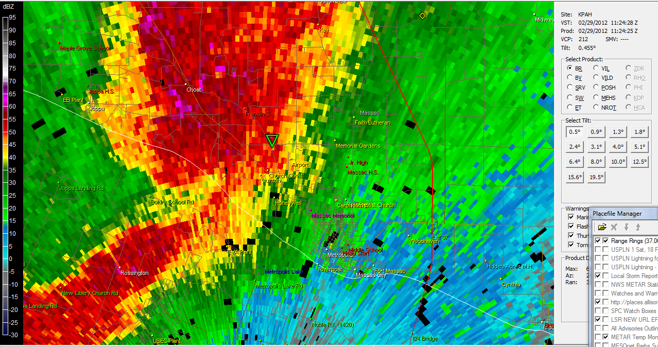
Gibson Ridge Radar Software - images as the storm moved through west KY this morning
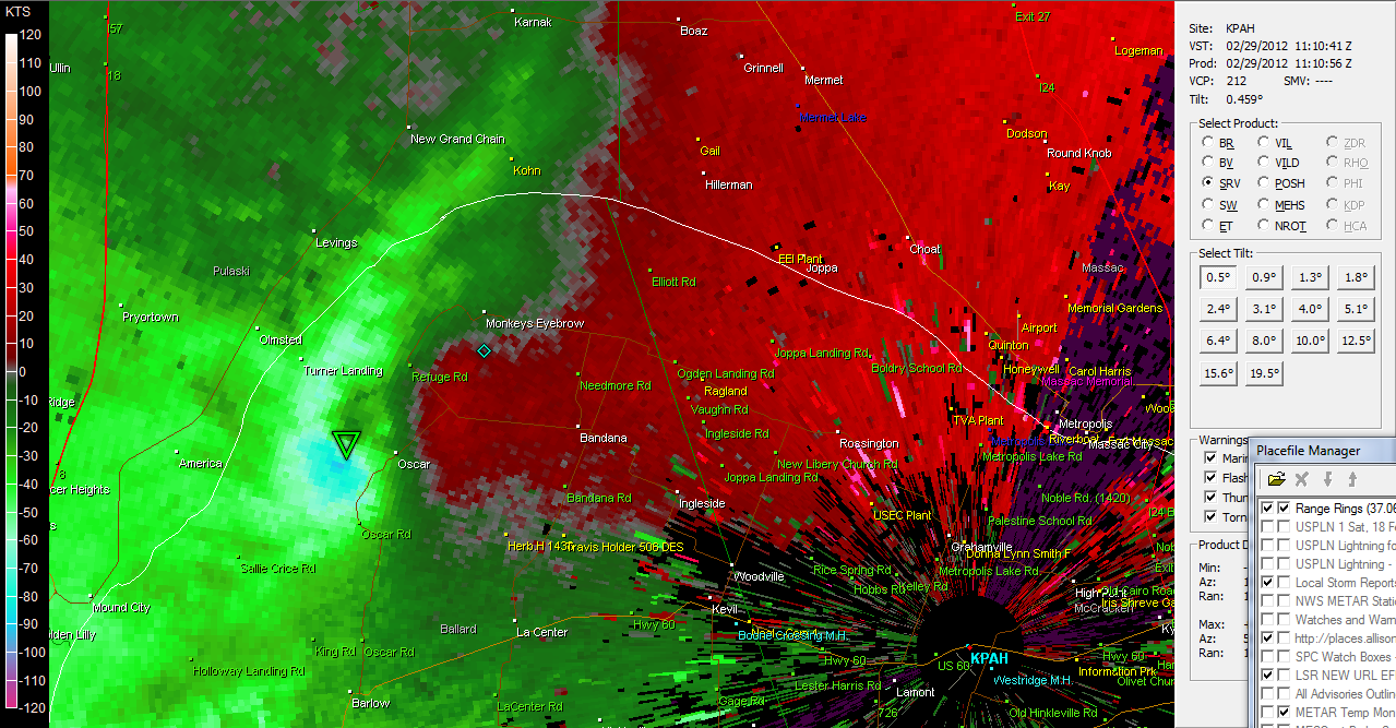
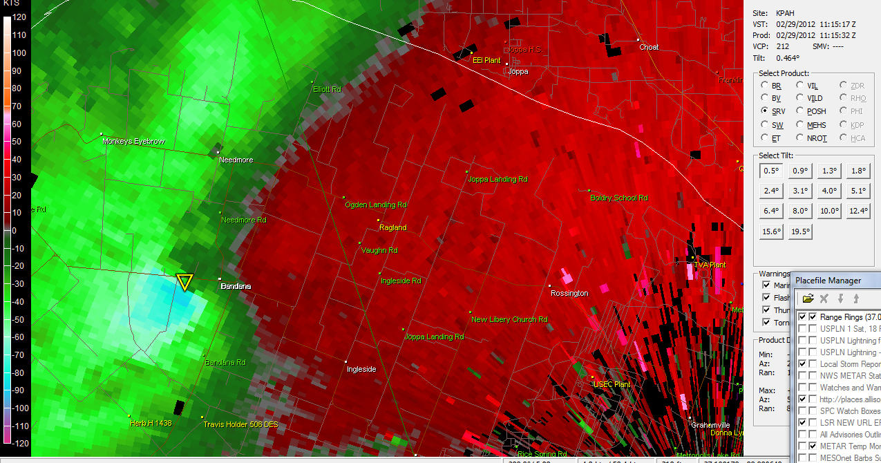
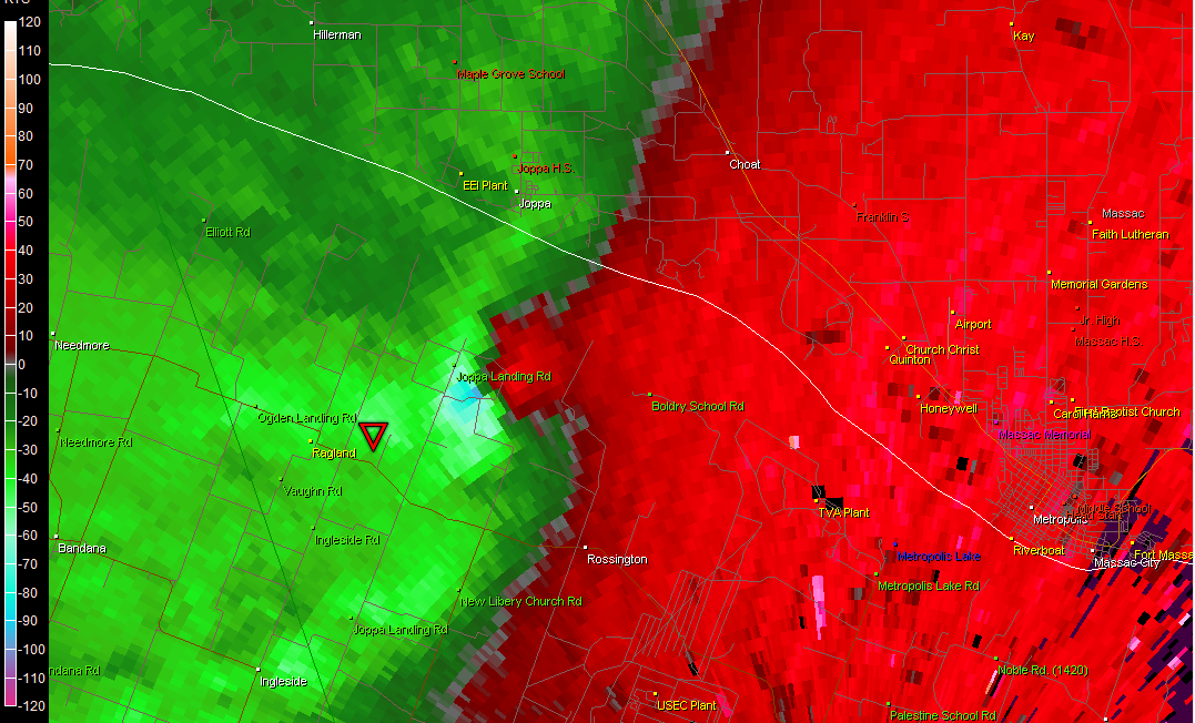
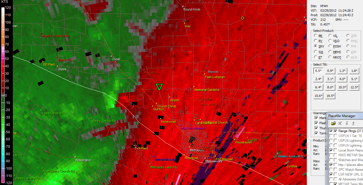
First image as storm entered Ballard County, KY - then progressing through Ballard into McCracken and eventually into Massac County, IL
- Beau Dodson
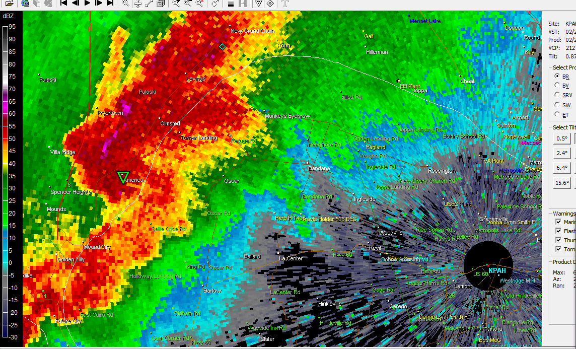
First images are base reflectivity
These images show the wind fields - SRM
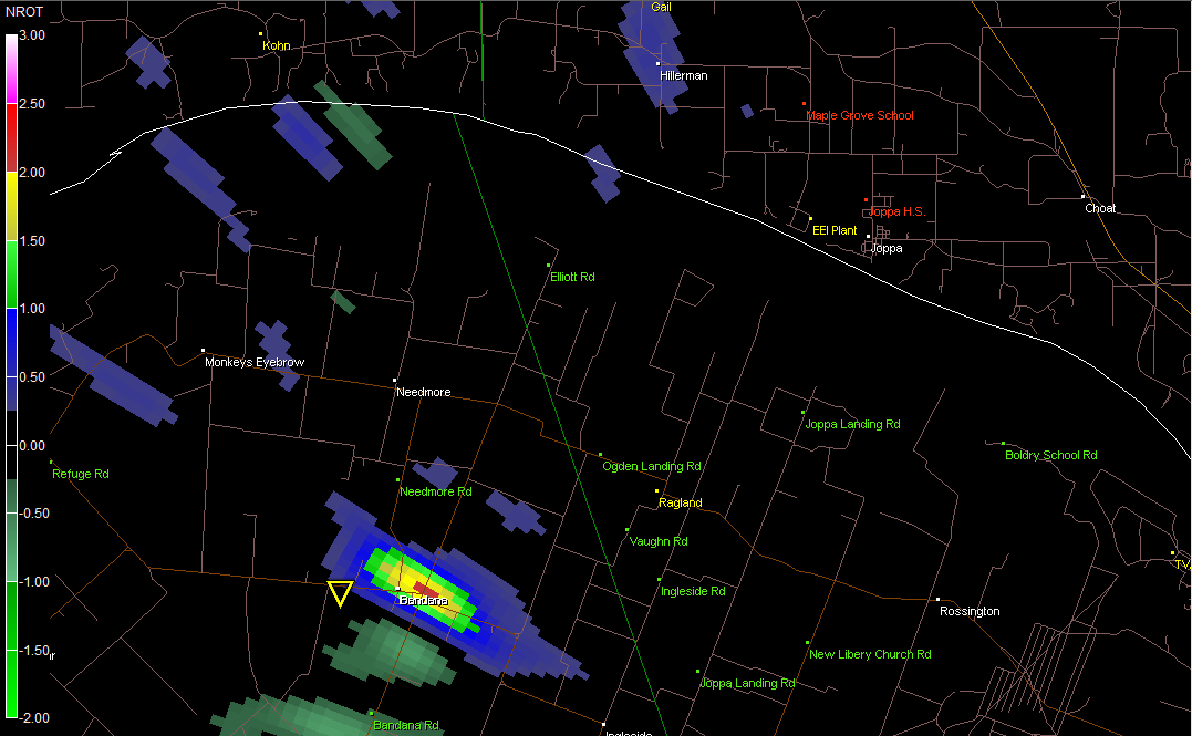
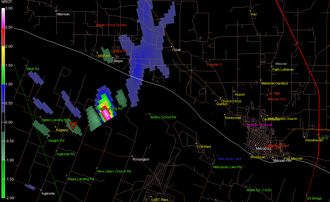
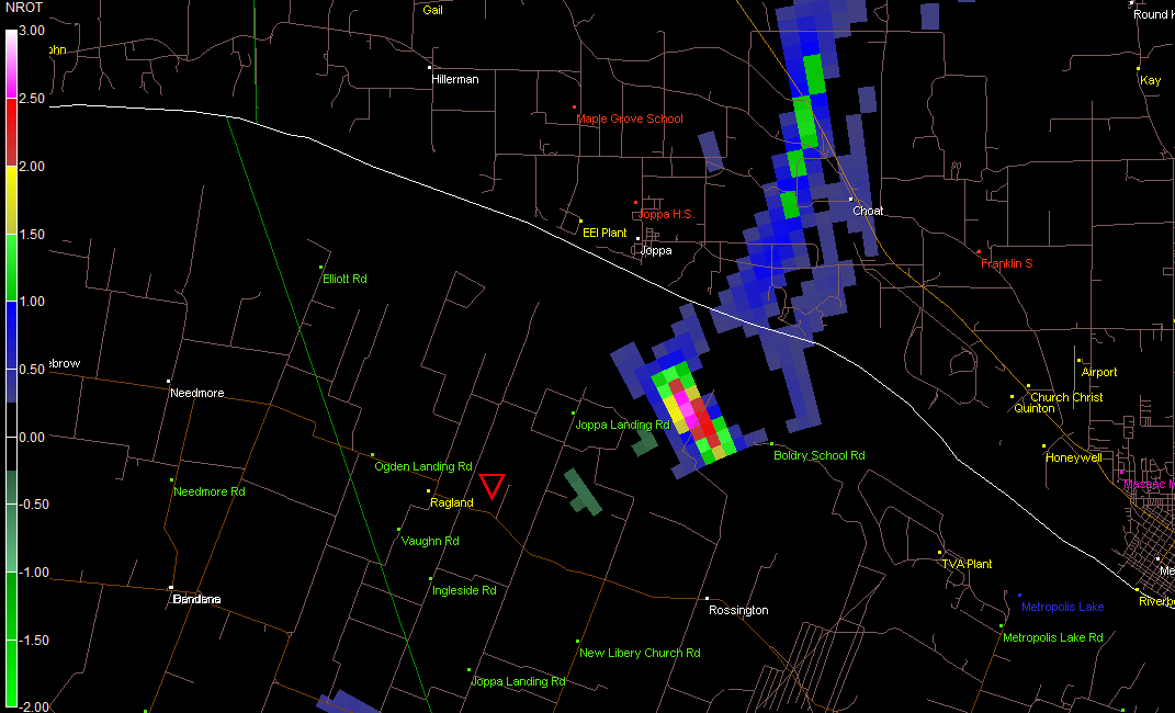
NROT IMAGES - clearly show where the most severe part of the storm tracked