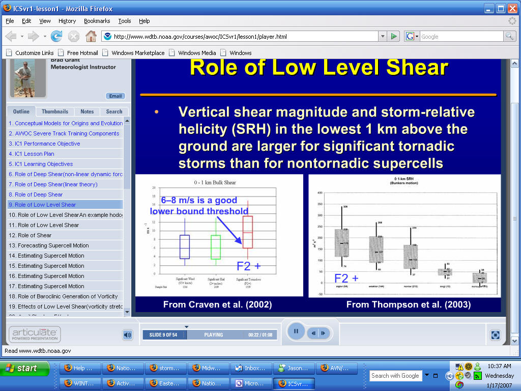
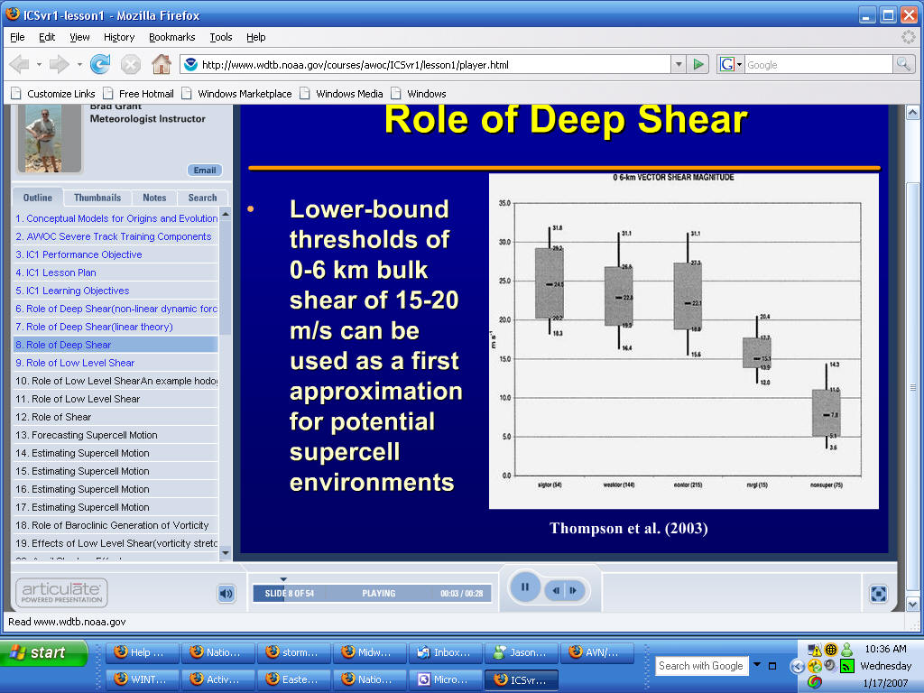
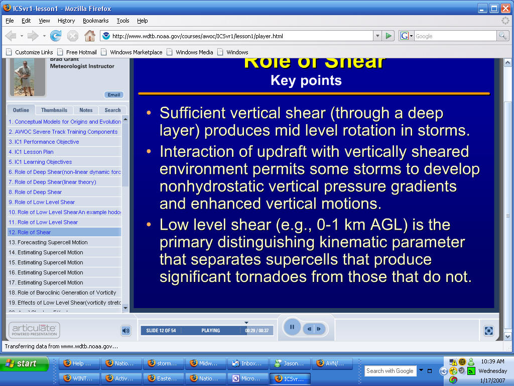
Bulk Shear Values to look for
0-1 km 6- m/s is a good starter
Surface to 6 km look for
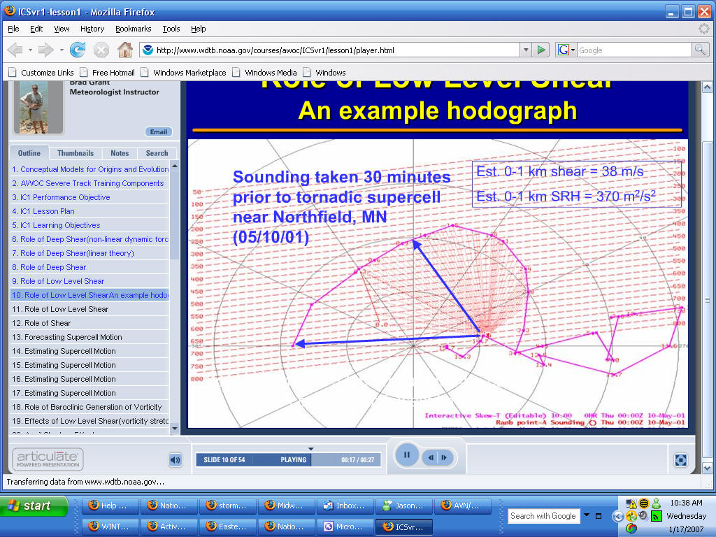
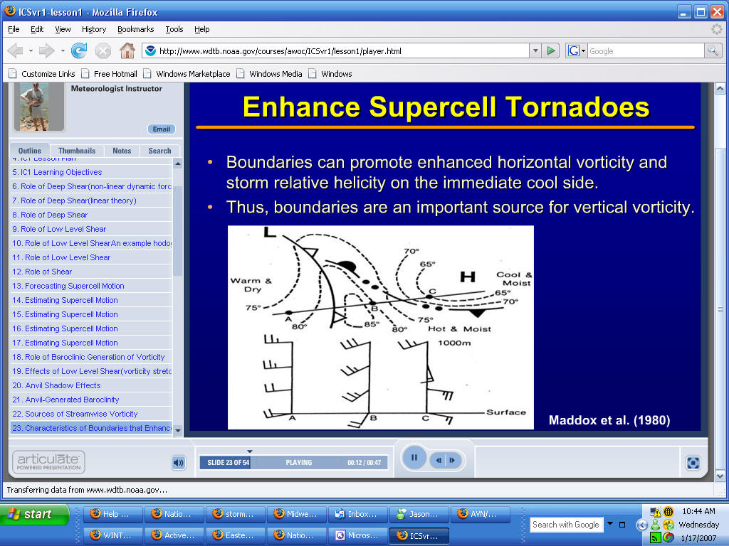
TORNADO HODOGRAPH
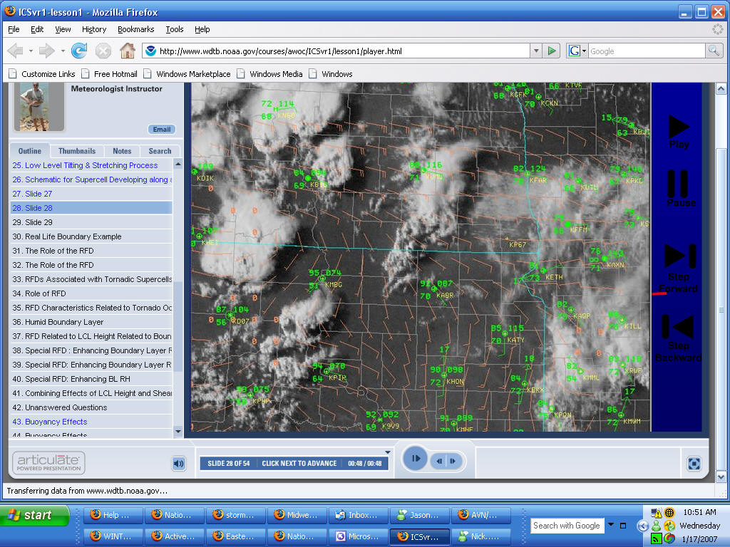
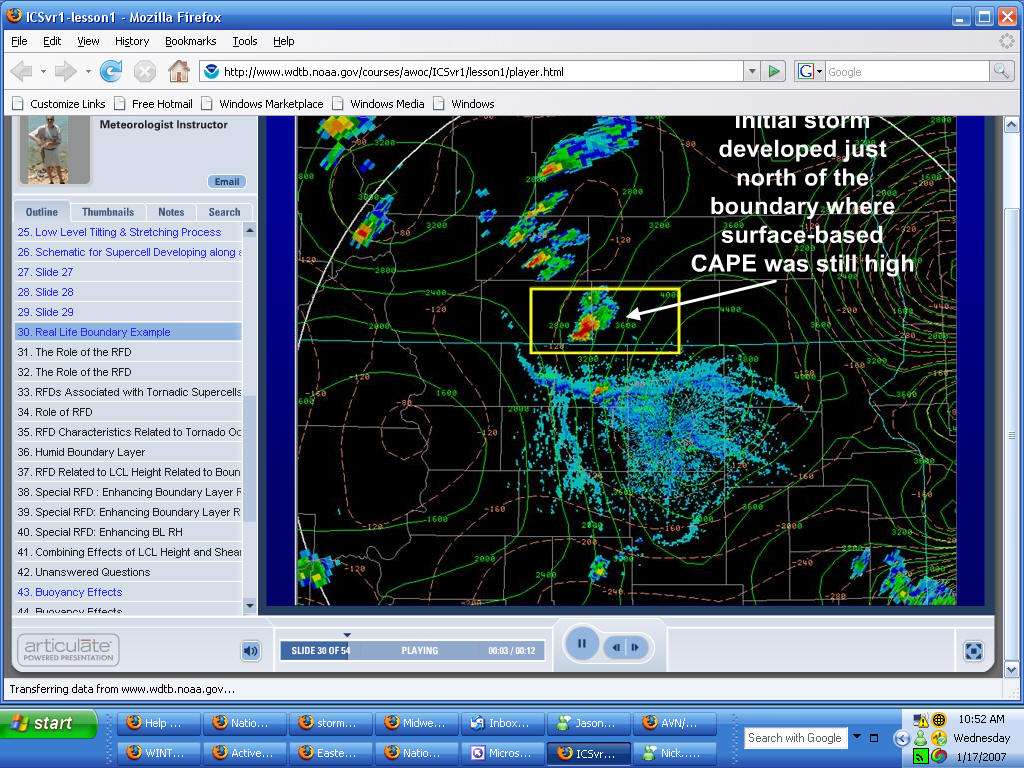
Note on the above image the west to east boundary across North Dakota and how storms formed in the moist unstable air to the borth of that frontal boundary.
Radar image below..note the four boundaries with the storms forming north of the most intense boundary
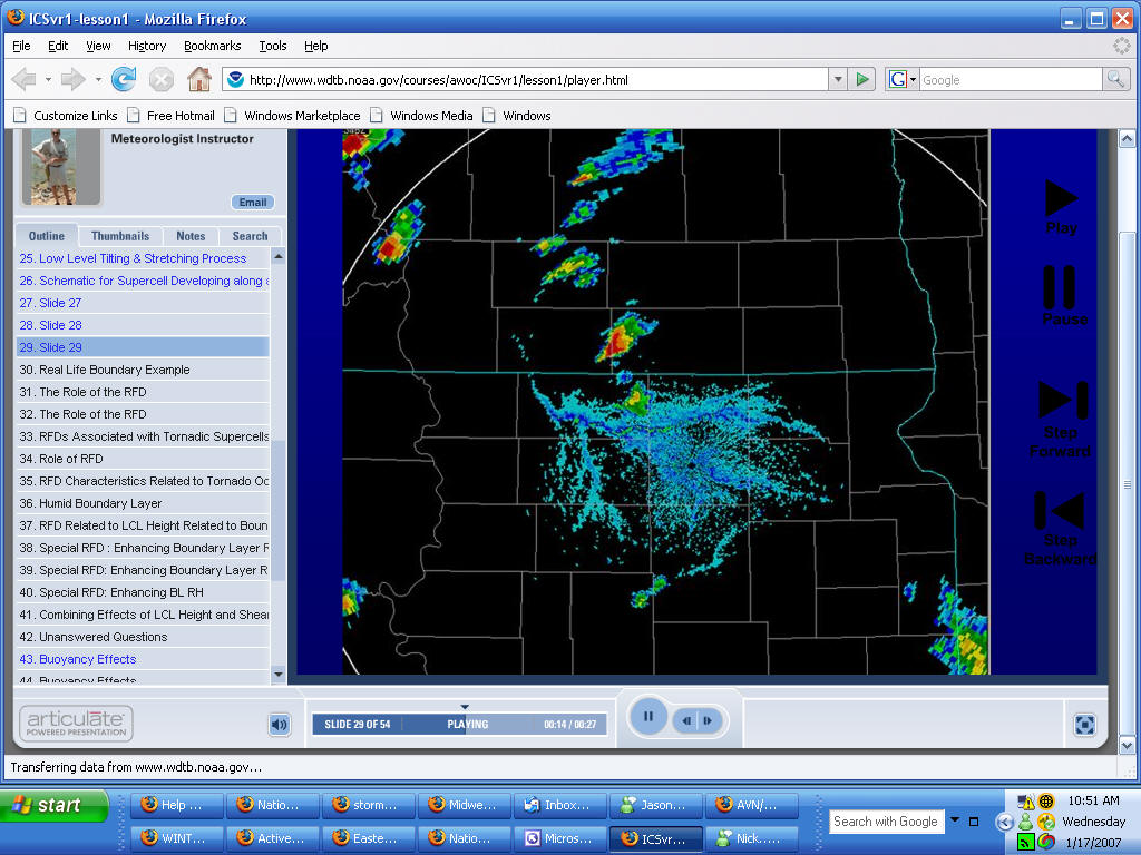
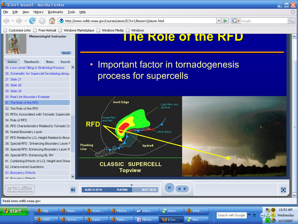
FLANKING LINE IS IMPORTANT
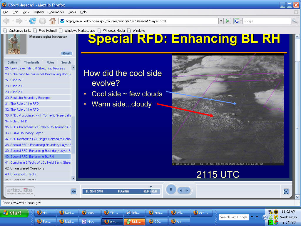
Clearing area is where severe weather broke out later...
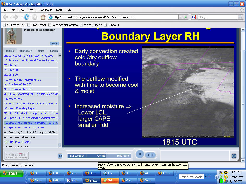
Look for very clear area south of convection old convection...then cloudy
area south of the clear area - see below
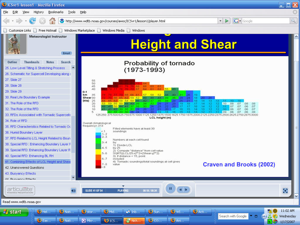
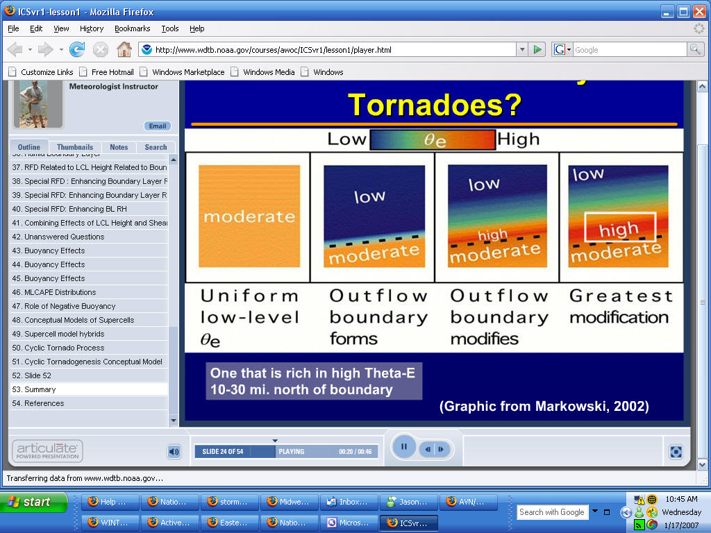
Note that tornado threat increases dramatically as you lower the LCL Height and then increase the 0-1 km shear
More low level CAPE the more chance for stronger tornadoes as well...something to look for
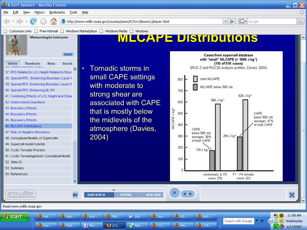
NOTE the low level CAPE and in SMALL CAPE settings look for the CAPE below
the mid levels to enhance tornado potential
Good for Winter
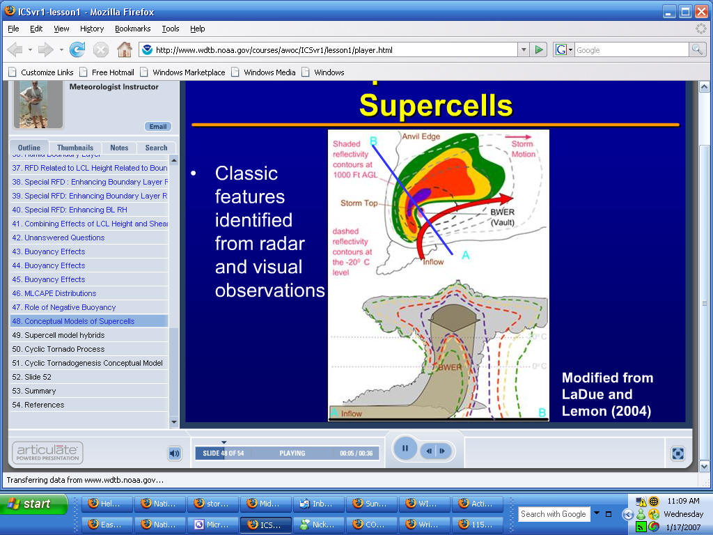
Classic radar things to look for...tight low level gradient - storm top slightly
displaced - BWER -
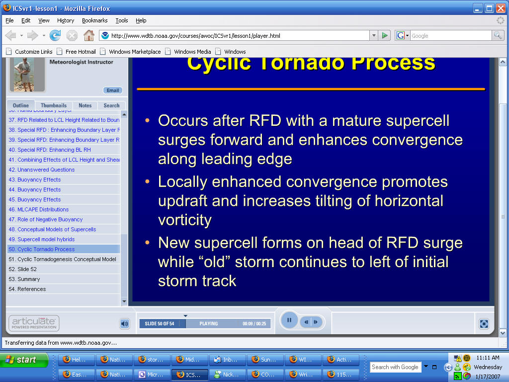
For CYCLIN Tornadoes...more than one look for the following